Friday, December 31, 2010

A Record-Setting Year of Extreme Weather That Will Not be Forgotten ends on a Tranquil Note!


Friday December 31, 2010     12:45 p.m.

http://lotsofbarkandbiteinyourforecast.blogspot.com/  Weather Blog Archive to 2007!

What a year it has been. I wanted to make sure I checked in with you before I begin the New Year's celebration with my family. Here are the top 5 weather stories of the year. Just one of these top five would make it a year to remember but to have a list of 5 and then some makes this year one of the most extreme years ever and it should be one of those years we talk about in Florida like 1989 and the late 1970s. It is hard to believe we set, tied, or broke 15 record highs and lows. I do not think that has ever been done before. We had 45 freezes and the previous record of 38 in 1977 was not even close. So that is why my yard has turned to hay! Our winter of 2010 was the coldest in 33 years with 12 of the first 14 days of the New Year experiencing freezes.

We did warm up in a big way for the summer with our second hottest one on record. We had an incredible 50 days in a row at 90 degrees or above. That was also a record! This was due to the fact that we had a blocking ridge of high pressure sitting over Florida so our normal afternoon and evening thunderstorms that cool us off never really got going like they normally do. We also had a trough of low pressure off the East Coast of Florida which tended to deflect all tropical systems that formed to our east out to sea. The tropical systems that did form to our south and west stayed south and headed toward Mexico around the clockwise circulation of our big high pressure.

Even though it did not make my  top 5 list, the US not having any land falling hurricanes in its third busiest season on record was unprecedented. Usually with 19 named storms you normally would have about 4 hurricanes strike the US if you look at all the averages. We had none! Since Florida receives a good chunk of its annual rain from thunderstorms and tropical systems that really never impacted us like they normally do we had our 4th driest year on record and Jacksonville ended up with a rain deficit of nearly 19 inches. The extreme drought will likely be a huge story as we head into 2009.

We also had snow flurries twice in the same year in our viewing area. Most people do not remember that Putnam County had snow flurries back in January and we did it again in a much bigger way Christmas weekend when many folks saw their first real flakes of snow since 1989. Some teenagers saw it for the first time ever! Ahhhh, the memories! The reason for this crazy weather I would not say is entirely due to the strong El Nino we had to start the year and the strong La Nina that developed by the autumn. While Pacific Ocean temperatures are a huge part of our climate puzzle at home I think the negative North Atlantic Oscillation and negative Arctic Oscillation played key roles.


This blocking pattern you see brought well above average temperatures to Greenland and Northeast Canada. Since nature likes keeping a balance somebody had to pay the price and that was us. Notice how the blocking high pressure forced the jet stream right from the North Pole to our backyards and with this north to northwest flow this also cuts off any moisture that could have brought us beneficial rain. Now as we head into 2011 I think this pattern will relax and it already is which is bringing us more typical La Nina conditions here in Florida.


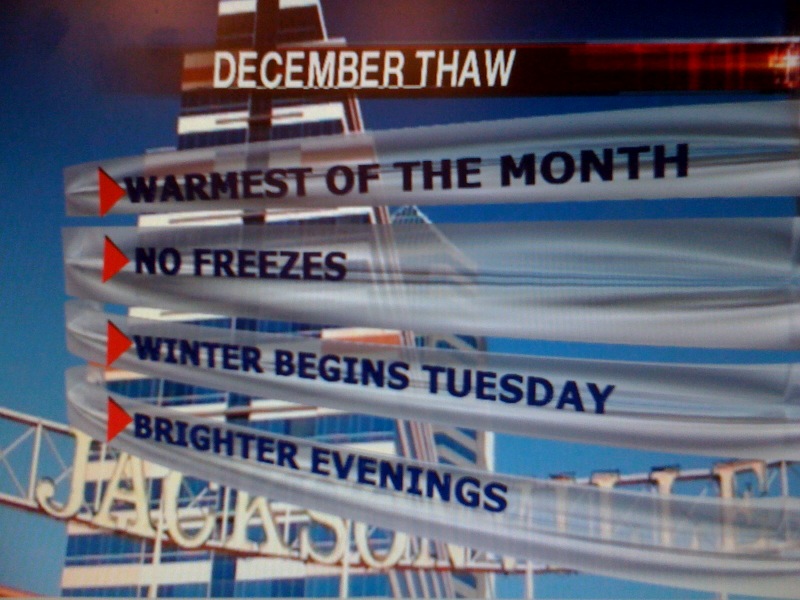
Check out the new jet stream configuration. Jet streams guide weather all over the globe. La Nina brings us above average temperatures and below average precipitation. Now the block will develop again this winter but it will not be a permanent fixture. So while we cannot rule out a couple more cold blasts they likely will not be for as long or as strong as we saw in December and the big news is the La Nina will take over rather than the North Atlantic Oscillation. This is good news for warmer weather lovers and all the snowbirds here from the North.


So bring on the 70s! They are here to stay throughout our big weekend and the only polar plunge I see taking place is in the Atlantic Ocean at Jacksonville Beach at 9 a.m. Saturday. It will be my second year partaking in this breath-taking event and this time we will have the television crew out there to capture you in all your glory. Here I am in all my glory. You see my friend Mike and I were happy to feel our faces and hands again after diving into the ocean. This year no rain to worry about like last year and temperatures will be a much more pleasant 60 degrees. But the water temperature of 51 degrees will make sure this event lives up to its Polar Bear Plunge name. The water is running about 5 degrees colder than last year.

Your New Year's Eve forecast tonight looks great but since we have a moist cool sea breeze that is working in during the afternoon there will be plenty of moisture for fog to form so make sure you are careful while driving late tonight. 8 p.m. temperatures will be in the lower 60s with middle to upper 50s at midnight. I wish you the best and many blessings for the New Year! Have lots of fun but be safe! The weather highlight of my year....I definitely think it was the snow but you come in first. To be able to bring you the weather forecast every week is a privilege and I cannot thank you enough for all your support. It is a dream come true to be able to do weather where it all began right here in Jacksonville, Florida! It is good to be home. I am excited about 2011 and so is our weather team!

Tomorrow on your weather blog we will ring in the new year by taking a look at the deadly tornadoes that hit Arkansas and what will transpire as it moves east and how much rain it will actually bring us.

Thursday, December 30, 2010

Good Riddance to the Coldest December Ever & A Whole Lot of Shake Rattle and Roll to our Weather for 2011!


December 30, 2010 Thursday, 4 p.m.

Today is Good Riddance Day. It is a day you bid farewell to all those setbacks or negative memories of 2010. Speaking of setbacks look at the latest average temperature anomaly for the month of December from the Southeast Climate Center. We are running over 9 degrees below average now for the month of December. Yes, we had a December that felt not like Florida but more like north Georgia or Tennessee.What sticks out like a broken, smashed up thumb is the purple or well below average temperatures for the month that extends throughout the southeast and up into the Mid-Atlantic and Midwest. You have survived the coldest December in recorded history here in Jacksonville and it is time to put this month behind us. Since the weather is always changing we have no choice but to move forward and here on Good Riddance Day it is time to write down what you did not like about this year on paper and then shred it up like they are doing in New York. Our autumn was actually quite normal. Check out our temperatures from September through November!


In fact much of the map has above normal temperatures with well above normal temperatures across much of the southeast. Yes, this gives warm weather lovers lots of hope because La Nina years are known for huge flips in temperatures so there is a reason I am showing you this. I do think we are going to snap back to above average temperatures as we start 2011. We will NOT see freezes 12 of the first 14 days of the new year like we did when we brought in 2010. This change is already happening as we hit 66 degrees today or 2 degrees above our average high of 64! It was actually a normal day! If you add up all our normal days (within 2 degrees of average highs) it was only our third December day that behaved like it normally should temperature-wise. It has been like the twilight zone!

Now hold onto your seats the 2011 weather pattern will still be anything but normal and the hurricane season is looking like a bear. This strong La Nina is not close to being done with us yet and our extreme drought could bring one of our worst fire seasons on record. Check back this evening and I will elaborate. I need to take the kids to gymnastics and it will be good to roll down the car windows!


Those girls at St.Johns Gymnastics were working hard tonight at practice and you can see my Abbey getting ready to do a full twist. There is only about two weeks until the first meet and their team looks ready to go right now. They are fired up and so am I. How they do those flips blows my mind! Now back to nature's full twist or big flip in our weather pattern. Yes, we should see warmer than normal temperatures but keep in mind no drought relief and signs are pointing to possibly our worst fire season since 1988-89. We have vegetation that was already killed off by our numerous freezes which creates more fuel for fires to develop. We already have about 20 active small fires in our viewing area. This may be the year we wish for an early tropical system...not of hurricane strength and one that moves nice and slow over our area (not stalling) bringing us a soaking rain.

Speaking of which, the tropical season of 2011 should be every bit as busy as 2010 which produced 19 named storms, 12 hurricanes, and five major hurricanes. Normals are 11 named storms/6 hurricanes/2 major hurricanes. The La Nina was strengthening during last year's tropical season while a trough of low pressure set up off the East Coast of the US. This helped protect us from one disaster after another. This year we already have an established La Nina along with above average Atlantic water temperatures. I highly doubt we will be so lucky with the location, location, location this year. Looking a past years, it certainly looks like the combination of the two will likely bring another blockbuster year.
One out of every 4 hurricanes that forms in the Atlantic Basin hits the US. This year was the first time we had 10 or more hurricanes without one land falling storm. There is usually a 95% chance of a land-falling hurricane in the US when it was as busy as we were but that 5% worked in our favor. I am expecting year's numbers just as robust as last year and I think it is safe to say we need to prepare for the worst and hope for the best. So while it may be a busy season hopefully some way somehow, it can help us with our dangerous wild fire situation. We just need to keep those big hurricanes away. Keep in mind 5 hurricanes have hit our area since St. Augustine was founded so they do happen even here in northeast Florida. Stay ready.


Around the country: Hard to believe another earthquake hit Indiana this morning. Yes, I got a few e-mails about folks waking up with their dogs barking up a storm before they felt the shaking. You see what my dog BJ did the last time a much bigger earthquake hit the Lafayette, Indiana area. The good news is there was no damage or injuries were reported and it was a registered a 3.8 on the Richter scale near Kokomo, Indiana which means it was a minor trembler. This was not as big as the one a couple years ago but many still felt it. This brought back fond memories of when I was awoken by an earthquake on April 18, 2008....check out excerpts from the weather blog....

It was a morning I will never forget. It was the first earthquake I have ever felt. We had a weak one here in the Lafayette area back in 2002, but this was our biggest shake due to an earthquake since 1987 here in Lafayette and for portions of our state farther south near Vincennes it was the strongest earthquake since 1968.

 
Where was I? It was just before 5:40 a.m. and I was sleeping with my wife and then boom, we both woke up to what sounded like a hurricane force gust of wind hitting the house, only it had a sensation I have never heard or felt. Our house was literally shaking and I knew there were no storms and I did not forecast any high winds. So I ran to the window, by time I got to the window the shaking had stopped. I immediately ran downstairs and outside to barking dogs and then I shouted it was an earthquake! I then went in immediately to the US Geological Survey web-site and it was confirmed within 10 minutes. I had goosebumps for at least 30 minutes afterwards while I was relaying this information to WLFI and my family. My daughter said the small TV in her room actually moved. Everybody in our house except Abbey heard it. This earthquake was felt as far north as southern Canada and as far south as Florida. No major injuries or damages have been reported. In Louisville there are reports of damage to a building facade.


This was officially a moderate earthquake was a magnitude of 5.2 on the Richter scale. It was centered near West Salem, Illinois which is located in the Wabash Valley Seismic zone. It is about 180 miles from West Lafayette.This is the norhward extension of the New Madrid Fault line. This type of thing only happens once every 20 years on average in our part of the state. There have been 8 aftershocks reported since the original earthquake hit at 5:36 a.m. The good news is that usually aftershocks are much weaker and we have not felt any of these here in Lafayette.

There is shaking in the Midwest and a whole lot of melting snow! Hard to believe my sister in law is reporting just plain rain in Oshkosh, Wisconsin. But do not get used to it. I reminded her that dense fog due to the melting snow pack and warmer air moving in is a warning sign of a blizzard about 60 days later. So circle your calendars especially if you live near Madison, Wisconsin. This Midwest folklore works more than it does not. The next big blast of cold air will likely hold off until around January 15th and the next big snow right around the 21st for  the Midwest in areas primarily east of Minnesota. No break for MinneSNOWta. I am worried about some ice as well with this one so stay tuned in areas farther south in Indiana. Keep in mind the main storm track will be coming through your area over the next several weeks. I think the East Coast may have seen their biggest winter storm during the first week of winter and nature will do what the snow plows failed to do in New York City and that is melt down most of that huge snowfall they saw over the next week.

Have a great night and remember to open the windows tomorrow afternoon! There is a whole lot of shake, rattle, and roll going on around the country weatherwise and otherwise! I will talk to you soon and see you on the air first thing Friday to get your New Year's weekend kicked off in style! We have a lot to talk about!

Wednesday, December 29, 2010

Last Hot Chocolate Advisory of 2010 Before the Icemen Melt and Real Thaw Begins!


Wednesday, December 29, 2010      4 p.m.

Well this picture will certainly be a thing of the past and soon. Here is an iceman that Patti built on Sunday here in Jacksonville when we had snow flurries. No, we did not have enough snow to build any snowmen or in this case an iceman. We only had a trace of snow reported at the airport, and any snow that fell quickly melted with our warm ground temperatures. But it was cold enough to take shaved ice from the Jacksonville Indoor Sports Arena and make an iceman in the flurries. Usually the ice melts right away, but not in this weather pattern.

But signs of change are coming our way. Icemen will be a thing of the past. Get this guy a ticket to the North Pole before it is too late! Most of our weather maps and many great discussions come from Washington, D.C. and here is BIG NEWS for us that I chomped over today! Check it out....

AN ARCTIC FRONT OVER THE HIGH PLAINS WILL PUSH SWIFTLY ONTO THE CENTRAL PLAINS EARLY THURSDAY BRINGING MUCH COLDER TEMPERATURES TO THE REGION FOR THE LAST TWO DAYS OF THE YEAR. TEMPERATURES WILL BE ABOUT 10 TO 20 DEGREES BELOW NORMAL. PRECIPITATION WILL SUBSIDE OVER A GOOD PORTION OF THE SOUTHERN ROCKIES BY FRIDAY... ONLY TO INCREASE OVER THE CENTRAL/NORTHERN PLAINS. AREAS EAST OF THE MISSISSIPPI WILL ENJOY RELATIVELY TRANQUIL CONDITIONS AS HIGH PRESSURE SLIDES OFF THE EAST COAST.

That is right the next arctic front entering the United States is NOT coming our way or anywhere close to Florida. This is some great news! After all we have had 4 arctic fronts already this month along with 4 records set in the past 3 weeks. The big storm to end the new year will stay west and over the Plains States.

We have a new pattern for the new year and I think most of us are ready. Reading between the lines this tells us a lot. The southeast ridge of high pressure we saw so often this summer is making a comeback over us as we head into January. It will protect us and block any arctic fronts from even thinking about coming our way. In fact, I do not see any freezing temperatures after tonight for at least 10 days! Even Jacksonville Beach got down to 29 last night and the 24 at Jacksonville was the same low as Minneapolis St. Paul and we do not have a 17 inch snow pack to work with.


Tonight we will not have to worry about the pipes, but I would bring in the pets and plants as temperatures once again plummet to freezing before our real thaw finally begins. The thaw is coming about a month early this year since our winter came so early. Normally our coldest time of year is the third week of January, this year it occurred without a doubt in December. Do not get me wrong, we will still have a few cold blasts between now and the end of winter, but not nearly as severe nor for as long as we just endured.

There were only 3 states in the entire country with no snow on the ground Monday morning. They included Texas, Louisiana, and Florida! Check out the visible satellite picture above showing just how close to home snow was covering the ground yesterday! The white you see is snow. Notice it covering the ground in South Carolina and you can really make out the Pee Dee River nicely. Columbia had its first White Christmas since records have been kept in 1877 and Georgia also has a nice mantle of white along with the Carolinas! Atlanta had its first White Christmas since 1881!


While we have had fun with all this strange weather on the air and here on the weather blog our thoughts and prayers are for Cindy and Lauren to get home safely. What a great picture, but they tell me they have been stranded in New Jersey since Sunday and hopefully tomorrow they can finally come home where they belong! Yes, this is the same New Jersey that was clobbered with over 30 inches of snow! This type of storm in this type of La Nina pattern has not hit the Garden State since 1909. Next year I think she should have all her family fly here to Florida. She has earned at least 5 Christmases at home in Florida after all she has been through. Way to keep your head up Cindy! Yes, she and Lauren are still showing their beautiful smiles!


So why the craziness? You can blame the strongest La Nina in at least the last 50 years and you can make the case in the last century. Check out all the blue in the Pacific. These are below average water temperatures that tend to shift the jet stream all over the world. The jet stream guides not only weather systems but control weather patterns. So what has been happening is no coincidence. The jet stream is out of place and our weather way out of balance. One of the main reasons for this is the La Nina cycle we currently are in. The La Nina will slowly weaken but likely be a formidable force into the Spring and Summer.

What this means for us is get ready for a bad fire season with our drought conditions continuing. At the same time we will shift to above average temperatures through the rest of our winter with only brief cold spells. What concerns me is hurricane season. I will talk more about this tomorrow along with other factors that will keep us from the crazy cold we have experienced.

Stay warm tonight. There is a freeze warning and I will issue my last Hot Chocolate Advisory of 2010! Remember the marshmallows and do not be shy and stay warm by writing to me at First Coast News. We have been through a lot together and I look forward to sharing your weather pictures and stories. Thanks, stay tuned, take care and do not burn your tongues!

Tuesday, December 28, 2010

Snow place like home! Year of the Snow Chasers and Freeze Continues with your Two Minute Advantage


Tuesday, December 28, 2010     4 p.m.

It is great to check in with you. I wanted to thank you for all your great e-mails and fun we had over the Christmas holiday. It was a memorable one and you certainly became like my extended family. This cold weather brought us all together. You see Sheri all hunkered down at the coldest Jags game in history. This is a microcosm of our December which will be the coldest on record. Tonight will bring freeze number 19 this month out of 28 days. In an entire year Jacksonville averages 17 freezes. Yes, this is crazy cold! If you add up all the freezes since January we are now up to an unprecedented 44 freezes! This should be called the year of the freeze! This morning we smashed a record low set back in 1925. The old record was 24 and we were at a bone-chilling 20! We have  now tied or broken a record low in 4 of the last 21 days. I could keep going on with these stats but I think you get the point! Okay, one more...Cecil Field recorded their coldest temperature of the year with a low of 17. We have two more nights of bringing plants in through Thursday morning and then we may get a week or more without a freeze! Hang in there!

The weather may be a bit frightful but it certainly did bring us all together and we certainly bonded after the snow flurries started flying on Sunday. I told you it would not be so bad to stay warm by watching First Coast News. In fact, I think it has exceeded both of our expectations. This weather kind of chased you inside and I wanted to make sure it was worth your while to tune in. Nobody loves snow as much as I do but what made it all worthwhile was sharing it with you on the tube. I enjoyed updating the crawls at the bottom of your television screen, doing snow cut-ins and sharing all your snow pictures. I had so much energy I could have done a two day cut-in and your help and enthusiasm was much appreciated. To talk to kids that have never seen snow before was one thing I had never experienced in this business before and I felt honored to be the one to break the news. It was my most exciting day as a meteorologist since the Blizzard of 2007 in Indiana when our weather team that included Ross Ellet and Kelly Greene were camped out at the station for 3 days! It had that same feel that is for sure.

Yes!!!  It was also great to be the first television station breaking the news about snow falling in the area. This is what it is all about! You saw how important your two minute advantage can really be since some areas only saw a brief burst of snow. Here is what it looked like on First Coast News Live Doppler.


You see some of the white splotches showing snow that had me running laps around the station. The two minute advantage is basically due to First Coast News actually having the only live doppler radar in the Jacksonville, St. Augustine, and Brunswick viewing area. As a result the data you are seeing is live and at least 2 minutes quicker than any other radar available. Sometimes our radar is 5 or more minutes faster than any other station and this includes the weather channel.

This two minute advantage was crucial on Sunday because we had to be quick to tell everybody where the snow was or they would miss it!  This was important to those that had never seen snow before while others called and asked me where they could go to see it in their cars. Now I have helped storm chasers in the past while in the Midwest...but to send out a convoy of snow chasers on the roads was a first and thrilling beyond belief! You can thank your only live doppler radar that will become even more valuable during severe weather because we know that tornadoes do happen in our area and can come and go in as little as two minutes. You can  count on us to keep your families safe and we also have street-level mapping that can zoom right into your neighborhoods.

Chief Meteorologist Tim Deegan has set a plan in motion that you will absolutely benefit all of us over the next year. I cannot wait to get to work every day to help make it happen. Our viewers deserve the best!  It is just another reason to watch. We will give you many reasons to watch!


Some of those bursts of snow on the west side were heavy and it looked quite odd seeing those sago palms with a backdrop of not sunshine but snowflakes.


The snow also briefly whitened some patio furniture around the area near Merril Road and 9A. Last year at this time folks told me they were out on the patio furniture having a picnic....lol.  These pictures back up your only Live Doppler Radar nicely. Thank you for sending these pictures in! Keep them coming! Thanks again for making my Christmas special and yes I am re-writing my meteorological Christmas story!

I wanted to thank my wife for holding up the fort at home and taking care of all those little things while I was at work with the snow. Holidays have always been a time where I am used to working and doing weather shows, since the show always must go on.  Julie has made this possible over the past 16 years I have been in this business. She has helped me balance this crazy work schedule and family and I cannot thank her enough. Yes, my girls had a great Christmas and I did get that valuable time with them between shows thanks to Julie! It takes a special wife to do all she does and she is amazing. Thanks Julie! You are way more impressive than any tornado, hurricane, or blizzard. I love you.


Speaking of thanks I think you will be thanking me soon for bringing 70s back in the forecast. Even a snow-lover like me has had enough of this cold weather! Here is one more glimpse of the Christmas weekend blizzard that had pressures as low as a category one hurricane. It looks like a hurricane in this picture. This hurricane did have pressures as low as 962 mb in Rhode Island which was the equivalent of when Hurricane Bob hit that area back in 1991. Look at that unbelieveable swirl and yes some areas exceeded 30 inches of snow in New Jersey! The circulation around this storm has been keeping us in the deep freeze and now that it is moving away we can get ready for real Florida weather to return and a new weather pattern for a new year! We will talk about this and melting icemen in your forecast tomorrow! Check back my friend! Have a great night!

Sunday, December 26, 2010

Some See Snow for the First Time Ever As Arctic Outbreak #4 Moves In!


Sunday, December 26, 2010 ( 11 a.m.)

Blog Archive to 2007 http://lotsofbarkandbiteinyourforecast.blogspot.com/

Wow! That is all I have to say. December of 1989 will always be remembered for snow and the White Christmas we had but December of 2010 will not be forgotten anytime soon. Christmas and Hanukkah came twice for many this year. All those kids asking for snow this week got a gift from nature that will last a lifetime! We had SNOW this morning in Jacksonville! I put in a chance of a brief snow flurry for us this morning during the morning news and sure enough it came true. It was just odd adding that to my list of weather notes even if it was snowing in Valdosta this morning at 6 a.m. and it did look like that upper-disturbance along the polar jet stream was swinging our way! It just does not happen that often here. In fact, one of our First Coast News videographers told me his 15 year old son saw snow for the first time ever this morning! Yes the arctic boundary or front moved in and you combine that with a vigorous polar jet stream with 140 mph winds overhead and you had plenty of lift to squeeze out some snow! It did not stick or cause any traffic troubles but it was just amazing to see snow in Florida. I have talked to several folks that told me this is the first time they have seen snow here in the Jacksonville area since 1989! It was the first time I have witnessed snowflakes here since March of 1993 when I was an intern at First Coast News. It must have been all the snow talk on this blog and all the snow video I have been showing on the air. Something had to give. Now for all the snow-chasers that want to go see some of this snow it does look like our snow fun is about over with maybe a few crunchy leftover dip and dot snowflakes since the air aloft is so cold! But this should be it. If you are heading to the Jags game wear the hats, gloves, and big coats. We may stay socked in with the clouds with highs struggling to get to the lower 40s. Wind chills will remain in the 30s. Here are some more snow pictures from this morning to enjoy. I will keep adding to this collection for you here on the blog. Please send in your snow story too!


We were talking snow all the way to the beach! This is what  Craig O'Neal captured for us in Ponte Vedra. This looks more like a scene from Virginia in the winter than Florida. Folks in Mandarin and the southside also reported a few snowflakes just after 9 a.m. Here is what our very own anchor Corrine Hautala saw!


She is from Arizona so she was pretty excited! Notice the snow almost looks like hail or what is called graupel. This crunchy snow tells us there is a huge drop in temperature from the ground where it is in the middle to upper 30s to a bitter 12 degrees at 5,000 feet. Usually you need it to be 27 degrees or colder at 5,000 feet for snow. We were more than cold enough to say the least and you can feel it when you walk outside. It feels and looks like snow and sure enough it did snow! Lori Dorman also caught some snow on her cape. She lives by the airport and here is what she found.


Now keep in mind there is STICKING SNOW not far from home. If you are traveling along interstate 95 slick spots could develop as close as Savannah, Georgia where there is a wintry mix! Check out our latest futurecast models below. Myrtle Beach could see 1 to 3 inches of snow before it tapers off this afternoon. Washington, D.C. will see about 4 inches to 8 inches near the Chesapeake Bay and then blizzard conditions for areas farther north. This means to check ahead before leaving for the airport today and if you know of friends driving home make sure they know that it looks like some rough driving all the way into the deep south.


In the meantime do you realize this will be our fourth arctic blast of the month. There are some Decembers where we do not have any freezes and folks plant their poinsettias in the ground. Not this year! You can see why! Look how wrapped up this low pressure is as it moves northward. It will have its central pressure dropping to 28.50" which is something you normally would see with a category two hurricane! Winds could whip up to near hurricane force before all is said and done near Cape Cod by later tomorrow even if this monster is not tropical by nature! Here at home this storm will control our weather with a vicious backlash that will last at least through the middle of the week. The atmosphere will be taking its cues from it and the flow around this storm will keep us in those bone-chilling breezes.

Tonight bring in the plants, pets, and protect the pipes. We have a hard freeze warning tonight that goes into effect at 9 p.m. Lows in some of the colder spots and inland locations will be in the lower to middle 20s. The beaches should even see a lows in the upper 20s. A wind chill advisory is also in effect for wind chills plummeting to 10 to 15 above by morning. Yes, December of 2010 will go down as the coldest ever without a doubt.

Not even the Keys and South Florida will be escaping the grips of this arctic outbreak as their wind chills will also drop to near freezing! You see all the advisories lined up including our hard freeze warnings in Florida that are labeled in blue and if you look closely you can see the red on the map from New Jersey northward into New England which are blizzard warnings! Now the positive to all this is that this is a progressive pattern and once this big behemoth of a storm moves on we should warm-up! I still think 70s are a good bet for New Year's Eve! Keep those warm thoughts and oh yes....you thought the snow this morning was unusual....how about last night's rain!!! We had our heaviest downpours since November 4th. Here is our rain-splashed weather window pane at First Coast News to prove it actually happened. I also left some rain totals for your enjoyment to get you through this cold day! Stay warm and keep sending in those snow pictures! Thanks again!


      • WAYCROSS       .75"
      • FOLKSTON        .70"
      • MACCLENNY     .62"
      • ORANGE PARK  .40"
      • MANDARIN         .35"
      • JACKSONVILLE  .30"
      • ST.AUGUSTINE   .30"
      • PONTE VEDRA    .25"
      • ST.JOHNS            .25"

Saturday, December 25, 2010

A Meteorological Christmas Snow Story and A Warm Merry Christmas from the Prangleys!


Christmas 2010 (4 a.m.)

I know there are no morning shows but I am up early.  I am making sure everything is just right for my 3 girls you see above when they wake up. They were bouncing off the walls last night and it will only get better today! I am also doing some dishes which includes Santa's cookie plate and glass of milk. There must have been a lot of good boys and girls in Florida because Santa worked up quite the appetite last night with all the presents he dropped off. He left only a few crumbs that my dog was not even interested in. Another reason I am awake is of course the weather!

I was texting friends and relatives all across the country yesterday, especially Maryland where I grew up. I called for a big Christmas weekend snowstorm all week long and I told them how the models kept flipping back and forth but before all is said and done the pattern still favors a big snowstorm. They thought I was telling a Christmas Story since they know how every year growing up I always asked for not a bike or Space Invader video games but snow on Christmas and it NEVER happened. They told me Santa could not control weather which is true but he had Rudolph and there has got to be something he could do for me. But year after year went by with no snow. Santa did try to make it up to me by bringing me lots of weather books and thermometers! This helped me to eventually become a meteorologist and feel very fortunate to do something I have always loved since I was 4 years old and that is to forecast weather. So now that I am an adult and a meteorologist I have always kept that dream of snow alive. All I ever asked for was snow right around Christmas. It did not even have to come on Christmas Day or Eve.


As a meteorologist you can say I am a lot like a quarterback. I read the weather pattern more than the mind-boggling numbers I digest and dissect every day. The model guidance I use every day which is weather data based on the laws of physics is only just a guide. When every single model yesterday morning came in with only flurries and some came in with no snow at all I felt like I was sacked with by an all-out blitz by nature. I was dazed and distressed. This never-ending nightmare I have dealt with since birth just will not go away.  After all Washington, D.C. has not had a real Christmas snowstorm since 1966 which is 3 years before I was born. But I am not one to give up, I run marathons. On the water vapor imagery you see above from this morning notice there are two strong jet streams (darker striped areas) we were dealing with and our models do not read those fast-moving streams of air very well. They are moving at over a 100 miles per hour. If they phase just a little sooner than the storm track would in fact support me and go farther west.

I did tell my relatives there was one lone model that agreed with me out of the 50 models I normally look at. So I told them they could bench me since the models were telling me this quarterback was just not reading the weather very well, but there was still that hope for a Christmas weekend snow miracle. The Jaguars threw a Hail Mary miracle pass to win a game this year and I am not giving up. I reminded them of a snowstorm that hit their area in January of 2000 after all the models wrote the storm off. Many folks went to bed at 11 p.m. thinking there would only be a mix of sun and a few flurries. They then woke up to a half-foot of partly sunny in the forecast. So my family believed in me and kept me in the game yesterday.

What happened? I made like David Gerrard and started throwing touchdowns. By 7 p.m. last night I told them to prepare for 4 to 8 inches of snow beginning Sunday afternoon. A second model came in with a big snow potential and then as the evening went on several models followed in line. By 11 p.m. last night I knew a big snowstorm was on the way. This morning I hopped out of bed as sure enough a Winter Storm Watch text message came my way from Washington, D.C. with chimes and all. This is the best present a meteorologist could ask besides being with my family and kids on Christmas Day. The moral of the story is to never, ever give up on your childhood dreams. Santa did finally make my Christmas wish come true. I knew he could do it! That is my Christmas Story.


Okay you can put away the tissues....lol...here is a good map showing where most of the snow will fall. What is amazing is that snow flurries could fly as far south as the Florida Panhandle tonight! That is right! I am not expecting it to stick but that is still amazing! The light blue line is where you can expect a dusting of snow...the darker blue line shows my 1-2 inch swath of snow and then by time you head to Atlanta they could see 2-4 inches! The deep blues along I-95 up in North Carolina will easily see 4-6 inches of snow and the purple areas include the areas that could have 6 inches plus of snow. It will have a local impact as well. This storm could bring us rain here on the First Coast by late tonight. The good news is that it will hold off making this a nice warm Christmas with highs near 70 degrees. It will be our third Christmas in the last 4 years with temperatures at 70 or above. What a difference 21 years makes. We had our only White Christmas in Jacksonville back in 1989. I have thoroughly enjoyed your stories and showing the snow video on First Coast News this week. I did not realize folks actually parked their cars on the Interstates and that I-10 was closed for 2 days. I knew our bridges were shut down, but the Interstates? That was a one in a hundred year storm. This is what I have been telling kids when I have done my school talks. Many have never seen snow before and like me have been asking for snow for Christmas. Now here is my solution. Take your kids outside today and have them look up at the wispy cirrus clouds like we saw yesterday in the picture below.


The picture shows falling ice crystals at 25,000 feet. So yes there is snow falling from the sky here at home and even if it is evaporating before it reaches the ground at least you can tell your kids they saw snow on Christmas! Our chance of a real White Christmas here in Jacksonville is only 1% so you may have to remember this and it could come in handy.

Speaking of snow I am concerned about the travelers that have hit the roads in the highest numbers in years. Yes, I love snow as you can tell but I want everybody to stay safe. If you have friends traveling from Atlanta or the Carolinas make sure they know the worst part of the storm will be late today through Sunday. Temperatures tomorrow in Atlanta will stay near freezing which means slick roads will be a problem throughout the day. By time you head into Washington and Philadelphia it looks like things will go downhill Sunday afternoon and night. New York and Boston will have problems Sunday night and Monday. Travel delays will be likely. Tonight at 11 p.m. I will come in and we will look at First Coast News Live Doppler Radar and track the rain coming our way and have an update on that all-important travel weather. God bless! Merry Christmas! I think I hear my daughters rustling. I better get ready!

Tuesday, December 21, 2010

An Inspiring Solstice Lunar Eclipse Love Story!


Tuesday, December 21, 2010 (10:00 p.m.)


Hello Mike!

I am proud to announce that she did, in fact, say yes!!!!

I taped the ring to the outer lens of a pair of binoculars and handed them to her, and as I had planned she noticed the obstruction and upon investigating she saw the ring, immediately smiled from ear to ear turned to me (I was already on one knee) and said yes (before running at me and knocking me on the ground :D ).

After a very long embrace and a very nice kiss, we both agreed that the night would never be forgotten but that it would be wise to retreat back to the warmth of our home!
Sincerely-
Justin Reeves

There you have it! This is what makes it all worth it. Last night Justin e-mailed me with his big plans for a marriage proposal. I gave him the thumbs up on the weather and the rest is history. Yes, the timing and weather were perfect. It was a night that many waited a lifetime for and then some. It had been about 400 years since we last had a solstice lunar eclipse and it will not take place at least for another 100. My congratulations to Justin and his fiancee! I wish you all the best in your future and may it be as beautiful and bright as last nights moon.

This picture you see was taken by Garrett Coley who is a sophomore at Bartram Trail High School. This was for his photo class. Well Garrett you have a lot of talent and you deserve an A++. Keep up the great work. Today as forecasted was short and sweet with love in the air as temperatures reached the middle to upper 60s. Our shortest day of the year was today with 10 hours and 11 minutes of daylight. We are now over the hump as the sun's direct rays move northward. Happy Winter Solstice! I will check back with you tomorrow for more on our winter outlook and why it will feel more like Spring to start before our wild weather ride. We will also check on how potent that winter storm will be for the Midwest and East Coast. Have a great night! Now I am off to talk about the Full Long Nights Moon during my weather cast. It has the highest arc in the sky than any other full moon! Enjoy! It will not be as cold as temperatures actually start rising after midnight.

Monday, December 20, 2010

Solstice Lunar Eclipse first of its kind since 1638!


Monday, December 20, 2010 (7 p.m.)

Get out and enjoy the total lunar eclipse tonight. It officially begins at 1:33 a.m. Totality begins at 2:41 a.m. and it reaches its peak at 3:18 a.m. Totality ends at 3:53 a.m. The total lunar eclipse ends at 5:01 a.m. This is the first solstice eclipse since 1638 or before Jacksonville was founded in 1791. We were not even called Cowford yet! Yes, the winter solstice or beginning of winter this year is also on December 21st at 6:38 p.m. These two events will not occur simultaneously again until 2094. Make sure you bundle up if you are heading outside with temperatures likely in the 30s. The beach may be closer to 40 if you are looking for a warmer spot. What I told folks is that they can stay in bed with all that chilly weather outside and we will show the video of it and pictures on First Coast News...lol...I know not many folks are as  crazy as me and I do have my alarm set for 2:30 a.m. As I told Jeannie on the set I will make sure not to wake up my wife who wants her beauty sleep. What will be interesting is that the moon should be a darker coppery red than usual. Here is why...the stormier the weather on earth the deeper the color since it is moving in the earth's shadow. So I am all fired up and ready to go!


Also bring in the pets and plants tonight. The Prangley coton de tulear may have a little Santa suit on but it is not enough to keep him warm. Freeze warnings are in effect from 2 a.m. to 9 a.m. I think most of the brief light freezes will be north of Interstate 10 and west of Highway 17. The great news is this chill is not going to last and the big news is a warming trend and lots of good weather on the way this week.


Wednesday we may have only our third day of the entire month with above average temperatures so this is well overdue. The stormy weather to our north will eventually bring in a cold wintry blast but likely not until Sunday! I think this is perfect timing for all those relatives coming to Florida looking for some better weather. They are going to find it! We have come a long way in a week. Have a great night and yes I better rest up for the big eclipse tonight....see you back here tomorrow with all the great pictures!

Sunday, December 19, 2010

Good Misty Morning, Time to Make the Mexican Dip & Watch the Jags to Stay Warm!


Sunday, December 19, 2010 (7:30 a.m.)

Fog and mist will greet you this morning. You can see the rain is not the only thing that has been disappearing, but the tops of some of Jacksonville's skyscrapers. The good news is the wind as kept visibilities in most areas over a mile. The bad news is that this London look will be with us through at least mid-morning and we will have slow clearing this afternoon. It will also feel like London today with highs stuck in the lower to middle 50s. But I do not think anybody is complaining. It is JAGUAR SUNDAY! I know of several Jaguar gatherings around town and this is the perfect weather to stay in and watch some great football and I wanted to share my favorite Mexican dip recipe. Better yet it is easy to make. If I can do it so can you. This dip is so good that even at 3 a.m. in the newsroom it will only last a few minutes...lol...My wife who perfected the recipe will send it shortly and I will post it ASAP. THANKS JULIE!

Best Layered Mexican Dip
Layered from the bottom up:
Publix black bean chipolte dip -in deli, if you cannot find use either refried beans or crush black beans or mix both together
1 cup guacamole
8oz sour cream w tastefully simple fiesta seasoning (or use taco seasoning)
Shredded lettuce
Cheese
Cherry tomatoes


Tonight everybody is ready to party like it is 1999 or the last time the Jags won the division title. Since you will likely be in a festive mood you will have to go check out the luminaria in Avondale and Riverside. This event has been going on since 1984 and is a must-see. Yes, 33,000 candles of fun along with caroling and live nativity scenes. Bike riders also take part in this big fundraiser event for RAP. The weather looks outstanding. There is no rain to worry about or wind that will blow out any of those candles. Just throw on a jacket. The event begins at 6 p.m. and temperatures will fall into the 40s through the evening.


This week is the big one for travelers and it looks like nature is going to bring the BIG ONE to areas of the northeast. Check those travel plans. Here is the latest long-range surface map for Christmas Day! I even think my Midwest friends can expect a big Christmas Eve snowstorm similar to the one we had in Lafayette in 2002 when many areas picked up about 7" of snow. I remember those snow totals vividly! It was one of my most memorable Christmases ever. Here they are.


Yes, Murdock Park will not need the fake snow this year and you may have a case of deja-vu in Indiana.  Get the sleds ready! Here in Florida we will stay on the warm side of this storm and even though we will start a bit chilly this week with 50s I have no doubt we will warm up into the 70s. Christmas day the big storm could bring a light shower but the bigger story will be the windy conditions with gusts over 30 mph likely as a storm bombs off the Mid-Atlantic coastline. I have already texted friends in Maryland this morning and they are preparing for the worst and hoping for the best! I am the grocery stores best friend this time of  year in several states...lol. On Friday I warned my Chesapeake Bay friends about the pattern being favorable for this to happen and it does look it will come true and they will not be dreaming of a White Christmas. They could be measuring the snow not in inches but feet so stay tuned. This is a part of the country that closes school for 2". It should be interesting.  Now since a lot of folks have been asking how far north they have to go to see snow on Christmas, here is the latest map for you.


It looks like northern Georgia and even Alabama could have snow on the ground along with South Carolina.  I hope my friend Ed is ready in Myrtle Beach because even a White Christmas there is not out of the question. You see the purple colors or the areas of heaviest snow cover from near Washington D.C. back to Indiana and the Midwest. I am not sure how temperatures in Chicago will get out of the teens on Christmas. Here in Jacksonville we will feel the next real blast of cold air from this storm that could deliver another round of lows in the 20s by later Christmas weekend and the following week. One thing is for sure and that is we will not have another White Christmas like we saw in 1989. That really was a one in a hundred year storm. Here is your 10 day outlook for Jacksonville that will help you plan ahead and since there will be a lot of folks ready to get out of the cold and snow from the north and visiting us here in Florida I think these temperatures will feel great, although we do have that colder surge of air coming after Christmas.


Have a great day! Go Jags and remember the jackets. As I posted on Facebook, I love all my Indiana friends but the Jags are this year's team of destiny and if they stay close to the Colts I just know they will find a way to win! Speaking of a win-win, tomorrow you absolutely will want to check in with me here on the blog. We are talking about an occurrence that has not happened since 1638 or should I say a couple of scientific phenomena. Thanks for reading and good luck to all the marathoners in Mandarin this morning. I am glad you have perfect running weather. It sure beats the 80s I ran in back in 2006! Send me some pictures at mprangley@firstcoastnews.com.

Saturday, December 18, 2010

Heaviest Rain Misses Us as this Forecast Goes to the Dogs! But the Holiday Dance Must Go On!


Saturday, December 18, 2010 (10 a.m.)

Blog Archive: http://lotsofbarkandbiteinyourforecast.blogspot.com/

Well it will certainly NOT be raining cats and dogs on our Saturday which we really needed with the stench of smoke in the air and an ugly mix of smoke and fog this morning. This forecast which had all the potential in the world for heavy rain is going to the dogs. I will explain why, but first some positive news! Speaking of dogs, here are the Glebus dogs all ready for the Jags game tomorrow. Bourke who is six is looking back at Jack who is two years old. They have been waiting their whole lives for the Jags to bring home their first division title since 1999, which is a much LONGER wait in dog years. Yes! They are wearing some nice threads. Their favorite player is Maurice Jones Drew and love imitating him by running around the house lightning quick. The Yorkie Jag fan club is excited that there will be some good dog walking weather today and once again Sunday. The good news for our Jags is the roof at Lucas Oil Field will be closed since the forecast high temperature is 27 degrees. The NFL mandates that the home team with a retractable roof has to close it with temperatures below 40! The actual indoor temperature at Lucas Oil will be closer to 70 in the stands and 80 on the field. This is Jags weather, advantage Jacksonville! Normally the Jags are 1-8 all-time in games with temperatures of 27 or lower, but tomorrow we can throw that statistic out the window.


Another statistic we can throw out was 80% of all our models today showed at least a half-inch of rain for us. There was one model at 4 a.m. this morning that showed most of the rain missing us. Guess which one won out? You got it. Check out the very latest forecast rain estimates in at noon today and notice how the rain is doing the infamous split around Jacksonville. I would be happy with .25" at this point and still do think we will see a few rain showers by late this afternoon and evening. They will not be anything to write home about but any rain at all is welcome rain. There will be plenty of dry weather to get outside and even fish in. It will be warm with highs topping out in the upper 60s to near 70. In Georgia to the north of the front and where there will be a little more rain it will be closer to 60. Here is what happened.


We had our front which was charging our way this morning stall out in Georgia. That means we lost some lift. The second rain maker for us was the low pressure coming out of the Gulf of Mexico. It brought a ton of heavy rain to Orlando and even Daytona Beach, but not us. It tracked too far south. So yes it is like a dome has been erected over us here at home and we have had some very bad luck on the rain. So most of the rain will stay north and south of the Jacksonville area today.  I wish I could say our bad luck on the rain will change but unfortunately things may get worse before they get better in this La Nina pattern. I do not see any heavy rain in our forecast for the rest of this year and as we head into January. Hopefully we can at least squeeze out a few rain showers by later today. This evening should be nice and mild for your evening plans with temperatures remaining in the 50s. We will not turn chilly until morning with lows in the lower to middle 40s.


We will stay positive and this morning on Good Morning Jacksonville I certainly did all I could in my control to make that happen by doing a holiday dance! You see from left to right, yours truly Len Kiese, and Chef Robert. We showed off our dance moves on the link below! It is the best I have ever danced that is for sure.  http://sendables.jibjab.com/view/A1qmMVO9ODJgtN2Q

Have a great day and be safe. I will have to learn how to do a rain dance and soon!

Friday, December 17, 2010

Ski coats to pj's & record lows to record highs!!


Friday, December 17, 2010 (4 p.m.)

It was a motivational Friday after all! This morning I said we should all treat every day like Friday and it would bring a new enthusiasm to our life. I may have pepped nature up as well. Can you believe Palatka has just checked in with a high of 82 degrees which would be new record high. Just 2 mornings ago they had record lows in Palatka in the lower 20s. We have seen temperature rises in Florida but I cannot remember any as dramatic as this. It was warm enough for the kids at the bus stop this morning to trade in their ski coats for pajamas. I know...pajamas? Well it was their last day of school for this year anyway and the kids celebrated by having pajama day. Saturday will be another strange day with temperatures in Georgia stuck in the 50s while areas near Palatka still near 70. You can see why!


We will have a cold front drifting south through the area. Most folks will take these huge temperature swings as long as they can get some rain for their parched lawns. We are in an extreme drought and today there were several hours of smoke reports at Jacksonville International Airport. Our Live Doppler has picked up more smoke plumes than rain this month. Enough is enough. The position of this front tomorrow will be crucial for our rain chances. Right now the latest model data is working in our favor. Today most of the rain in Georgia was post-frontal which means just to its north. On Saturday with the front sitting south of most of us and with an area of low pressure forming along it I do think it will be a day where we can finally say we will get some beneficial rainfall. It has been a long time when all of us have had a widespread rain that has lasted more than a few minutes. Saturday expect occasional rain showers becoming more numerous in the afternoon. I do not want to jinx this forecast but I am feeling good about this being our most significant rain since November 4th. Here is why. I picked the driest model run of the bunch and it still shows a good .25" to .50" of rain over Jacksonville with more elsewhere. Yes, I do think we can believe this. The .50 to 1" range may be a better idea of what to expect.


Do not focus on the amounts as much as where the blue areas or heavier rains are setting up. Notice the first blue stripe is in Georgia. That is from today's rainfall. Saturday it shows the next blue stripe setting right up through the center of our viewing area. This is very good news. We should have enough lift and moisture to pull it off. The third thing we have in our favor was right above our heads today. Check out the picture.


Yes we had building cumulus clouds this afternoon in St.Johns County where temperatures flirted with 80 degrees. This is a sign of instability and tomorrow our lifted index will drop to -1 which is not too shabby. I do not want to get greedy here, but we cannot rule out thunder! I have already picked up lightning strikes in the Gulf of Mexico today. Since it has been six weeks since our last good rain and it seems like 100 years, I will not rest easy until it actually happens. I know I do not control the weather but every forecast is like my Super Bowl. I have my fingers and toes crossed. Make sure to tune in for Live Doppler updates this weekend. We also have the big Jaguar game in Indianapolis and I will let you know the cold Indiana weather is good news for our Jags. Some jag fans are already dressed up for the game and it is still a couple days away. Check out the blog tomorrow for pictures from some of their biggest fans. Check back for another meteorological phenomenon we normally do not see that may keep most our temperatures above freezing until after Christmas. So much to talk about so little time. It is a good thing I have morning and evening shows this weekend and will take you all the way through Christmas weekend here on the blog and on-air. Thanks for watching and reading. We will have a lot of fun as always! Time to hit the gym. You have to stay in shape to keep up with nature or you will be left in the dust. I am going to go do my rain run is what I will call it! This time just maybe it will help!

Thursday, December 16, 2010

Singing in the Sunshine & Best Weather of December on the Way!


Thursday, December 16, 2010 (12:30 p.m.)

It was a fun morning as usual and we even played fireworks sound effects during the 7 day forecast to celebrate not just the best weather of the week but the best weather of the month on the way. I know that is not saying much when temperatures are running 12.3 degrees below average. By Friday I think we could be almost 10 degrees above our average high of 66. Today with a southwest wind we could hit 70! Yes, that is where we should be for this time of year. Today at noon on the air I was certainly a proud Dad when I was talking about my daughter and how great the Fruit Cove Middle School chorus did out at the Landing this morning. My hats off to the music director Mr. Staffaroni. I am relieved the weather cooperated. First Coast Christian and Westview also sang and I wish I could have heard them. The good news is there will be many more holiday performances to enjoy:

Fri., 12/17


5:45 p.m. Fleming Island High School Step Club

6:15 p.m. TNT Dance Force

7:15 p.m. Dynamic Country Academy

8:15 p.m. Switzerland Dance School


Sat., 12/18

4 p.m. Nancy Dance Studio

5 p.m. Bravo Dance and Theater

6:15 pm. Jax Starz

7:15 p.m. Dynamic Dance

8:15 p.m. Switzerland Dance School


Sun., 12/19

4:15 p.m. Musical Theatre Troupe

5 p.m. Miss Duval, Miss St. Johns

6:15 p.m. Scott Jones Dancers

7:15p.m. The World of Dance


Thurs., 12/23

6:15 p.m. Dazzling Diamonds

7:15 p.m. Blake Dawson (ATrue Productions)

Now the question is will the weather continue to cooperate? I think it will and here is why!


The Pacific express is now in charge and will help warm us up into the 70s Friday and even Saturday I think we can hit 70. This is a huge pattern change from the polar express that took over our pattern and has brought as an infamous December chill here in Florida many will not soon forget. The flow is now coming off the warmer Pacific Ocean as opposed to it coming right down from the polar bears nesting grounds. As we finish out the rest of this year I do not see any bitter cold outbreaks like we have seen. Not anything close. Yes we could see a light freeze Christmas Week but that will seem like a walk in the park. The blocking pattern in Greenland is now changing and the coldest of the weather is shifting from the eastern and central United States back up toward the Arctic Circle and Alaska where it belongs. The other batch of really cold weather will start to center on Asia and Siberia. While Europe will have below average temperatures I do not see them setting 200 year records like they have been. So here at home there is plenty of good news. Bottom line here at home is we will look back on this the worst of winter's cold taking place before winter even takes place. I do not think we will hit 20 or lower again until maybe next autumn or winter! Check out the latest weather notes.
 
 
I am just going to keep the good news coming. See I am not all doom and gloom and love talking about good news. Let me brighten your day up more. Well nature will be doing so as well! We have now gained two minutes of daylight in the evening. Yes, I know the shortest day of the year is on Tuesday or the first day of winter which officially begins at 6:38 p.m. But what most do not realize is that with the earth's elliptical orbit that we start gaining daylight in the evening before the shortest day arrives. Keep in mind the mornings will still be getting darker but really not by much. The sunset tonight is at 5:28 p.m. compared to 5:30 p.m. on December 21st. The sunrise today was 7:16 a.m. and will be 7:19 a.m. on December 21st so there is only a net loss of one minute. Yes, the darkest and coldest days are really behind us!
 
 
Want more good news! Okay you need to leave work early Friday because we have a cold front that will come later rather than sooner. I think with drier weather most of us can pop up in the lower to middle 70s. Most of your rain will stay from Alma northward and it should be light and scattered. If you look to the left of your screen you see an area of low pressure. This will actually track along the front Saturday and act to slow it down. This means we have a better chance of lift and more widespread rain. Areas to the north of the front will have the heavier amounts will areas south would have less but should still see some rain. Stay tuned to Chief Meteorologist tonight and of course I will be back first thing in the morning with your most up to date models and local forecast! Now it is time to get out in the sunshine! Enjoy.