Monday, February 28, 2011

We say goodbye to meteorological Winter feeling like Summer!


Monday, February 28, 2011

What a finish to February and yes I do think we have a good shot of at least tying if not breaking the record high of 87 at Jacksonville International Airport set back in 1962. St. Augustine will also have no trouble reaching well into the 80s and you may want to go to the top of the lighthouse to take in some of those refreshing southwest breezes. We have all the ingredients in place to have the warmest February 28th in modern recorded history! The 5,000 foot temperatures are now up to 58 degrees and with plenty of sunshine this time of year and tons of warm air advection you can add about 30 degrees to come up with your surface temperature highs!  You go nature! Even at the beaches temperatures will reach their highest levels of the year in the middle 80s.Yes, it is all roses and sandcastles as we say goodbye to a winter we will never forget that included our first trace of snow in many spots since 1989! Meteorological Spring officially begins on March 1st and many really would like to have some Spring weather. Here on the blog yesterday I did say that the pattern did favor going right into summer with warmer than average temperatures expected for March based on prior years that have behaved like this one, but in the short term though we do have some cooler Spring temperatures in the forecast so we will have to enjoy them while we can.


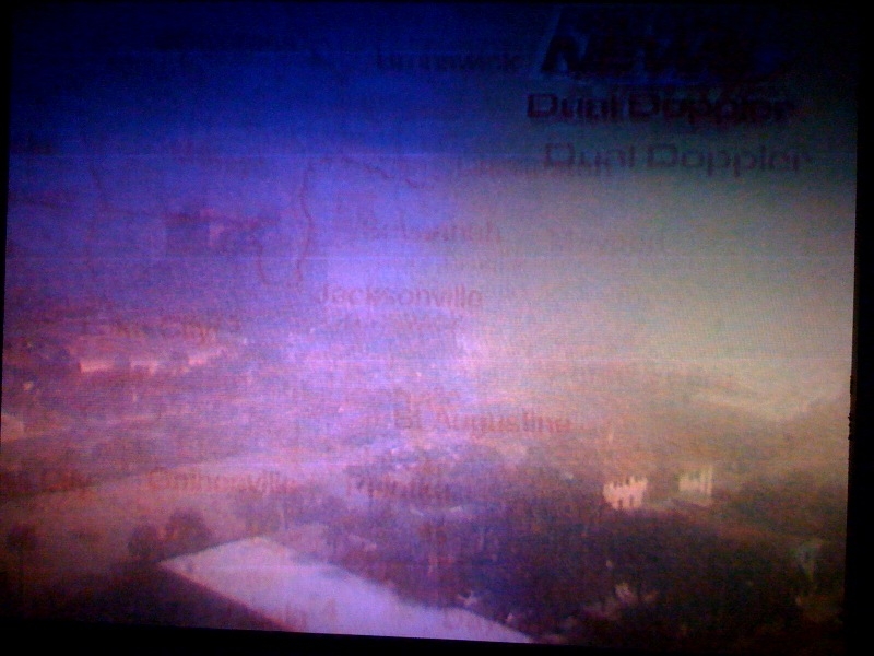
This cooler weather will be ushered in by the strongest cold front in weeks and it will sweep through first thing Tuesday morning. Now that it is March and the heart of our severe weather season we watch these fronts very closely. The good news is that it is coming through late tonight and first thing Tuesday which means our atmosphere will be much more stable. We may have a rumble of thunder up near Waycross and Alma late tonight, otherwise I do not think this line of rain will bring much in the way of lightning and will continue to weaken as it moves south. This is the same front that has caused over 50 damage storm reports across the country including an EF-2 tornado in Dubois County, Indiana with wind speeds near 120 mph. Two homes had collapsed walls and lost their rooftops. An RV was tossed across the road like a toy. Luckily, everybody is okay. We can count are blessings that we will not have to worry about any severe weather here at home. But we really could use the rain and unfortunately the latest models show the rain drying up as it moves south. I think most of us will see amounts of less than a quarter-inch.


This is not good news for our drought but at least I do see better chances of rain for us over the next 2 weeks. I do not think we will see another stretch of almost 3 weeks without a drop of rain. You can see those familiar green rings around our retention ponds showing the dropping water levels.  After starting the year with a rainfall surplus we have had a rain deficit of 2 to 2.5 inches of rain over the past bone-dry 18 days. The good news is the southeast ridge that has been blocking all our rain is not expected to be a permanent fixture like we saw for much of 2010. But the overall pattern does still favor drier and warmer than normal this Spring and wildfires will continue to increase across the area. Now to our weather blog question of the day. Will we get to see the Discovery Space Shuttle fly-by at night over Jacksonville?


Here is a shot of the Discovery taken from the International Space Station before it docked up. There are really no words to describe this incredible image.( Goosebumps!)Now here is the good news. The latest from NASA is the shuttle will be staying in orbit a little longer than originally planned. This is exactly what we needed to hear to see the shuttle here at home, because it is in the earth's shadow over our part of the globe at night through at least March 8th. Without sunlight illuminating our space ship at night we cannot see it.

Now if it is still in orbit on March 9th which now looks more likely we will be able to see it in our night sky. Look north-northwest at an elevation of about 17 degrees beginning at 7:50 p.m. The magnificent light will cross our skies in 2 minutes and exit to the north-northeast at 7:52 p.m. at a higher elevation of 52 degrees. Now keep in mind it will be preceded by the International Space Station at 7:49 p.m. Even better, we should be able to see both separately in the sky at the same time without binoculars. A lot also depends on our weather. It looks like we do have a lot of clouds in the forecast this week beginning on Tuesday, but next week favors us clearing out once again for good viewing. I will keep you updated here on the blog as we get closer. Exciting stuff!


Well I better get back to some Spring cleaning and maybe work on some dance moves. You see anchor Len Kiese working with me on a dance called the Len Bounce during commercials on Good Morning Jacksonville. Len was trying to be patient with me. That guy is not only one of the most professional anchors I have ever worked with but an awesome dancer and teacher. My goal is to take my wife dancing. I was having problems coordinating my shoulder shrugs with a little swagger in the hips and legs. He was trying to get me to loosen up like I was in front of the weather wall pointing at a storm. It did work. Practice makes perfect. I am not ready for any you tube videos just yet but just wait! My garage also needs some work. I will also make sure not to pack away the jackets in the attic just yet with cooler 60s returning to our forecast tomorrow and even some lows in the 40s by the middle of the week. You have a great day and keep those great questions coming and thanks for reading. We are less than 2 weeks away from the Gate River Run and tomorrow here on the blog we will have a sneak peek forecast. I know its brave this far out but we hit the Donna Marathon forecast right on the head several weeks out. Today's running mantra: A new season is here and it is time to run with no fear! Do not be afraid to sweat! Your a running machine without a regret!

Sunday, February 27, 2011

Slippin' n' Sliding to more 80s and a historic finish to February 2011!


Sunday, February 27, 2011

Wow! The wild weather pattern that seemingly began about 2 years ago continues! Things have heated up and you see my daughter Lauren enjoyed cooling off in the slippin' n' sliding weather yesterday and yes it was plenty warm with areas from Julington Creek and Mandarin to downtown Jacksonville having no trouble reaching the middle 80s. Forget the April pattern we have been talking about. We have gone right into May. The amazing part is while some areas were still in the middle 80s at 3 p.m. folks in Fernandina Beach were shivering in the lower 60s and in Saint Simons Island it was a ocean-chilled 58 on the pier! Welcome to spring time in Florida! While we did not set a record high at Jacksonville International with an official high of 83 we are going to be in the record books here in February before all is said and done.


We are going to go down in the top 3 for having the most 80 degree days in the shortest month of the year. Pretty impressive. That is some big company being on the same list as 1989, 1962, and 2001. In 1962 we set count them six record highs while in 1989 we went right into summer! This brings us to our blog question of the day. Will we have a Spring this year or go straight from winter into summer! Last year of course we did without a doubt. This year we are in a total opposite pattern but it matches up with the La Nina pattern we had in 1989. In 1989 not only did we stay drier than average through the Spring but temperatures stayed well above average. The 90s hit the area by late April and May pushed 100 degrees! So while every year is different and we are seeing plummeting temperatures across the globe I do think we have a better chance this year of going straight from winter to summer here on the First Coast. While rain looks scarce we will have to keep an eye on severe weather. This season could be one of the worst in a long time across the country and it only takes one outbreak hitting close to home to make it a Spring to remember for storms. Of course with all this wild weather I will keep you updated. I hope I am wrong on this forecast and we get heavy rains and some nice classic Spring weather. But right now I remain most concerned about our on-going drought and a robust fire season that officially starts on March 1st.


Our star weather intern Andrew Wulfeck took this picture of the National Weather Service launching a weather balloon at Weather Fest yesterday. This took place at UNF and was a big success. Our own Chief Meteorologist Tim Deegan took a ton of questions and enjoyed talking to folks that were excited about First Coast News putting weather first with its commitment to having the areas only real-time live doppler radar. Time does save lives and was of essence on this date in 1984 when an F2 tornado that hit Clay County with wind speeds estimated near 150 mph. It was 30 yards wide and on the ground for 3 miles. It caused a quarter-million dollars worth of damage and injured two people.


Today our main weather issue will be patchy dense fog through at least 10 a.m. and it could linger at the beaches a little longer. So make sure to slow it down so you can enjoy a nice sunny afternoon with temperatures back up near the 80 degree mark. We are going to have to watch for big changes as we head into March. We have a big storm system that is crossing the country with another severe weather outbreak for Arkansas, Oklahoma to Tennessee tonight and tomorrow. This cold front looks like it will hold together better as it moves our way and we could have a few thunderstorms in our viewing area by late Monday into Tuesday. We do need the rain but we may have to be on the outlook for a strong storm or two. Make sure to join  me tonight at 6:00, 6:30, and 11 p.m. to do some storm tracking with me and we will also take a look at challenging record highs before a big cool down to start March.

Saturday, February 26, 2011

Another fog front brings more fog advisories and wild temperatures but no rain


Saturday, February 26, 2011

This is the time of year when you get plenty of fog which happens when our weather starts to warm up and you are still surrounded by a winter-chilled ocean. It can make forecasting a lot of fun for meteorologists and challenging too! This great shot by Mike Lyons really put this morning into perspective. While areas near Mandarin had bright sunshine to start our weekend out just to the north and east it was a much different story with ominous thicker clouds and fog. Another forecast impediment you have this time of year is exactly when will the fog form and or lift. Notice this morning at 10 a.m. our Jacksonville Beach camera captured some of this instant condensation, but by 11 a.m. it had lifted and you cold see the palm trees once again!


There were fog advisories for Camden and Glynn Counties but they have been allowed to expire. The next big key to the forecast today is how far south a weak cold front moves. The good news for us is that I do think it will stay mainly north of Interstate 10 today and it will continue to weaken. What is left of it moves north as a warm front tonight and this means you've guessed it more patchy dense fog on the way. But for today it does look like any sea fog that does develop should be over the ocean and will not scoot inland until this evening and overnight. This is hard to believe that this is what is left of the same cold front that brought over 200 storm reports including at least 10 tornadoes across the country. We can just call it a fog front now. Our beach camera at Jacksonville Beach confirms our sunny forecast. One thing to keep in mind though is that this is MONSTER JAM weekend not only at Everbank Field tonight but with our temperature you could call a monstrosity if you are not prepared. Check out what that cooler ocean breeze does this time of year!


Many areas on the soft sand and near the sea-shells will have highs stuck in the upper 60s while just inland it will be near 80. Even areas north of the front across inland southeast Georgia will have no problem reaching well into the 70s. This morning we said you may need a light jacket on the beach and keep the shorts out west of the Intracoastal Waterway! What is amazing is some of our inland areas like Palatka and Keystone Heights will have their 6th 80 degree day of the season. Our average high does not reach 80 degrees until mid-April. This will also be our 16th straight day of dry weather and 10th day in a row with above average temperatures. Yes, nature is on a roll! But too much too soon for some.


This may have been a nice change but look what it has done to our pollen count. It has not only come early this year but we have one of the highest pollen counts in the entire country! The count is really off our pollen page, but I had to make it fit for television purposes. Pollen seems to be accumulating faster on my car than an Alberta clipper snow. I washed my car this week early in the morning only to have it go back to a greenish color by evening. So even though we have good car washing weather with no rain in the forecast the next couple days we may have to wash our cars a couple times over. It is good exercise at least, it feels great out there in the sun and it certainly is better than shoveling snow. Although.....don't get me started...lol. Our big blog weather question today is when will we see this pattern shift. We do need the rain and are still playing catch-up from last year. This despite us already wrapping up above average rainfall for February. Will we dry out like we did over the summer into our autumn season? Well look no further than California!


It snowed in the hills of San Francisco for the first time in 35 years! It was not enough for a snowball fight but incredible. Las Vegas has a chance of snow tonight! Yes, what are the Vegas odds on that happening. This could be our pattern-changer and this storm should be strong enough to break down the big ridge of high pressure that has been keeping us warm and dry for the past couple of weeks. It should even bring at least some rain to our area by late Monday night and Tuesday morning. Temperatures may not reach 70 by the middle of next week even for inland locations! The good news is that more rain chances are in the forecast late next week and weekend! But until then it is sniffle and sneeze weather and we will continue to watch that fog closely again mainly at night and during the mornings. Temperatures could actually rebound into the 80s again by Sunday with even 80s possible at the beach on Monday! Tonight join me on First Coast News at 6, 6:30, and 11 and we will track another severe outbreak across the country by later Sunday into Monday and how it will impact us here at home. See you soon and enjoy the great weather!


Monday, February 21, 2011

Temperatures and Kids runniing wild on President's Day

February 21, 2011 Monday

Happy President's Day and like many parents I am doing my best to hold up the fort here at home. My fort is being overrun at this time and taken over by my darling kids. Things are crazy. But I am tough, I am a marathoner! I am making some peanut butter and jelly sandwiches and packing plenty of food for our trip to the beach. It will be the warmest day of the year on the sand! While most of us inland have hit 80 on at least two occasions this year the cool sea breeze has kept things much cooler at the seashore. But today the sea breeze will be overwhelmed by a balmy springy southwest breeze at 10 to 20 mph. I cannot rule out 80 degrees at the beach and even some lower 80s inland. If we get full sunshine we could even see some middle 80s which would be our warmest February 21st since 1953 and possibly our warmest President's Day ever! I will keep you updated here on the blog!

You see above we have settled in on quite a persistently warm Spring weather pattern despite the calendar saying that Spring does not begin until March 21st! We have gone 10 days without any big rains which is a concern in our drought and 5 days in a row with above average and we will add at least another 7 days to both of these weather streaks so after the beach today I will likely be washing my car like the colonel you see above! The signs of Spring are ubiquitous in Jacksonville and you can really see it on our cars in the form of a green film! Yes, my kids have already finger-printed my car with the words, WASH ME!! But there is a lion lurking and we talked about it last night at 11 p.m. with your exclusive 10 day forecast. Let's take a look! Do not be scared!


Now this is also available for free and updated on our First Coast News weather app and your local weather team from First Coast News keeps it updated on a daily basis! Check it out and download it to stay ahead of the lion. But notice the lion is not lurking anywhere close to home. Our next good chance of rain will be the last day of February into March. I do think March will come in like a lion with possibly some strong thunderstorms. I am in the process of overhauling the weather web-site at firstcoastnews.com so you are covered on the tube and here on the web with the fastest most current information, including the only live doppler radar in Jacksonville so you and your family stay safe. Yes, our weather team is taming the lion so to speak. Notice we could get a bit chilly by early March as some of that cold air finally makes a move south with the jet stream that is creating blizzards and havoc across much of the country. But again I do think this is the year we can plant BEFORE ST. PATRICK'S DAY with less than a 5% chance of a light freeze and a 10% chance of a little patchy frost from here on out. Well I am out of here for now...the kids are calling. Make sure to check back this evening and I will be posting more on how we did today temperature-wise today, some beach pictures and your space shuttle forecast. Have a great day!

Sunday, February 20, 2011

The green flag is waving and folks swimming in our Fine February pattern


Sunday, February 20, 2011

It is good to be back on the weather blog and yes I have gotten my second wind after completing the 26.22 mile National Marathon to finish breast cancer. Here was a shot from the beach portion of the run and when you looked out over the ocean you really could not feel any pain. This was not about me or my aching achilles heel. I thought of all those that this disease has impacted and how we really are close to finding a cure. It all starts with love and all of us coming together for great events like this one. I believe you can do anything you set your mind to especially if you are working with others on one common goal. There is no stopping us now, we are finally going to finish breast cancer!  I wanted to thank all the wonderful folks from around the country I talked to during the race! They really did keep me going and I loved hearing about all the crazy weather from the coast to coast. They were surprised when I told them about our wild weather ride here at home and they could not believe it snowed here this winter. One of the highlights of my race was when I got to run on the beach and talk to running legend Bill Rodgers. I could hardly believe I was running next to one of the all-time greats! I kept up with him for a bit and we also talked about the rough winter he was having back in Massachusetts and he was thankful for the picture-perfect weather day we had. He was training for the Boston Marathon which of course is in April. Nature has already put us through a marathon of its own this winter with our coldest December and January period on record! But things have certainly changed and it looks like we are running straight into Spring way ahead of schedule. Officially Spring begins March 21st but we have had back to back 80 degree days now in Jacksonville and I cannot rule out a couple more 80 degree days on the way as we finish out February. How nice has this weather pattern been? Well check it out below!


This is the Delfano family enjoying a nice swim yesterday in Jacksonville! Now the air temperature did hit 80 but keep in mind the water temperature was only in the middle 60s. Yes, half the kids in this picture are visiting from New Hampshire and this was like a nice June day in Lake Winnepesaukee! Yes, more snow is on the way for New England this week and they could not be happier here in Florida. I was not brave enough to jump in since I already paid my dues at the Polar Plunge...LOL.  I will be ready to swim in March but not the middle of February! This is in stark contrast to last February when we did not have any 80 degree weather and our first 80 degree day held off until March 30th! This weather change is well deserved and just in time for race day at Daytona! The green flag will be flying and it will be the first time in 3 years we will not have to worry about any weather delays! Check out the latest forecast that does include plenty of sunny comfort!


There will be a sea breeze developing that could drop temperatures a bit during the afternoon but otherwise it looks terrific. Here in Jacksonville our temperatures will also reach the lower to middle 70s today and with the east breeze kicking up off the ocean this afternoon it will hold in the upper 60s to near 70 on the sand! This will also be a great day to check out the Moe's Southwest Grill Sunshine Lacrosse Classic at Everbank Field. I was singing the Notre Dame Irish fight song this morning on Good Morning Jacksonville since our producer Anne Roy is a graduate from there. She is simply an amazing producer and appreciate all she does.  Yes, I was also looking for a little extra weather time since everybody knows I am a Boilermaker fan first and foremost. I really hope nobody from West Lafayette is reading this and if you are please forgive me! Boiler up! Other top teams like Duke and Georgetown are also competing today. A lot of folks do not know much about lacrosse but today is the perfect weather day to go check out how great of a sport it is here in downtown Jacksonville. Yes, stop the goal and there is no stopping this Spring weather pattern! Check out our latest synoptic map this morning!


This pattern is producing blizzard warnings in the Plains and tornadoes to California. Once again from coast to coast the weather is frightful except here in Florida! We could actually hit 80 again on President's Day due to all the extreme weather to the north helping to whip up nice balmy southwest breezes! Yes, more swimming weather for some! These mammoth storms are forming along the big temperature contrasts taking place in the center of the country. The flow around these storms are bringing us balmy breezes. This trend should continue at least for another week. This means Spring is king in your forecast. Will this pattern hold into March and can we actually plant early this year. Make sure to check back here on the blog and tune in tonight at 6, 6:30, and 11 p.m. for much more! Thanks again for reading and it is good to be back blogging! Enjoy the weather and remember the sunscreen.

Saturday, February 12, 2011

National Breast Cancer Marathon weekend off to a bright, enthusiastic start


Saturday, February 12, 2011----10 a.m.

I started to really get into running after completing the Indianapolis Half Marathon in May of 2004. I ran around the world's most famous speedway and even though I did not get a chance to kiss the bricks at the Brickyard I was hooked for life! To be able to run with such great people and athletes from all over the world and have folks cheer for you is a wonderful feeling. Now almost seven years later my love for running has been taken to a new level. I have run 8 marathons but never have I been more excited about tomorrow. This is not just a run but a celebration of life. I spoke to Donna Deegan this week and she gave me the best pep speech of all by having me watch her touching story about her friend who we now just call Angel. Click on the link for more at http://www.firstcoastnews.com/news/topstories/news-article.aspx?storyid=190821&catid=3 . Angel taught us about letting all the positive energy around you flow and it starts with helping others. You see the big love poster I signed this morning really is what it is all about. Breast cancer is a horrible disease but she did not let it control or live her life. Angel lived her life by helping and loving others in huge ways and just knew she would be fine no matter where she was. I appreciate Donna taking time to share this with me. It gave me a much better understanding about what this weekend is really all about. It is not about how fast you run, or if you can get through the proverbial wall with less pain, but it is about folks from all around the world coming together to help finish breast cancer once and for all. Just finish it!


This morning the Guerrero family you see above all finished the family fun run which included their five year old. Great job! I also met a 4 year old that did the fun run and a 6 year old Caleb from Missouri that completed the 5k. Caleb told me he does not miss all the snow and cannot wait to run 5 miles for his relay team tomorrow at the marathon. It was great to see so many kids this morning. I also spoke to Sid from Charleston, South Carolina who has completed 175 marathons! He said he ran this marathon last year like me and agrees this marathon offers a whole lot more to you than other marathons. It is much more than a run and you could really feel that positive energy at the Expo this morning. I feel like I can run 2 marathons now after talking to all the great people and volunteers. This really has become one of Jacksonville's biggest events and it is something we should be proud of. Another fine gentleman I met and interviewed on the air was Miles who was part of the original group that ran for breast cancer. He told me they started with 70 runners and ran it as part of the Jacksonville Bank Marathon. How far we have come and we will not stop until we finish breast cancer!


The forecast is looking terrific! Nature has impeccable timing. I am giving all the credit to ANGEL like Donna Deegan is! So far in February we have had an amazing 4.07" inches of rain at Jacksonville which is an inch above average for the entire month and it is not even half way over yet. But the statistic that stuck out to me was that we have had only 2 sunny days this month. February is supposed to be one of our drier and brighter months. Well this weekend nature finally gets it right. We will double our sunny days to four thanks to high pressure building in.

Now you see your race temperatures above and they can be a bit deceiving. We will start a bit chilly but keep in mind that temperature of 37 will warm up in a hurry and by 8:30 a.m. temperatures will be in the middle to upper 40s. In the sunshine it will feel more like 55-60 for runners. It is what I call runner's temperature. So just keep in mind those temperatures above are shade temperatures and you also will want to add 10 to 15 degrees to come up with your true runner's temperature. So to me the actual temperature range is actually more like 47 degrees at the start to near 75 in the sunshine by the finish.  If there was humidity our runner's temperatures would be adjusted higher. Humidity is what does runners in the most and tomorrow it will be a non-factor! Last year we started with a race temperature of 39 and ended with temperatures at 64 and I remember the heat getting to me the last 4 miles or so....it was also due to fatigue but that sun does beat down on you and the pavement heats up quickly. That is why I came up with runner's temperature which is a whole lot more accurate as to how it really feels to a runner. So yes, shorts and tank top weather for runners. I may wear an old sweatshirt I do not want to keep the first 3 miles or so while I warm up. It all goes to charity so all is good! One more thing you may not realize is that you will need to wear sunscreen tomorrow. The UV index will be borderline high tomorrow or the highest of the year and a sunburn could happen in as little as 40 minutes. Make sure to put on an SPF 45 or higher. Your body is not able to cool itself down properly if you are all sun burnt. That is one less thing you should have to worry about. Remember the shades and sports sunscreen!


Now tonight make sure to tune in at 6, 6:30, and 11 for the latest on this big pattern change and I look forward to showing you the brightest and warmest 7 day of the entire year. You can see the big flip-flop in the pattern with the colder weather moving out West and the warmer air moving East thanks to a jet stream that has finally retreated. This could not come soon enough for areas of Oklahoma that set a new all-time record low temperature of at least -28 degrees Fahrenheit in Bartlesville this past week without a wind chill. It had never been that cold on any day or in any year in modern recorded history. In fact the warm-up in Oklahoma will be so dramatic that temperatures could rise 100 degrees this week alone compared to last week! The power of nature!

Snow cover will quickly melt down and instead of covering 65% of the country will only be covering about 20% of the country by next weekend. The big thaw should also keep the frost quakes to a minimum in western Ohio and Indiana. They were having a phenomenon called frost quakes that scared a whole lot of folks. Many folks heard loud booms and their homes even shook. This can be caused be a sudden cracking in soil or rock caused by the freezing and expanding of water in the ground. Temperatures were below zero in many areas that felt these localized quakes. Since the freezing does not go very far down into the soil these quakes never get too big or dangerous. But they can be scary. It is something I never heard of before.

While we have not had frost quakes here in Florida we have had plenty of frosts and freezes this winter. Do you realize we had our coldest first two months to a winter season ever this year. Yes, it has been confirmed that our December and January were the coldest two months to start meteorological winter on record!  Tonight we may have some patchy frost and inland freezes away from the water, but it will be a thing of a past with a zero percent chance of a frost or freeze for at least the next 10 days and no frost quakes in the forecast. I will see you soon and wanted to give a special shout-out to Mike who I met at the expo who reads this blog! Thanks so much for your support! Have a great day and race. Thanks to the many hundreds of folks I met this morning that truly inspired me. God bless!

Sunday, February 6, 2011

Glimpses of Sun, Super Recipes & Improving Weather on Super Sunday!


Sunday, February 6, 2011------7:30 a.m.

Everybody has been watching and waiting. That is right everybody is ready for some sunshine. Now for meteorologists this weather pattern has been great! I have loved tracking this busy weather here at home. It has been the best gift of all that I received from nature for National Meteorologists Day which was on Friday. No, I did not receive any other gifts, chocolates, or even a card....lol. I teased my news director that we celebrated a ground hog on Wednesday, but there was no mention of meteorologists on Friday. That is okay because we are a humble breed, yes a little strange too at times, but the ground hog can have all the glory as long as I do what I love! Now you see Jaxon de Ville and Jake yesterday were keeping their eyes to the sky yesterday looking for our brightest star in the sky to make an appearance. After all, it is the sunshine state! They did not get to see any sun but Jake's 8th birthday party was a success yesterday and they were thankful for a nice break in the rain during his outdoor party that Live Doppler Radar showed clearly heading our way during Good Morning Jacksonville. I breathed a sigh of relief because my kids were at that party and there was no room for error on that forecast. I would never have heard the end of it if it rained on Jaxon de Ville and all that good food that was outside....lol. Speaking of rain February you have a right to be a little antsy for sunshine since it has brought rain on five of the first six days this month and so far this year our rainfall is running about 2.34" above average. Now keep in mind we are still in a drought and St. Augustine is still running about an inch below average for 2011. So yes even though it has been a bit gloomy this month so far at least we really need the rain and it has made for some good sleeping weather. Ready for more good news! Okay, drum roll please....


We will have sunshine return to the area today. But it depends on where you live. I do think we will have a few lingering showers south of Duval County but it should be a much drier day. The farther north you go the better chance you have of seeing at least some glimpses of sunshine. Now it will not be a bright sunny day with what I call filtered sunshine through the high cloud canopy, but it is an improvement! I would say this is still a big improvement from all the thick fog and rain that has turned Jacksonville into London East. Temperatures will remain seasonable today with highs in the lower to middle 60s.


First Coast News is lucky to have Mike Lyons who like me will stop on the side of the road no matter where he is to take photos of clouds and the weather. Today he did capture a shot of some breaks in the clouds! Thanks Mike, I do hope we get more blue patches than this but it is a start. You even see a little blue. So today that is our theme. It will not be picture-perfect but at least we will see a few rays of sunshine and maybe even a bit of blue to replace the never-ending gray skies. The good news is nothing will be slowing you down or any fog to worry about if you are going out grocery shopping this morning. Yes! It is Super Bowl Sunday. It is all about family, friends, commercials, and yes there is also a game. I do have a couple recipes I want to share with you as promised on our 7 a.m. Good Morning Jacksonville show today. Lori Dorman who also helped form Kick it Up First Coast was kind enough to send it this to me! Here is HEALTHY CHICKEN NUGGET SUPER HORS D'OEUVRES!
Boneless skinless chicken breasts

Eggbeaters

Bread crumbs (whole wheat is best if you can find them)

Reduced fat Parmesan cheese

Paprika

Italian seasoning

Cayenne pepper (optional)

Any other seasonings you like


Preheat oven to 375 degrees. Line baking sheet(s) with aluminum foil, spray with Pam.
Cut chicken into bite-sized cubes. Combine bread crumbs, cheese and spices in a shallow dish. Pour Eggbeaters into another shallow dish. Dip each nugget into Eggbeaters, then dredge in crumb mixture. Place on prepared baking sheet(s). Lightly spray tops of nuggets with Pam. Bake approx. 20 minutes or until cooked through. They don’t even need sauce, but you can use your favorite dipping sauce if desired.

Okay I know the game is still 10 hours away but I am very hungry after reading this! Thanks Lori. Make sure to check out Lori's cool blog at firstcoastnews.com. She has a lot of fun with it like I do and one of the nicest people you will ever meet! Okay, ready for another recipe. This is from my wife and this Mexican Dip is legendary! I brought it in for an early morning show about a month ago and set it out at 3:15 a.m. It was gone by 3:45 a.m. Yes, this dip recipe is dangerous because it may cause your guests to want more and it runs out quickly. Here it goes...

Seasoned black beans for the bottom layer, drain and mash (black bean chipolte dip does very well)
Second layer is guacamole (homemade is best)
Third layer is a cup and a half of sour cream with taco seasoning (tastefully simple fiesta works best)
Then add shredded lettuce, Colby Jack cheese and sliced cherry tomatoes

It is easy to make and it took me longer to find the ingredients than to make it!

Now that I posted all this good eating, I am thinking I will need to run all this food off! My saying is I RUN SO I CAN EAT!! Well the National Breast Cancer Marathon is ONLY A WEEK AWAY! Here is a sneak peak at the forecast. It could change but hopefully it does not!


This will be my 9th marathon and now the hardest part is waiting! I wish I could start it now especially with a forecast like this. Ideally, the best running weather is when temperatures stay below 65 and it looks like everything is on track. Notice we will have GREEN FLAG conditions which means the weather will pose a low risk to runners. During the race there will be Heat Index Risk flags set up at all the first aid stations and they should all be green! Here are what the different colored flags mean just in case...since all participants should monitor alert flags to understand and react to the level of risk of participation based on the measured heat index on the course.

Black Flag: Heat Index Greater than 82 degrees F( Greater than 28C) -Extreme or hazardous risk. Be on high alert. Take steps to reduce risk.

Red Flag: Heat Index 73-82 degrees F (23-28 C)- High risk, everyone should be aware of injury potential and individuals at risk should not compete

Yellow Flag: 65-73 degrees F (18-23 C)- Moderate Risk- level increases as event progresses through the day.

Green Flag:  Less than 65 degrees F (Less than 18 C) LOW RISK- BUT RISK STILL EXISTS ON THE BASIS OF RISK FACTORS

throughout the It may be a bit breezy but I will continue to fine-tune that for you as we get closer. The big news is we are going to FINISH BREAST CANCER. LET'S GO!!


Tonight make sure to tune in to First Coast News. I will talk more about this bizarre weather pattern not going away anytime soon and why February will not live up to its dry reputation as you see above. More heavy rain is on the way with another rainy Monday looking likely. Whenever you receive beneficial rain this time of year I would certainly say it is bonus rain. Most of our rain in Florida comes during our thunderstorm season from June through the first part of October and of course from tropical systems. We fell so far behind last year that we need a whole lot more of this "bonus" rain. Expect more flooding around the area before all is said and done this week along with the threat of strong thunderstorms. You will also want to check out the 7 day forecast that does include a freeze. Yes, it will be like my own Super Bowl as always. I look forward to seeing you soon! Have a fun day.

Tuesday, February 1, 2011

Ominous skies but we will dodge the worst of historic storm


February 1, 2011---7 p.m.

Well I have some good news here today on the blog...it has been all doom and gloom with the historical storm update I did earlier. Despite our skies here over Jacksonville turning ominous this afternoon as you see above it does look like we will be the lucky ones when all is said and done. I have been talking to tons of folks in the Midwest, Kansas and the Northeast that wish they were here in Florida.


You can now see why. Rick Thomas who I dub the "weatherman" was out walking his dog just south of Kansas City and he almost got lost between all those big snowdrifts. They have had about a foot of snow and Rick who has been through a lot of storms will always remember this one. Thanks Rick! Stay warm and keep in touch from Jay hawk country. While this picture was being taken I felt like I was a million miles away as my kids were outside in shorts playing on their electric scooters and I even opened up our windows. The warm breezes even had a little touch of humidity but most of all it was comfortable. The good news is that humidity will not be bringing severe weather but just some needed rain showers. The big blizzard impacting several states across the country will stay about 1,200 miles north of Jacksonville. The 150 mph winds feeding the two to three inches of snow per hour will also stay well north of us. This means the severe weather that has brought numerous damage reports from Texas into extreme western Florida will weaken by time it arrives here tomorrow morning. There was an EF-1 tornado report confirmed in Oak Hill, Texas with two homes damaged. About three dozen wind damage reports of wind gusts near 60 mph have also been received. A tornado watch has been extended into far western Florida but with the monster storm quickly lifting north overnight this line will continue to weaken. We will not see a repeat of last week and since we are now in our severe weather season that is a big relief. We certainly can count our blessings. The bad news is the storm is lifting so far north that our rain amounts look more scattered and less than a quarter-inch. We could use a whole lot more. More rain chances will at least move our way late Friday into Saturday morning, hopefully bumping our weekly rainfall totals up to at least a half-inch.


Now we could wake up with a few rumbles of thunder but again the atmosphere will be much more stable since the front is moving through early in the morning and all the upper support is well north. This brings us to our severe weather tip of the day. Florida is certainly the lightning capital of the country with 1.4 million cloud to ground lightning strikes per year. We have the perfect breeding ground for lightning which plentiful moisture since we are on a peninsula. We also have plenty of heating and direct rays of sunlight. Sunburns occur here even in the middle of the winter. You add in the sea breeze that naturally forms and collides with all of our humidity and heat and you have all the ingredients needed for building cumulonimbus clouds that produce lightning. Lightning kills more Floridians each year than hurricanes. Most folks do not realize that it travels at half the speed of light or 93,000 miles per second, so my favorite saying is this.....when the thunder roars outdoors head indoors! You are in danger and have no time to play weatherman and if you are on the beach or by the pool your danger risk is increased ten-fold. Most people are in fact struck by lightning when it is not raining outside and half the lightning victims are hit after the storm has passed. Lightning travels outside the main parent cloud by up to 10 miles. Some day there will be lightning warnings issued and until there is make sure to tune in for the latest on Live Doppler radar to find out where the lightning is and where it is moving. We showed it quite a bit during last week's storms and remember even if there is no severe weather warnings and you hear thunder, you are in danger.

You have a safe evening and tomorrow is one of my favorite days of the year! Yes it is Ground Hog Day and I have my forecast all done. I will have a Ground Hog Day update tomorrow! I do not have time to fall asleep like Phil.....not with all the exciting weather we have every day in Florida and all across the country. Have a great night and thanks for reading.


3,000 Mile Storm Unleashing its Fury & Florida Will Dodge Its Worst


Tuesday, February 1, 2011----12 p.m. and updated again by 5 p.m.

Here is the Blizzard of 2011 as seen from space. This storm is a beast! Its clouds extend over 3,000 miles and it is wrapping in moisture all the way from the Pacific Ocean not far from Hawaii. So it has a huge domain of influence and is one of the biggest winter storms since the 1950s just by its sheer size and it will go down for many as the biggest winter storm in modern history. The latest models are in and as I posted here on the blog yesterday it still looks like Chicago will  be the bulls eye with 24 inches of snow possible. Their all-time record snow occurred on January 26-27, 1967 when they received just over 23 inches of snow.


Areas farther south in Indiana can breathe at least a little sigh especially south of Benton, Newton, Jasper, White, Miami and Pulaski Counties. Do not get me wrong, this will be a dangerous storm for all of Indiana. But it may not be as bad as it could have been and here is why. This storm is so strong that it will wrap what is called a dry slot into Indiana which will hopefully keep the catastrophic ice totals away. Indianapolis will hopefully have ice accumulation closer to an inch rather than two inches. Keep in mind anything over a quarter-inch is considered dangerous and treacherous and can cause numerous power outages. Lafayette, Indiana will have a wintry mix and hopefully the sleet and freezing rain accumulations will be held down closer to a quarter to a half inch of ice. Notice on the latest satellite/radar composite as of 5 p.m. the dry air has made its way into St. Louis. This storm will also be stronger and deeper which means it will actually cut off the warm air quicker. This should cut into the ice totals....hopefully! Check out the extent of watches and warning across the country. I have never seen anything like this. Every state or its adjacent waters has some type of weather issue!


Lafayette, Indiana I still have in a 4 to 6 inch snow band with maybe a few spots with a little more. There could be thunder sleet tonight before you see a break in the mixed bag. Then snow will fill back in by 4 a.m. and with wind gusts near 40 mph it will look like a blizzard when you wake up. You should actually meet blizzard criteria with visibilities due to blowing and drifting snow being reduced to a quarter mile or less for 3 hours or more. As we all know in Indiana, 4-6 inches of snow can drift into 3-4 feet with enough wind and that will be the case tomorrow. So my next big question for Indiana is when will the blizzard warning be extended farther south to cover Tippecanoe County. Areas toward Monticello and Remington I still think should be in the 8 to 12 inch snow bands with a blizzard warning issued for good reason. So remember if you are in Indiana there could be huge differences from south to north. Areas just south of Crawfordsville could end up with 2 inches of snow while areas toward northern Newton and Jasper Counties could see 16 to 18 inches of snow!


You see this accumulation snowfall map from one of the weather models and do not focus on amounts as much as where you see the brown and red areas. Those are the areas that could see the most snow. This also now includes southern Wisconsin where the cheese heads may not be able to get to the Super Bowl until later in the week. That is okay because it is very cold down in Dallas where they had snow  and ice today and the airport was shut down for the first time in 5 years! Temperatures will likely not go above freezing in Dallas until Friday! The Super Bowl will bring warmer weather for the Pack and Steelers with highs near 60 but temperatures could fall into the upper 40s by games end. Send in those pictures and I would love to post them here on the weather blog. I have a ton of viewers here at First Coast News that moved here from snowy climates and many of them love reminiscing and remembering when they had to deal with all that snow. Many I talk to actually miss the snow. I fall into the category but one thing I do not like is the ice and I hope the lower amounts come to fruition. Check back here on the blog for more and if you are in Jacksonville, do not worry....your local blog forecast is next....we are the lucky ones!