Wednesday, December 31, 2008

We Say Goodbye to 2008: When Storms Ruled the Hoosier State


This past year will be remembered as one of Lafayette's stormiest on record. This picture sums up 2008. Wolcott and the rest of us were certainly swamped! I was just compiling the total yearly precipitation and while we did not set a new record for precipitation like they did in St. Louis and Chicago we were not that far off! We will certainly remember the historic floods that hit the Tippecanoe River and the areas from Newton County through Monticello, Monon, and Logansport.

Monon was turned into a lake with a winter's worth of precipitation in only 10 hours combined with melting down six inches of snow. The northern watershed of the Wabash melted down about 20 inches of snow almost overnight. This brought crests of 20 to 25 feet above flood stage and disaster as folks were rescued from rooftops. It was reminiscent of some of the scenes that we saw from the flooding after Katrina hit New Orleans. Hundreds were displaced and many lost their homes forever.

The good news is that 2008 is going out on a quiet note with great travel weather. The wind gusts of 40 mph at WLFI last night will diminish to near 10 mph by late today with light winds tonight. Here is your Kokomo Ball Drop New Year's Eve forecast! I will have more on this coming up today. Happy New Year!! I think tonight will be a great night to take in that great event while listening to some music and drinking a cup of hot chocolate. The picture above is from the technokats who help make the ball drop a success every year! They are a robotics and tech team that competes in (FIRST) For Inspiration and Recognition of Science and Technology. They do a lot to motivate and inspire high school students to get interested and involved in science and technology. I am motivated that is for sure! Bring on 2009! Every year in Indiana is always fun and interesting when it comes to the weather. Tonight we will take a look at just how stormy we really were here in Indiana and if our temperatures actually ended up below average in the world's coolest year since 2000. See you soon!

Tuesday, December 30, 2008

Wall Clouds to Wonderful Weather for One More Day!

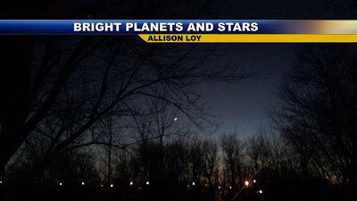
Bob Baumgartner of Romney shows us a nice sunset for a change in our new and improved weather pattern. A red sky at night will certainly be a Lafayette delight. It was so nice to see the stars again last night and yes that bright object in the sky was Venus. This was nicely captured by Allison Loy as it was getting ready to set in the western sky. Usually stars and planets are very tough to pick up but it was so clear out and Venus was so bright it does in fact stand out nicely.


Three out of every four days this December have brought every possible kind of weather. The only thing we haven't seen is a blizzard! No, I am not forecasting one but it would be a fitting end to this month that will go down as Lafayette's stormiest or wettest month since 1990. No, I am not forecasting a blizzard. I do not want to start any rumors.....LOL... Our monthly precipitation at WLFI at is now up to 4.66 inches with 4.2 inches of snow this month. In 1990 we had 5.05 inches of total precipitation. December is normally our third driest month but not this year. We have almost doubled our average precipitation of 2.43 inches. Saturday was certainly a microcosm of how stormy it has been and a reminder that you can have severe weather in every single month of the year. This was never more evident than on Saturday when the tornado sirens blared in Clinton County. Dena Flanagan sends in pictures of our ominous month or what I have been calling our delirious December! WOW! Thanks Dena!

Hey Mike, well before I turned on the TV tonight, I of course was outside taking pictures of the sky,...I thought there were a few interesting clouds as well as many colors in the sky before this storm hit us....while I was on the deck, the winds shifted from blowing towards northeast to blowing real hard to the southwest, it was an amazing change, then the wind completely stopped.....I took a few pictures of the rain that was coming across the field from the northwest of us, and wow was that sound incredible....I guess it was a little worse just a few miles south of us, but it proves, Weather of ALL seasons can happen at anytime in Indiana...LOLOL

This is looking towards the northeast from our house, towards Lafayette
~~~~~~~~~~~~~~~~~~~~~~~~~~~~~~~~~~~~~~~~~~~~~~~~~~~~~~~~~~~~

This was about 5 seconds later looking towards the Southeast
~~~~~~~~~~~~~~~~~~~~~~~~~~~~~~~~~~~~~~~~~~~~~~~~~~~~~~~~~~~~

This is looking towards the West......Huge Wall cloud heading our way
~~~~~~~~~~~~~~~~~~~~~~~~~~~~~~~~~~~~~~~~~~~~~~~~~~~~~~~~~~~~~
One of the many odd clouds that kept dropping out of the wall cloud.
~~~~~~~~~~~~~~~~~~~~~~~~~~~~~~~~~~~~~~~~~~~~~~~~~~~~~~~~~~~~
This massive cloud is what was heading towards the Interstate 65 & 28 area..this was just crossing over US 52 South....it was Beautiful, yet I had no idea we were under a Tornado warning until I was done taking pictures...lol
~~~~~~~~~~~~~~~~~~~~~~~~~~~~~~~~~~~~~~~~~~~~~~~~~~~~~~~~~~~~

This was taken facing South, I took this and had to go in due to the wall of rain that hit us!
~~~~~~~~~~~~~~~~~~~~~~~~~~~~~~~~~~~~~~~~~~~~~~~~~~~~~~~~~~~~

Happy Holidays Mike,
Dena Flanagan
(Wyandotte & New Castle Rd)

Yes we can have happy holidays because that circulation stayed in the sky. Live Doppler 18 did show a hook on the radar when it crossed over Interstate 65 and 28 and you can see why with the above picture. This is why tornado warnings were issued and yes we should all feel very lucky that that rotating storm stayed up in the sky. The cool outflow that hit the area right before these storms moved through may have been just enough to stabilize things and keep us from having a tornado. Speaking of tornadoes, one of the top weather stories of
of 2008 was our busy tornado season. We had the second most active season since 1953! We have even more reason to be thankful about that we had no fatalities in all those tornadoes. It was a deadly year for tornadoes nationwide with 120 deaths which is about twice the normal. Here at home we had 11 tornadoes in our viewing area. Keep in mind Tippecanoe County ranks number one on the list for most tornadoes in the state of Indiana since the early 1950s. This is tornado alley not only in the U.S. but in Indiana.

Normally we average four tornadoes here in the Lafayette area. We almost tripled this number due to a La Nina year which is notorious for bad tornado seasons in the Midwest. The jet stream not only takes a dip in the Midwest helping to form storms but they track right up from Oklahoma and this is the area where our biggest storms come from. These storms have added fuel from the strong jet stream that adds rotation to our thunderstorms which makes them more likely to bring destructive winds, hail, and tornadoes. Tons of moisture is also lifted north from the Gulf of Mexico and as a result we have plenty of lift, moisture, and instability causing a dangerous and robust tornado season.


Here is a graphic showing why it was such a busy season. Notice we were in the red zone or the zone of concern for destructive storms. The La Nina did begin to fade out but not until the autumn and that is why we had a much quieter and beautiful autumn pattern to start. But believe it or not some signs point to La Nina making a comeback which means we could have another interesting winter and severe weather season in 2009! I will keep you posted here on the blog. There are no clear-cut answers on any of the long-range forecasts. Now compare this jet stream to the current jet stream below. You can really see the difference.

This means there will be no worries about any tornado sirens going off today. In fact this week it should be mainly dry! This is great news for the rivers and streams that will continue to recede. This zonal pattern or more of a west to east flow is known for much quieter weather and it will live up to its reputation. Also, the main storm track shifts farther north. How long will this last?

Well it is Indiana and with a Greenland Block expected to develop things could be a whole lot different by later next week and the following week. This time I do not think we will be talking ice that is for sure. We could certainly get the first of two big snows that I have forecasted this winter. We are due! That is for sure. Check back tonight for your New Year's travel weather. It could be a little rougher if you are traveling North, but nothing like we saw Christmas week! Make it a wonderful day and do something nice for someone.


Monday, December 29, 2008

Wabash River Ready to Crest & A Nice Rest from Delirious December Pattern


Here is what it looks like from where you live. I snapped this picture on the way back from working out. You see the new waterfront property along Highway 231 from lowland flooding along the Wabash River. The good news is the river will crest just below 18 feet this afternoon at 17.7 feet or 6.7 feet above flood stage. The critical flood stage on the Wabash is 18 feet so we have dodged extensive flooding by the hair of our chinny chin chin. Good news also at Covington on the Wabash today with only minor flooding expected. The news is not so good in Illinois where they melted down a big snowpack so be careful of more significant flooding if you are traveling west or in that direction.

The blue skies are back today and they couldn't come soon enough. Our delirious December weather is finally giving us a rest but how long will it last? This is what I am working on for the newscast along with your travel weather. We do have a couple fronts I am tracking but I do not see anything like we saw last week and we may not see another week like it for quite some time. I know most people are more than okay with this.

While you are waiting for the shows here is our weather blog question of the day: When was the last time we went from wind chills of -25 to 68 degrees in the same week?(a whopping 93 degree temperature difference!)


This is a good question. Believe it or not we did this before the historic floods hit the northern parts of our area from Remington to Monticello and Monon the first week of 2008. We had wind chills of -20 to -30 and by the end of the same week a record high of 69 degrees which went down as the second warmest day ever in January. Luckily this time around we only had about an inch of rain with no big snowpack. In January 5 to10 inches of rain fell to our north with a good 6 inch snowpack. In the northern Wabash watershed there was up to 20 inches of snow. This all melted in addition to a season's worth of rain in only 10 hours. This is why there was not a 100 year flood...but the worst flooding ever recorded during January.

The good news is this time around we will not see a repeat. So it is a good thing that we missed out on all the snow and we had a beautiful and drier than normal autumn. We can certainly count our blessings. Get out and enjoy the beautiful afternoon and I will see you soon!


Sunday, December 28, 2008

Good Morning! Our Beast of a Pattern Finally Tamed!


The Storm Chasers share a rare break from one of Lafayette's worst weather spells on record! Dr.Chris Melick (doctor of meteorology and former intern) on the left, yours truly, and of course Brian Wolfe.

It will be a week I will never forget with wind chills that froze everything in sight at 25 degrees below zero last Sunday to record-breaking high temperatures that rocketed up to 68 degrees yesterday. That is right it was even a bit humid out there with shorts sightings at Armstrong Park. A temperature range of 93 degrees in one week! I am just sitting here in a daze. I should be resting but nature has gotten me used to a pace where little rest is even expected or warranted. I have been whipped into shape that is for sure.

Saturday's record high smashed the old record of 62 set back in 1982. Of course this all came on the heels of a devastating ice storm for much of northern Indiana. More ice hit the area just before Christmas, and a third icy mess developed on Friday. Indiana is known for wild weather but you can make a case that the last 10 days or so have brought the wildest weather on record. Just since early Friday morning and yes there was a reason I rushed back to work after a 24 hour holiday and I want to thank my wife and kids for putting up with this.....our viewing area has experienced snow, sleet, thundersleet, freezing rain, thunder freezing rain, rain, dense fog, severe thunderstorms, damaging winds, and a possible brief tornado between Stockwell and Clarks Hill. Oh yes, we did have some penny size hail in the first line of storms came that came through. We had two lines of thunderstorms and a third almost formed! This is like a Hollywood movie that is all too real! Here are the damaging wind gusts reported around the area.

Medaryville 70 mph

Stockwell 70 mph

Clarks Hill 70 mph

Boswell 65 mph

Remington 53 mph

Now that the storms have passed early on this Sunday morning you would think it would finally get better! Not even close. Just after midnight Lafayette has been hit with 50 to 55 mph wind gusts and our temperature at Lafayette has fallen an amazing 16 degrees in one hour from 57 to 41 and our wind chills have dropped quickly below freezing in an instant. This stuff is unprecedented! I will look over the almanac data over the next week and see what I can find, but I just do not see anything comparing to what we have all been through.


Our thoughts and prayers go out to those that lost their lives across Indiana and here in the Lafayette area due to the bad travel conditions this wild weather has caused. All of us at WLFI had a very tough time covering and reading those tragic stories of how four people died on our roadways on Friday. Even if we do not show those emotions on the air during and after those stories we felt every bit of it and then some. When anchor Laura Kirtley and I cannot even break a smile during the commercials something is terribly wrong. Heart-broken is the word that comes to mind. Weather is the number one thing that impacts Hoosiers and this sometimes comes at a terrible price. This is why protecting lives and property from where you live is my number one weather mantra. The weather is anything but trivial and Indiana does need its own 24/7 weather channel and I am not talking about taping a few segments a day and playing them over and over. Give me a break! Our Indiana weather changes so rapidly it needs to be live around the clock.


So what caused all of this pain and havoc? We have had a huge Spring-like Bermuda high to our southeast and a deep trough to our West and with this highly amplified pattern something had to give. We have had a taste of every season this week and those seasons clashed right over us. It has been a rough, tough haul we have all been through. Yes, I live for this stuff, but enough is enough. We all need a break and this includes meteorologists. Thanks to a more zonal flow in the atmosphere I do think we finish out the year much quieter. This is great news for the swollen area rivers. Here were those all-important weather watcher rainfall totals for the Lafayette area and a picture of those huge raindrops that were coming down in gushes outside of WLFI.


Boswell 1.75"

Kentland 1.30"

Remington 1.17"

Monticello 1.12"

WLFI 1.06"

Finally I do have more good news here on the blog. It looks like flooding will be on the minor side as rain amounts did stay closer to the one inch totals as expected across the area. Just be careful of those normally flood prone spots through the rest of today and of course near those area rivers that are just over bankfull. The Norway and Oakdale Dams are still below the critical 13,000 cubic feet per second flood stage and should slowly steady off over the next couple days. Flooding on the Wabash may impact Tapawingo Park, the Municipal Golf Course, and a few lowland spots on north 9th street with a crest close to 15 feet or 4 feet above flood stage. Covington will also see minor flooding. If these levels should change significantly I will do another blog update. For now though I am heading off to la la land and spending much needed time with the family. I want to thank you bloggers and viewers for giving me and your weather team a ton of inspiration day in and day out. Your observations and thoughts are all appreciated and as you know by now can literally help save the lives of others. Thank you. Hold up the fort for me and blog away! It is much appreciated and I will make sure I catch up and read all your comments from a wild weekend.

Saturday, December 27, 2008

Weather Team 18 is in Storm Mode

Brian Wolfe and I are here doing cut-ins.....most concern right now....

Storms moving in from Champaign...they are showing rotation and will be near State Line City by 5:01 p.m. ......West Lebanon 5:10 p.m................5:16 p.m. Attica...........5:20 p.m. Wingate....


Please be safe.....Wolfe and I will check back

Record-Breaking Highs Bring January Thaw Early!


All eyes are on flooding this weekend. Stay with WEATHER TEAM 18 for the latest. The good news for our area rivers is that the bulls eye of heavier rain is setting up in Illinois. If this map holds true we will only see minor flooding. In fact the forecast crest on the Wabash River has already been lowered to just above bank full this weekend. Check below for the latest advisories. The only wild card in all this is if that heavy red band shifts over us. This would be caused by more widespread thunderstorm activity over our area which I think will stay to our south. Our cold front does not arrive until late tonight which will help stabilize things. We just have to take it hour by hour and watch those radars together this weekend. I still think we will have a few rumbles out there. I will check back with you. The good news today is that we will not see an all day rain. Get outside while you can. Spring is about 84 days away but today it will feel every bit like it!

Friday, December 26, 2008

Flood Warnings Hoisted Along the Wabash & Dense Fog Heralds Arrival of Spring Surge!


We have an encyclopedia of watches and warnings in our area. Make sure to tune in and I will make sense of it all for you. These are all put out by the National Weather Service offices in Chicago, North Webster, and Indianapolis. I do have some good news as well to share with you on why the flooding may not be so bad for most of us and record-breaking highs on the way! See you soon!


IROQUOIS-FORD-NEWTON-JASPER-BENTON-
INCLUDING THE CITIES OF...WATSEKA...PAXTON...MOROCCO...
RENSSELAER...FOWLER


...DENSE FOG ADVISORY REMAINS IN EFFECT UNTIL 4 AM CST /5 AM EST/
SATURDAY...

THE FLOOD WARNING CONTINUES FOR
THE WABASH RIVER AT LAFAYETTE.

* UNTIL MONDAY AFTERNOON...OR UNTIL THE WARNING IS CANCELLED.

* AT 9:00 PM FRIDAY THE STAGE WAS 10.4 FEET.

* MINOR FLOODING IS FORECAST.

* FLOOD STAGE IS 11.0 FEET.

* FORECAST...RISE ABOVE FLOOD STAGE BY LATE TONIGHT AND CONTINUE TO
RISE TO NEAR 11.3 FEET BY SATURDAY MORNING. THE RIVER WILL FALL
BELOW FLOOD STAGE BY LATE SUNDAY NIGHT.

* AT 14.0 FEET...LOWLAND FLOODING IS IN PROGRESS. HIGH WATER AFFECTS
MCALLISTER PARK GOLF COURSE IN LAFAYETTE AND RIVER CABINS NEAR
NORTH 9TH STREET. LOW COUNTY ROADS ARE NEARLY IMPASSABLE.
TAPAWINGO PARK IN WEST LAFAYETTE BEGINS TO FLOOD.


LAKE IN-PORTER-NEWTON-JASPER-BENTON-
INCLUDING THE CITIES OF.....GARY...
VALPARAISO...MOROCCO...RENSSELAER...FOWLER


...FLASH FLOOD WATCH REMAINS IN EFFECT FROM MIDNIGHT CST /1 AM
EST/ TONIGHT THROUGH SATURDAY EVENING...

* FROM MIDNIGHT CST /1 AM EST/ TONIGHT THROUGH SATURDAY EVENING

PULASKI--FULTON IN-WHITE
INCLUDING THE CITIES OF......WINAMAC...
FRANCESVILLE......ROCHESTER......MONTICELLO...

...FLOOD WATCH REMAINS IN EFFECT FROM 7 AM EST /6 AM CST/
SATURDAY THROUGH SUNDAY MORNING..


Flood Watches May Be Extended This Weekend & More Significant Wabash Flooding by Late Weekend & Next Week


Here are the latest advisories from the National Weather Service in
Indianapolis and Chicago. I will keep these fresh and have more
specifics on rainfall and thunderstorms on the way today.


THE FLOOD WARNING CONTINUES FOR
THE WABASH RIVER AT COVINGTON.
* UNTIL SATURDAY AFTERNOON...OR UNTIL THE WARNING IS
CANCELLED.
* AT 10:00 AM THURSDAY THE STAGE WAS 14.2 FEET.
* MINOR FLOODING IS FORECAST.
* FLOOD STAGE IS 16.0 FEET.
* FORECAST...RISE ABOVE FLOOD STAGE BY LATE TONIGHT AND CONTINUE TO
RISE TO NEAR 16.7 FEET BY FRIDAY AFTERNOON. THE RIVER WILL FALL
BELOW FLOOD STAGE BY LATE FRIDAY NIGHT.
* AT 16.0 FEET...LOW AGRICULTURAL LANDS BEGIN TO FLOOD. BACKYARD
FLOODING OF COTTAGES ON RIGHT BANK STARTS A SHORT DISTANCE UPSTREAM
OF GAGE.

------------------------------------------------------------------------

MCHENRY-LAKE IL-DE KALB-KANE-DUPAGE-COOK-LA SALLE-KENDALL-GRUNDY-
WILL-KANKAKEE-LIVINGSTON-IROQUOIS-FORD-LAKE IN-PORTER-NEWTON-
JASPER-BENTON-
INCLUDING THE CITIES OF...WOODSTOCK...WAUKEGAN...DEKALB...
AURORA...CHICAGO...OTTAWA...OSWEGO...MORRIS...JOLIET...KANKAKEE...
PONTIAC...WATSEKA...PAXTON...GARY...VALPARAISO...MOROCCO...
RENSSELAER...FOWLER

...FLASH FLOOD WATCH REMAINS IN EFFECT FROM LATE FRIDAY NIGHT
THROUGH SATURDAY EVENING...

THE FLASH FLOOD WATCH CONTINUES FOR

* PORTIONS OF ILLINOIS AND INDIANA...INCLUDING THE FOLLOWING
AREAS...IN ILLINOIS...COOK...DE KALB...DUPAGE...FORD...
GRUNDY...IROQUOIS...KANE...KANKAKEE...KENDALL...LA SALLE...
LAKE IL...LIVINGSTON...MCHENRY AND WILL. IN INDIANA...BENTON...
JASPER...LAKE IN...NEWTON AND PORTER.

* FROM LATE FRIDAY NIGHT THROUGH SATURDAY EVENING

* WIDESPREAD...AND POTENTIALLY SIGNIFICANT FLOODING IS EXPECTED
TO DEVELOP FRIDAY NIGHT INTO SATURDAY. RAIN AND EMBEDDED
THUNDERSTORMS WILL PRODUCE WIDESPREAD RAINFALL TOTALS OF ONE
AND A HALF TO THREE INCHES FRIDAY NIGHT THROUGH SATURDAY
NIGHT...WITH LOCALIZED RAINFALL TOTALS IN EXCESS OF THREE
INCHES POSSIBLE. IN ADDITION TO THE HEAVY RAIN...TEMPERATURES
WARMING WELL ABOVE FREEZING WILL CAUSE EXISTING SNOW AND ICE
COVER TO RAPIDLY MELT INCREASING RUN OFF...WHICH WILL ALREADY
BE VERY HIGH DUE TO THE FROZEN GROUND. FINALLY...THE BITTER
COLD TEMPERATURES OF THE PAST WEEK HAVE CAUSED ICE TO FORM ON
MANY RIVERS...THIS ICE WILL LIKELY BECOME DISLODGED AS
TEMPERATURES RISE ABOVE FREEZING AND STREAM FLOW INCREASES.
THIS WILL RESULT IN A HIGHER CHANCE OF LOCALIZED FLOODING DUE
TO ICE JAMS.

* IF CURRENT FORECAST RAINFALL AMOUNTS OCCUR AS EXPECTED THEN
WIDESPREAD AND SIGNIFICANT FLOODING OF STREETS...CREEKS...
STREAMS...AND LOW LYING AREAS WILL OCCUR. IN ADDITION...MANY OF
THE LARGER MAIN STEM RIVERS WILL GO INTO FLOOD. GIVEN THE
FORECAST MAGNITUDE OF THE UPCOMING SNOW MELT AND HEAVY RAINFALL
EVENT...MAJOR FLOODING AND NEAR RECORD CRESTS MAY OCCUR ON SOME
OF THE LARGER MAIN STEM RIVERS...INCLUDING THE DES PLAINES...
KANKAKEE...VERMILLION...LITTLE CALUMET...IROQUOIS...AND
ILLINOIS.

THE POTENTIAL EXISTS FOR VERY SERIOUS AND POTENTIALLY LIFE
THREATENING FLOODING TO DEVELOP THIS WEEKEND...WITH SOME AREAS
THAT TYPICALLY DO NOT FLOOD POSSIBLY EVEN BECOMING INUNDATED WITH
WATER. PEOPLE LIVING IN FLOOD PRONE AND LOW LYING AREAS SHOULD PAY
VERY CLOSE ATTENTION TO LATER FORECASTS AND WARNINGS FROM THE
NATIONAL WEATHER SERVICE AND BE PREPARED TO EVACUATE TO HIGHER
GROUND ON SHORT NOTICE. EVERYONE IN AND NEAR THE WATCH AREA SHOULD
BE PREPARED TO TAKE QUICK ACTION SHOULD FLOOD WARNINGS BE ISSUED.

PEOPLE PLANNING TO TRAVEL THIS WEEKEND SHOULD ALSO MONITOR
FORECASTS CLOSELY...AS FLOODING COULD POTENTIALLY IMPACT ROADS
MAKING TRAVEL DIFFICULT.


Thursday, December 25, 2008

Merry Christmas from Snow Heaven

On behalf of my weather team I wish everybody a very Merry Christmas. It is absolutely gorgeous up here in Oconomowoc, Wisconsin. It is the snowiest Christmas I have ever had with 16 inches of snow on the ground. Many of the snow piles are up and over mailboxes and the sidewalks look more like tunnels. So on a scale of 1 to 10 my Christmas is an 11! Yes, I am going nuts! You think my kids are wired....LOL. So far Milwaukee is up to 34.5" of snow and it is the snowiest December since 2000. They are an unbelieveable 26.1 inches above average and it will likely go down as their second snowiest December on record and 13th snowiest month ever. I know this could easily have been us in Lafayette but know that we have a long way to go this winter and we will have our turn.

I will share some pictues on here as soon as I get back in town. In Lafayette I know we may not be having a White Christmas but at least it is a BRIGHT Christmas and there will be much better travel today. Tonight things go downhill again with some freezing rain developing mainly between 2 a.m. and 8 a.m. The good news is that ice accumulations will be light and less than .10" but the bad news will be slick roads once again return. We will quickly turn to rain showers and fog Friday.

The bigger story developing is heavy rain and thunderstorms in the forecast late Friday night and Saturday with at least one to two inches of rain possible. With our ground already saturated from all of our recent storminess and possible ice jams on area rivers this is a bad combination that could bring significant flooding to our area by late weekend and next week.

Already flood advisories are in effect for Tippecanoe, Warren, and Fountain counties for rivers near bankfull. There could be some lowland flooding in spots but any significant flooding will likely hold off until late weekend and next week. Minor flooding also continues in Newton County with a flood warning near Shelby. I will check back with you. More presents to open and family to spend time with. Merry Christmas!

Wednesday, December 24, 2008

Flooding Concerns Grow & I Will Make Sure A Part of Lafayette has a White Christmas

Abbey and Lauren Prangley were enjoying the quick half-inch of snow that fell in Lafayette before the change-over to an icy mush. My brother and I used to chase each other with shovels. But my girls actually were well behaved and Lauren loved her little broom that swept away the dusting. They certainly earned bonus points from Santa and I know that Christmas morning cannot come soon enough for them. Their older sister Megan also got some points for working on a present for Grandma and Grandad. If only this storm could have stayed all snow! But it evolved into another ice-maker. Here were the freezing rain totals from the Lafayette area.


First the good news! The worst of Ice Storm Part 2 or the Grinch storm is now over just be careful on the roadways this morning with all the standing water, lowland flooding, and leftover ice we have to deal with since the ground is still frozen. It is a very bad mix. Travel will continue to be tricky out there today but at least an improvement from yesterday's debacle or travel nightmare. Ice amounts did remain under a .25" but there were still some sporadic power outages in parts of Remington and Monon.

We will start with patchy fog and a little drizzle this morning. Then get ready for some light snow showers to break out in the afternoon
and early evening. I see little or no accumulation with this so even if we do not get our White Christmas at least it will be safer to spend with your loved ones.
If you want a White Christmas head north. The amazing part is that every part of Canada this year will have a White Christmas for the first time since 1971. Oh Canada! That is one impressive snowpack over much of North America and like we saw last January it is one of the most extensive North American snowpacks we have seen since the late 1970s. We are certainly in a weather cycle more reminiscent of the early 1950s. This snow pack does mean a lot for us here in Lafayette! Once we get any type of blocking going on in Canada or Greenland our chances of snow go way up! I think this could happen the latter part of January. Get ready snowhounds. This is my Christmas present to you!


Do we have any more wintry weather in the near future? Thursday night into early Friday we could have another band of freezing rain develop but it should quickly change to rain with much warmer temperatures. I will continue to monitor this and possible flooding on area rivers. Flood warnings have been posted on the Kankakee River in Newton County due to heavy precipitation and ice jams. It should not impact any residents in Indiana but this could change with another big rain-maker on the way Friday into Saturday which could produce thunderstorms. The models are not in agreement on amounts so hopefully the lighter amounts will win out.

Have a safe and Merry Christmas! If you do not want to travel to Canada for that White Christmas you do not have to go too far! I am heading up to Wisconsin to spend time with my family where there is over a foot of snow on the ground and more on the way. I am ecstatic and that really is my BIG PRESENT this year. It's the little things that amuse me. I will have a White Christmas without a doubt! Here is a picture sent to me from Oshkosh, W
isconsin from my sis Shelli! Yes, she certainly put me back in the Christmas spirit after two very harsh storms have hit our area with miserable rain and ice. I told her this shoulda and coulda been Lafayette. We would have had the 12 to 16 inches of snow on the ground. Shelli was talking at least 5 foot drifts and that is right, her mailbox had to be dug out. I will gladly help her and my relatives shovel when I arrive later today.


Thanks Shelli. Now I am on a mission. My goal is to bring some Wisconsin snow back with me on Christmas afternoon to Lafayette so I can throw some out on our lawn. This way I can officially say at least a small part of Lafayette had a White Christmas. I have the cooler ready! I may be just taking this snow thing a bit too far but it is me. Some folks go bonkers with the Christmas lights or big trees but SNOW is my thing. You should see me on Ground Hog Day. Anyway, this will be better than a snow machine and it will not cause any travel problems. I will be back for the late show Christmas night with the evidence and more pictures. I will try to check in with you from the winter wonderland of Wisconsin. God bless!

Tuesday, December 23, 2008

Interstate 65 Shut Down By Ice

WEATHER TEAM 18 UPDATE:

STATE POLICE HAVE REPORTED BOTH NORTH AND SOUTHBOUND LANES ON INTERSTATE 65 AT MILE MARKER 163 ARE AT A STANDSTILL AS THE ROADWAY IS TOO ICY FOR SEMIS AND PASSENGER CARS TO GET UP THE HILL.

AT MILE MARKER 193 SEVERAL SEMIS ARE JACK-KNIFED ON ICY ROADS BACKING UP TRAFFIC 15 MILES OR MORE. TRAVEL IS NOT ADVISED UNTIL TOMORROW MORNING AT THE EARLIEST WITH A WINTER WEATHER ADVISORY IN EFFECT UNTIL 4 A.M.

Freezing Rain Changing to Mainly Rain...Travel Still Not Advised


Well this is the first break I have had since before my 5 p.m. show. Before I go on I just wanted to thank all the bloggers and remember to treat all bloggers with kindness and respect. You can pick on me but do not go after my weather bloggers....please! It is almost Christmas, come on. Even if it wasn't the holidays there is no reason to put others down to try to make yourselves feel better. E-mail me at storm@wlfi.com if you are having a rough day or cannot stand this weather. I am part psychiatrist and meteorologist this time of year. Try me.
For those that get what the blog is all about I really appreciate you sending in those road conditions and observations. I read ALL OF THEM. I can tell you I know for a fact it is saving lives tonight.

I am sorry our weather hasn't been the be
st and wouldn't we all have liked this to just be a nice light snow for a White Christmas, although we could still see a nice light coating tomorrow afternoon and early evening. If you told me on Christmas week we would go from -1 in West Lafayette to highs in the 50s I would have laughed. That is what makes forecasting so much fun! Yes, the long-range maps did call for a snowy, not an icy month. The big factor was the southeast ridge bounced back about 2 to 3 weeks earlier than expected and a big ridge moved into Alaska causing a big trough of low pressure to form out West. That is where the true polar air air has been. We have been right in the battle zone between very cold weather to our north and west and warm, tropical weather to our southeast and thus the ice! This in effect shifted our jet stream out of the south and southwest bringing warm layers of air in the atmosphere our way over our cold December ground. This is not an exact science but we do have the blog to tell you why things changed and what it means for you.

Now don't try to be a hero tonight that is for
sure. Even though our freezing rain is changing to rain travel is still not advised for tonight. I have been talking to a ton of folks trying to travel and two hour rides from Chicago to Lafayette are taking more like 4 to 5 hours with things at nearly a standstill. The temperatures above may be rising but here is one big thing to remember. Here in Lafayette we have a temperature of 34 degrees and Mark called in a temperature of 33 but that temperature is taken about 6 feet high. At ground level it is still closer to 32 so it is still very icy out there although I do think we will not see much more in the way of any ice accumulation it will still be treacherous out there if you are driving or even walking. You can see the final call on the icing at the top and I do think most of us can breathe a sigh of relief. We should dodge those widespread power outages like we saw last week.


We need good news and there is more. The heaviest of this precipitation will be over by 1 a.m. and there could be a break in the action for travel first thing tomorrow morning, but it will only be about a 4 to 6 hour window between 6 a.m. and Noon for any extensive travel.


There will be another batch of snow moving in behind a cold front by late morning and during the afternoon which could cause more slick spots as temperatures begin to fall to near 32 by late day. Tomorrow night be careful going to Mass because the roads will likely re-freeze with some standing water still left over from our Grinch storm. I will check back with you before I head out of town first thing on Christmas Eve. I wish you an early Merry Christmas and best of holiday seasons. It should be a lot of fun heading into 2009. Be safe! Be kind! Look for a February 2007 rewind!


Avoid Travel If You Can As Ice Takes Over

Alright, here is the latest. While there are winter storm warnings in Newton, Jasper, and Benton Counties it still looks like worst icing will be farther north from state road 14 through highway 30. Those areas including northern Newton, Jasper, Fulton, and Pulaski Counties will see close to a quarter inch of ice. The highway 24 corridor including areas of Kentland, Monticello, Logansport, and Peru will see close to .15" to .20" of ice. Here in the Lafayette area we will stay with close to .10" of ice. I will make some maps and check back with you. If you do not have to travel please do not do so. There are tons of accidents and closures even on the main interstates.

The freezing rain should change over to all rain by midnight in Lafayette....2 a.m. in Monticello and 4 a.m. far northern counties.


Morning Snow Breaks Out With Winter Weather Advisory

Mr. and Mrs. Clause enjoy the nice dusting of snow this morning in Lafayette

A lot of times in these overrunning situations your snowfall and wintry weather can come a few hours early. The easiest and quickest way for the atmosphere to create precipitation is when you have warm air advection or warm air being lifted or forced over the heavier colder air at the surface.

Despite the snow coming in a couple hours early we are still on track with our expectations of this system. We will keep our 1 to 2 inches of snow and sleet before we switch over to freezing rain and rain. The inch of snow would likely be the top of the range for much of Tippecanoe County with only isolated amounts near two inches of snow based on the latest trends. A winter weather advisory is in effect until 4 a.m. This means travel with be hampered but we did not get the upgrade to a winter storm warning as expected which means things will not and should not get as bad as last week, especially with the freezing rain. Just remember to do everything very carefully and slowly if you are out on the roadways this afternoon and tonight.

The good news is we could see a lighter band of precipitation with the freezing rain which should hold our amounts close to .10" or less as forecasted. Most of our freezing rain and rain will be between 6 p.m. and midnight.As temperatures go above freezing late tonight it will turn to all rain. By morning all of our temperatures should be in the middle 30s with heavier rain overspreading the area.

If you are traveling South a freezing rain advisory continues for Indianapolis. The Interstate 70 corridor could be hit the hardest. Try to avoid traveling in these areas. Be very careful as those areas could easily see closer to the .25 of ice accumulation and we all know how much trouble that can cause after what happened here last week.

If you are heading to Chicago and southern Wisconsin today travel is really not recommended if you have not left yet. My family has put its holiday travels to Cheeseland on hold until at least tomorrow afternoon at the earliest. Chicago will see at least 4 to 6 inches of snow and sleet. Farther north in Wisconsin the cheeseheads could easily end up with 9 or more inches of snow. More on this with a special report coming from WISCONSIN later today. I will also check in with you from the Badger state later tomorrow on my family holiday vacatioin. Yes, I will be having a White Christmas!

If you are traveling west through Illinois conditions will be similar as Lafayette with the worse of the road conditions coming in by mid to late day and tonight as freezing rain and sleet mixes in.

Rainfall will be close to an inch with this system before it changes over to another band of snow Wednesday afternoon and evening. That is right! Both models are still showing some snow accumulations just in time for Christmas Eve night here at home. Keep hope alive! I will keep you updated on our White Christmas chances as we get closer.
One developing concern of mine: As we head into the holiday weekend will be flooding on area rivers and streams. The Kankakee River is already flooding due to heavy amounts of precipitation and ice jams. We will have to watch this situation very carefully especially if we do get another heavy rain producer for Friday into Saturday which could give us another inch or more of rain along with thunderstorms.


Bloggers take it away! Please send pictures if you can. Here is another one of our quick, slick coating of snow from the Prangley house.

Travel Tuesday will Be No Joy Ride


The map above shows the Grinch storm impacting much of the Midwest today. This is the nickname I have given this storm because it will likely cause travel delays on our busy travel day. Check those flights ahead of time and you will certainly have to pack more patience than normal today. If you are going to Chicago from Lafayette or coming home make sure you leave both by early afternoon. If you are traveling farther west and south things will quickly go downhill by late morning with freezing rain being the big threat along the Interstate 70 corridor. You see the purple above showing where heavy amounts of
freezing rain could fall. Ice accumulations could approach .25" in these areas hampering traffic.

Farther north including the Lafayette area we will have less in the way of freezing rain like we saw last week and an ugly mix of snow a
nd sleet this afternoon and freezing rain and rain mixing in this evening before changing to all rain after midnight. I think we can keep our ice amounts close to .10" while our snow and sleet accumulations could come out close to a crunchy inch. This would be much better than the .25" of ice we saw in many locations north of Lafayette last week. This is a very tricky forecast so make sure to check back today for the very latest.


The Grinch eventually did give back all the presents as his heart grew bigger and this storm may try to give back our White Christmas it is taking away from us. We easily would have had 6 or more inches of snow, but the Grinch storm may still in fact give us a nice Chrismas Eve coating of snow on the back side of this storm as it moves by. Precision and at least two other models are showing light accumulations Wednesday afternoon and evening. It will not be enough to cause travel trouble but just add a nice touch before Santa arrives. The good news is we have gotten rid of the dangerous cold weather that hit the are
a. That brings us to the blog question of the day:

When was the last time winter started this cold?


It took awhile for me to find because I had to go back to 1989 when we had a low of -16 and a high of just 6 degrees. On Sunday the first day of winter we officially recorded a high of 30 close to midnight and dropped to zero degrees by late evening! There were a few places that actually dropped below zero as you can see above. On Monday it was our coldest December day since 2005 and it was the first time since December 7, 2005 that parts of Tippecanoe County dropped below zero. Congratulations you have made it through the worst of this arctic blast! But it is bittersweet with another wintry mess on the way by later today and tonight. Be careful please. I will be back soon with an update.


Monday, December 22, 2008

Keep Hope Alive! White Christmas or Not!

Just checking in before the late show. I have been able to digest more model data and one thing that stuck out was more of a backlash snow once this system moves by. We showed this during the early shows and I said do not give up hope if you are wishing for a White Christmas. Then I came to this blog and was glad Justin and Teri were keeping your spirts high with some great stories no matter what nature decides to do. I wish I had a crystal ball but the fact of the matter is that I do not and their are plenty of gray areas in the field of meteorology when it comes to forecasting.

One good trend I have seen tonight is that I do think our freezing rain duration will only be from 2 to 4 hours and we should all have electricity for Christmas. That is great news in itself....White Christmas or no White Christmas. This pattern that came in during December was supposed to lock in with a negative NAO, but those warm sea surface temperatures in the Atlantic that brought an active hurricane season may have had the final say on keeping our pattern more progressive so far this month. This means while we have had very impressive cold shots there really has been nothing to lock that polar air in place and thus we have had warm air intrusions from the south and southwest aloft holding our snowfall totals down from what could have been record-setting numbers.

Farther north where the cold air has sat nicely in place with a thick snow pack there have been no worries. My aunt in Oshkosh, Wisconsin called in a snowcover close to 30 inches with more on thew way! Hopefully you are going snowmobiling for Christmas. It looks terrific up north! But just maybe we can still eek out a White Christmas here at home and I am hoping the model that showed a nice burst of snow to at least give us a light coating of snow on Christmas Eve is right! I will check back in with you before hitting the hay later tonight! Thanks for watching and blogging!

Winter Storm Watch Tuesday Afternoon & Night

Here we go again we that familiar moist southwest flow aloft meeting our cold polar air mass at the surface once again. I think we will have a mix of snow and sleet tomorrow afternoon between 4 and 8 p.m. with an inch of snow and sleet not out of the question. The good news is our south to southwest wind should kick in quickly during the evening helping to changeover the mix to freezing rain and rain between 8 p.m. and 12 a.m. and mostly rain thereafter. This is the timeline for Tippecanoe County southward. If you are north near Monticello add about 2 hours and in our far north including Rensselaer 3 hours to the changeover. I do think amounts will be very similar from south to north. Right now here is my breakdown.

1" of snow and sleet (closer to 2" from Monticello northward)
.10" of freezing rain
1" of a cold rain as tempeatures rise into the middle 30s by Wednesday morning.

I will continue to watch it very carefully for you. If there is some good news it does look like our period of freezing rain will be about half as long as last week with more snow and sleet involved. This could hold down accumulations on powerlines and trees. But we are still watching a developing storm and it is still too early to make a final call on amounts.

Sunday, December 21, 2008

North Pole Cold Punishes Lafayette Area


This is not what I call cold....it is dangerous cold. Santa's sled isn't the only thing flying our way from the North Pole this week. You can trace this punishing cold from Santa's workshop. Best advice today is to stay inside and make reindeer cupcakes like my wonderful wife did to keep the Prangley family warm at heart and well fed. This cupcakes go well with hot chocolate and there is a double hot chocolate advisory with extra marshmallows in effect until further notice! This is the first time I have issued a DOUBLE HOT CHOCOLATE ADVISORY because you will need at least two cups of hot chocolate to stay warm! I will have my wife post her recipe here on the blog for you shortly. She is my better half and she will give you a nice break from me since I have been writing you day and night for days in this crazy pattern. :)

This is the coldest I have felt since Ground Hog Day 1996 when my weather watcher in Tower, Minnesota called in the state record low of -60 without wind chill! To this day it stands as the state record low. It was so cold trees were exploding! Well at least I am not calling for exploding trees here in Lafayette and we will not get that cold. I am just trying to make you feel better. Our wind chill and wind advisories continue through Monday morning across the entire area and I have the latest bone-chilling breakdown for you.


Temperatures will hold steady near 6 degrees for the remainder of today with west winds continuing at 23 to 40 mph. Wind chills will be in the 15 to 20 below zero range.


This evening temperatures fall to near 2 with wind speeds at 17 to 35 mph through midnight. Wind chills will remain in the 15 to 20 below range.


Monday morning we will start near zero degrees with lighter wind speeds at 12 to 20 mph. Wind chills will be near 10 below zero as we wake up.


Monday afternoon we warm up to near 12 with wind chills above zero.


Hang in there! The worst of the wind chills and wind will be before midnight tonight. Take the appropriate precautions. Here is a wind chill chart that shows frostbite times. Notice we are right in that 30 minute range today. Our hearts and prayers go out to those still without power, especially in the Fort Wayne area today. Here at home we are very lucky that most of us have power.

White Christmas Update: We have a blockbuster storm on the way Tuesday into Christmas Eve. I will not call it the Grinch storm yet, but I am worried it will take the same track as our ice storm did last week. Wisconsin could get another foot of snow while nature tries to ice us over. This could be the biggest pre-Christmas storm since 2004 and it needs to be monitored closely. This pattern is not showing any signs of slowing down that is for sure.