Friday, November 30, 2007

It's Parade Time: Put Away the Parkas & Get out the Umbrellas


Last year we had a toe-numbing high of 24. You can see how the Prangley sisters had several layers on and Lauren was covered in blankets in the wagon. It was more of a typical parade. This year a lot of folks have been worried about the forecast and telling me to change it. Well if I could I would but I do have some good news to go along with the bad news. The temperature this year will be about 30 degrees warmer and will be our warmest Lafayette Christmas Parade in 3 years. We have been brutally cold the last two years as you see below.


This graph does give us plenty to get excited about. But we do have a major winter storm moving into the Midwest so the next question is how much rain, snow, and sleet will we receive. The latest computer models still keep the main track well to the northwest of Lafayette so as a result we will be on the warmer side of the storm. But it will be a sloppy day tomorrow with afternoon rain, snow, and sleet moving in. The good news is that no ice accumulation is expected as temperatures rise above freezing by noon and into the 40s by later tomorrow evening. Here is a parade weekend graphic to help you plan ahead. So not only will it be mild, but we do have a good chance of seeing a dry slot work in for at least a few hours on Sunday. So it will not be a washout which is great news. Bring the ponchos and umbrellas for a few occasional rain showers during the afternoon on Sunday.


We really should not be complaining. The heaviest rain this weekend will be Saturday night. So this is a glimmer of hope for the YMCA Sleigh Bell 5k, the Dickens of a Christmas, and even the Frankfort Christmas Parade which all take place on Saturday. The earlier you get out on Saturday the better. But conditions will get worse as the day goes on. One interesting note is just how close we were to having a tough time getting anywhere. The winter storm warnings are in blue with the heavy snow running right through the Twin Cities and north-central Wisconsin. There are also ice storm warnings in the fuscia color for areas of west-central Illinois which includes Bloomington and Peoria, Illinois. If you are heading to Chicago you may want to check plans with a nasty wintry mix up there as well.


The map below shows that heavy snow band a little better.


The golden snow shovel contest lives to see another day but I have a real good feeling for all of us snow fans that we will not miss out on snow in December. This storm is setting the stage for a nice pattern for sledders. Stay tuned, stay safe, and I will see you at the parade!

Thursday, November 29, 2007

Rossville Elementary 4th Graders Ready For Snow, But They Will Have to Be Patient


I had a lot of fun out a Rossville Elementary today and spoke to about 75 great kids. The fourth-graders actually sat and listened to me speak for about an hour. I told the teachers to give they certainly deserve some extra credit. One of the great things about being a meteorologist is not only living in a great community, but getting involved in the community. Going out and speaking to schools is always a lot of fun! The kids had fun learning how to make lightning by chewing on Mint-O-Green lifesavers. The nitrogen in the air reacts with the sugars that are broken when you chew the mint. This creates an opposite charge sparking a mini-blue bolt of lightning. The good news is this static electricity is safe unlike the real lightning. We went over lightning safety rules as well and parents you should not have to worry about the kids asking you to go through the drive-thru for food ever again during a thunderstorm. A Minnesota mother was struck by lightning trying to do this a few years ago and it got their attention. I watch out for them and you. There certainly should be a lot of kids paying closer attention to their math homework as well. The highlight today at Rossville was not only their warm hospitality on a cold, blustery day but we went over the winter forecast.


They may only be 4th-graders but I was very impressed with their prognostications on when the first inch of snow would take place. You can see their wall of forecasts. The popular days were November 30th, December 1st, December 10th, and of course December 25th. I do think a lot of them will hit it the forecast for the first snow right on the head. We will not have to wait until January 15th like we did last year for our first inch of snow.


During school talks I also talk to the kids about some old Hoosier weather proverbs. Here on the blog yesterday we all had fun with the squirrel weather predictions. They are warning us about a snowy December on the way. I am still getting squirrel pictures in today which is great! The more pictures the better and I cannot thank you enough.

Today I wanted to share sandhill crane pictures with you. All the birds have been very active this week which indicates a big weather change on the way. Notice there is one whooping crane in white surrounded by several gray sandhill cranes at the Jasper-Pulaski Fish & Wildlife Refuge. Monty Sloan was kind enough to send this into us. He took a trip up there because he had heard how beautiful these birds are and he certainly enjoyed quite a treat. I have had several e-mails and calls this week about migrating birds which includes geese and sandhill cranes. So the birds are telling us like the squirrels that real winter weather is coming. You can see why below.


Thanks to Monty Sloan

Here are just a couple of many e-mails confirming this:

I saw and heard 100+ Sandhill Cranes flying south over the Wabash about 3:15 today......
Nancy from south of Otterbein


These migrating birds were magnificently captured by Monty Sloan above. What makes it even more impressive are the beautiful altostratus clouds at sunset. It looks like a painting. Here was another picture and e-mail sent in by Pamela of migrating geese.


This is a pic of some of the thousands of geese that flew over today. They just kept coming from the north in waves that lasted for a few hours. It was just amazing.

Pamela Jones
South of Rossville


Today I think we would all agree with the birds and squirrels. It certainly feels like winter! The good news is that we will have a brief reprieve from this big chill on Friday. But December promises to come in with a fury. A big storm will bring over a foot of snow to parts of the Midwest. I talk more about this tonight and have the latest parade forecast. You stay warm and take care! Watch out for those birds and squirrels, they are not nearly as calm as I am when giving the forecast.

Wednesday, November 28, 2007

Squirrely Weather Moves Our Way: If You Don't Like the Weather Just Wait a Few Minutes


Earl the Squirrel in Goodland

I had a great workout this morning. I am not the only one. Apparently the squirrels have been busy making final preparations for real winter weather. Heidi Cobleigh was kind enough to send this picture in to verify it for us. Earl looks friendly but is quite healthy-looking and hefty. Is he trying to tell us we have lots of snow on the way? That is what the Hoosier proverbs say. The bigger the squirrels, the heavier the snow.


Randy the Reynolds Squirrel

Chris Fullerton sent this picture in of Randy to help us out. Randy looks like he has been lifting weights and it looks like he agrees with Earl. Look at those biceps! Well, it is important to have a sense of humor when forecasting the weather in Indiana. No, I do not really use squirrels to forecast, but I do try to keep an open mind as to how nature's creatures are responding to the weather. Was it a coincidence last year that some squirrels were dragging big chunks of pumpkin pie into their hide-aways before the blizzard hit? Maybe or maybe not. I do know that animals like humans are closely tied to the weather and it has a big impact on behavior. Do you know humans have a much bigger appetite when the pressure is higher. So you may want to look at the barometer before you plan your next meal. So today I will give the squirrels their due. They are on to something. We are in for a wild pattern! Let's take a look at it meteorologically!


We have a powerful jet stream moving across the Midwest at well over 100 mph and a polar vortex rotating around Hudson Bay. At the same time we will have a building ridge in Alaska. This is usually a stormy and colder than average set up for the Midwest. So say goodbye to the 50s we are having today and by morning it could feel about 40 degrees colder with brutal wind chills in the lower and middle teens.You would think eventually this pattern would produce some snow. It eventually will but I think later rather than sooner. The big chunk of arctic air in the blue you see above will come at us in pieces and I do not think the bulk of it will move our way until later next week. Then we will be in business for some sledding weather. In the shorter term here are the main threats as we head into this weekend.


This weekend the big wintry storm will still need to be watched closely. If it comes in early enough Saturday there could be a few hours of sleet, freezing rain, and snow across our area. But at this time it looks like any big icing problems that could develop will likely stay in extreme northern Indiana and up near Chicago. Heavy snow is looking more likely in Wisconsin. If Lafayette does see a wintry mix it will likely change to rain pretty quickly with a tremendous amount of warm air advection. This is due to a storm track that is expected to stay to just to our northwest. This means we will be on the warm side of the storm as you can see above. These tracks sometimes waffle during the week but the latest consensus of the many different weather models we use is that everything is heading west. This means the big green area you see over us has the making of a good old-fashioned soaker with over an inch of rain likely. I will keep you posted on this squirrely weather. Tomorrow, we will see what the sandhill cranes are thinking about all this and have a more detailed Lafayette Christmas Parade forecast. Have a great day!

Tuesday, November 27, 2007

A Sad Day for all Redskin & Football Fans


October 14, 2007 (Lambeau Field)

I write to you with a heavy heart today as Washington Redskin Sean Taylor passed away early this morning. He is pictured above in the upper right hand side of this picture staring in at Brett Favre. I took this picture last month at Lambeau Field in Green Bay. Little did I know that this would be the last time I saw in person my favorite Redskin. I was born and raised in Washington, D.C. so everybody that knows me understands how much the Washington Redskins mean to me. They are like my extended family. For the Colts fans he was the Washington Redskins equivalent of Bob Sanders and then some. He was on his way to having a Hall of Fame career and was already in my book the best safety ever to play for the Redskins. He was only 24 years old. It will take awhile to sink in and I am still in shock. God had bigger plans for him and has picked up one heck of a safety. It was certainly tough coming to work today, but I am sticking it out just like Sean did every single time on the football field. My prayers and thoughts are with him and his family and may the NFL come up with some solutions to a growing problem. The NFL has now lost two promising athletes to senseless shootings in the past 11 months. Something needs to be done.

Tonight on the news I am tracking our first big winter storm to move our way. Meteorological winter begins Saturday and brings a wintry storm. Tune in for the latest and thanks for all your support.

Monday, November 26, 2007

Brighter Days Ahead! Keep Those Heads Up!


Forgiveness is like sunshine after a rainy day.
-Anonymous

I am not sure who came up with that quote but it should help us all get through a murky, dreary Monday. We can expect plenty of forgiveness the next couple of days. We will easily be able to forgive nature with temperatures reaching near 50 degrees by Wednesday and we should have sunshine to work with the next couple of days. What makes November one of the darkest months of the year is the unsettled weather coupled with the short days. But we have brighter days ahead as you see above and sooner than most of us may think.

The winter solstice is actually December 22nd this year which will be our shortest day of the year. Of course every day is 24 hours, but I am talking about the all-important "daylight". Notice above you may not realize that we start gaining daylight in the evenings beginning December 14th. How is this possible? Well, we still lose more minutes of daylight in the morning than the evening all the way through the winter solstice. But the real key is sun-dial time does not always coincide with mean clock time, but can be up to about a quarter of an hour ahead or behind clock time depending on time of year . The earliest sunset occurs about nine days before the winter solstice, and the latest sunrise a similar amount of time after the summer solstice. The difference in time between the date of eariest sunset and latest sunrise is greatest in the lower latitudes as one approaches the tropics, and least as one approaches the arctic or antarctic circles. This all goes back to the cause of our seasons. The earth has a 23.5 degree tilt and it does not orbit the sun in a perfect circle but an ellipse.


At any moment in time, our reality is based on whatever we focus on."
-- Anthony Robbins, motivational speaker

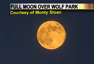
Monty Sloan sent this picture in just in case you did not want to wait more than two weeks for brighter evenings. This is an incredible view of the Full Frosty Moon from Wolf Park this past weekend. The moon had a nice orange hue during moonrise. So this would be another nice thing to focus on. By late tonight bright moonlight is back in our forecast thanks to high pressure moving in and it could not come soon enough. Here are the latest rainfall totals from Sunday night and Monday:


This brings our November precipitation grand total to over 5 inches of rain at WLFI. We only average just over 3 inches of rain and snow. But there is a silver lining in the clouds. We had to look no further than the area skies yesterday afternoon. Raibows were spotted in the area on Monday afternoon from Oxford to Harrison High School. Ron Brose was kind of enough to send in another positive picture.


This rainbow was located in the north sky because the sun popped out in the southern sky. Remember you can have a rainbow in any portion of the sky. It all depends on what part of the sky you have sunlight popping out. Its light is reflected off the backside of raindrops so the sun would always be located behind you when viewing a rainbow. I hope I helped you through a less than desirable Monday. It will only get better from here. Tune in for more tonight and I will also have the latest on how all this rain will impact the Wabash River. Tomorrow we will take a closer look at what you can expect at the Lafayette Christmas Parade on Sunday. Have a great day!

Friday, November 23, 2007

Sunny Leftovers & Pumpkin Pie Weather Moves In!

My wife actually got up at 5 a.m. this morning and she verified the weather forecast. It was very cold out there and she was relieved she did not camp out last night like other folks. It is hard to believe that stores opened at 4 a.m. Why not just stay open all night? Have they ever heard of frostbite? Now this is okay in Jacksonville, Florida where the palm trees and average temperatures in the 50s and 60s dominate the landescape. But here in Lafayette, Indiana you have to do a turkey dance just to stay warm this time of year at that time of night. Oh, my apologies to the outlet malls. They apparently opened at 1 a.m. which is more weather-friendly. The only problem is that the closest outlet malls to Lafayette are well over an hour away. So on this crazy Friday, I mean Black Friday which of course is today we can all be relieved that sunny leftovers are coming our way courtesy of nature. The weather will be sweeter than pumpkin pie! Welll, almost. But really this is the best kind of leftover! I think I ate over 30,000 calories yesterday. That may be a bit much, but I felt like it. Our dark, stormy start to the Thanksgiving weekend is going to turn brighter and milder. Black Friday which is named for shoppers helping to put all the stores in the "black", can be renamed Sunny Friday! I really have nothing to complain about. Luckily, I got to stay home and be in charge of all the sleepers in my household this morning. I still feel a bit groggy from all the turkey, carbohydrates, and several desserts I ate last night but all is good. How will I work off all the holiday food?

Well my plan is actually crazier than the stores opeining at 4 a.m. I will hit the gym and run 6.25 miles. I want to send a positive message to my body that I am in fact still in the game. I am 38 years old, but we all saw what 38 year olds can do on TV yesterday as Brett Favre led the Green Bay Packers to a 10-1 record. Brett gives me lots of hope! I do have the Washington Marathon coming up in March so I will start coming up with a strategy to break 4 hours. Once I am done running, I will lightly lift some weights before coming home and cleaning up! Once that is done I will check out the latest weather models and maps. This can be quite invigorating for a meteorologist, especiallly with the wild weather pattern we are in right now. Lunch will not include anything heavy. I may have a leftover turkey sandwhich along with fruit salad. I will wait until dinner to have any more stuffing or macaroni and cheese. Before heading into work today I will head up to the attic and finally put my family's summer clothes away and take down some Christmas decorations. So you see the key is to keep on moving! Now are you awake? I am getting there. If not, here is something funny that can jolt you out of the holiday stupor. A sense of humor is also important during the holiday season so I have a funny turkey story link for you to check out below. Check it out to find out if turkeys really drown in rain.

http://www.snopes.com/critters/wild/turkey.asp

I will see you later today at 6 p.m. and 11 p.m. This will be a nice break for you and me from the hectic holiday rush and I will make sure to include more things to keep us motivated. Remember you have to pace yourself. Tomorrow my family is going to pick out the Christmas tree. I am like Clark Griswold in the movie Christmas Vacation this time of year. So my next obstacle will not be digesting food, but trying to find a way to fit an oversized tree into my average-sized living room. You stay safe and remember to keep the ladder securely against the house when hanging holiday lights. Now it is time to run, run, run! Have a great rest of your holiday weekend!

Thursday, November 22, 2007

Biggest Storm Since Blizzard of 2007 Stuffs Lafayette


Nature served up its own version of stuffing yesterday as we were walloped with our biggest storm since the blizzard of 2007! We tracked at least 3 thunderstorms across Tippecanoe County from late afternoon through the evening hours. Travel was snarled and a slow go across the area. Some areas had more than a months worth of rain. Millard See in Frankfort reported water standing everywhere. So the big question was if this was snow how much would we have seen?


The Blizzard of 2007 had a liquid equivalent of about 1.5" which translated into 17" of snow. Yesterday we had 2.25" of rain and using a 10:1 snow ratio it would have come out to 22.5 inches of snow. So today we could have been more busy digging out from the storm than eating which would not be a good combination. Even though I usually root for snow I was even happy this did not happen. We just have too many folks traveling and I really do care about my viewers getting to their destinations safe and sound! So on a day we count our blessings this is one more thing to be thankful for.


Now I did find some areas that will have a White Thanksgiving. A band of one to three inches of snow fell from Oconomowoc, Wisconsin to Oshkosh, Wisconsin. My brother-in-law, Rob Becker and Dad of Carson that was on the blog last week sent in a picture to get us ready for today's Thanksgiving forecast. Yes, the baby is doing great along with the rest of his beautiful family. Here is his deck last night being covered in a nice coating of snow. Carson will spend his first holiday in a winter wonderland. It still looks like here at home we will have a few snowflakes without any accumulation. We will have just enough snow to get you into the holiday spirit. If you want to see a dusting of snow you will need to drive about 60 minutes north of Lafayette to northern Jasper and Pulaski Counties, but the main thing is it should not keep you from getting to your destinations. Any accumulations should be on grassy locations. The only "drifts" you will find will hopefully be on your Thanksgiving dinner plates. Check out your Thanksgiving Dinner Forecast below.


I want to take this opportunity to thank all of our viewers and weather blog readers for all their support throughout the year. This job is my dream job and I know how lucky I am able to do something I love so much. But what makes this job really special is you and the great community I live in. I cannot even begin to thank you and I look forward to another great year of weather in one of the country's best kept secrets. Lafayette is the family capital of the country and the Midwest way of life is unsurpassed. The weather lives up to the hype and it is certainly a meteorological paradise. Enough said, now it is time to give thanks and chow down. That picture above has made me even hungrier. Part of this job is to work holidays which I have learned to accept and it has now become second nature. The good news is that I will spend most of the day with my family where I belong and then I will look forward to seeing you tonight at 11 p.m. Tune in to stay warm because I will have a special picture from Hawaii that you will likely enjoy. Happy Thanksgiving from our WLFI family to yours. Thanks again!

Wednesday, November 21, 2007

Nature Lam"bastes" Much of the Midwest With Unsettled Weather


Most folks are getting ready to baste their turkeys while nature looks to lambaste much of the mid-section of the country with rain, snow, and even a few strong thunderstorms. While this storm is not a monster storm which would cause any cancellations of flights or stranding anybody, you can expect plenty of delays. Patience is the key word today on the busiest travel day of the year. Here are my travel grades for the heartland! I gave areas of Kentucky, Tennessee, and the deep south a "D" because a few strong damaging thunderstorms are possible this afternoon. So be ready to pull over if necessary and let the storm pass before continuing your trip. Most of Indiana will see rain which could be heavy at times, so a C- will do just fine. Areas of Wisconsin, Illinois, and Iowa which could see light snow break out by late day should only expect accumulations on the grassy areas so a C- will do. The only other D I gave out was for the upper Peninsula of Michigan where they could see a quick 2 to 4 inches of snow and maybe a few slick spots on the roads. Other than that we all know it could be a lot worse out there. So just slow it down and have a safe trip.


Make sure to tune in tonight for your complete holiday weekend forecast. In the meantime, here is Lauren giving you a sneak peak at the first part of your holiday weekend forecast. Lauren these days is not only into going to the mall, but catalog shopping. Now I am in some deep trouble! Have a great day and be safe!

Tuesday, November 20, 2007

Golfing Weather to A White Thanksgiving for Some Hoosiers on the Way


The only thing keeping us from a record-breaking high temperature today will be those pesky clouds. But it will still feel great for all golfers, joggers, or those just wanting to get outside. We need to soak up all the warm weather while we have it because huge changes are on the way with snow showers likely by Thanksgiving morning. The question is not "if" but "how much" it will snow. This brings us to our blog question of the day:

Hi Mike,

This is Tyler(from the job shadowing) just telling you how excited I am about the first snowflakes this year. So my question is; Will we see at least a dusting of snow?

-Tyler Heckstall-
~Have a great Thanksgiving~


Great question Tyler! I can answer this because we are just talking about forecasting a dusting. Of course to win my snow shovel contest you have to forecast the first inch of snow here at WLFI and
not only will I shovel your driveway but you win a free year's worth of pizza from Mad Mushroom. The snow showers on Thanksgiving will not amount to much here in Lafayette. We have three things working against us. There is a warm ground, the storm track will bring only scattered light precipitation and air temperatures during the snow should be hovering above freezing. Now areas to our north and west will have a chance for that first dusting. Here is an up-close map for you.


So head to South Bend and extreme northern Indiana if you are looking for a dusting to one inch of snow. These areas will be just cold enough for grassy accumulations. The good news is that travel should not be hampered with just wet roadways. To answer your question now...Lafayette could see its first dusting of snow as early as next week or the first week of December. There is a huge ridge of high pressure building in Alaska which could bring them a Spring pattern. All of the cold air usually found there will be pushed out and head in our direction. We will also have a polar vortex near Hudson Bay which will keep us in a cold northwest flow. This "clipper" pattern could give us a candy coating of snow. Check out the new 6 to 10 day outlook.


What you do not see is that Lafayette will also have a wetter than normal pattern which will also enhance our snow chances. I still think we have a good chance of a White Christmas, because long-range patterns still indicate the cold air winning the battle along with a stormy weather pattern continuing well into December. So Tyler you have plenty to be happy about over the next few weeks. I know I normally root for snow as well, but over Thanksgiving I am happy it looks like most of us can get to where we need to go without having to worry about being stranded. I will post those travel grades for you first thing on Wednesday morning before you head out. Have a safe trip wherever you may be going!

Monday, November 19, 2007

Here Comes Nature's Version of the Turkey Hop!

It looks like nature is giving dance lessons. Just in case you do not know how to dance the turkey hop like the pre-schoolers were at Kids Alive Covenant Church last Friday, we will have temperatures dancing all around this week with highs as warm as the 70s and lows in the 20s. It is actually that time of year when the jet stream really starts firing up because of much bigger temperature contrasts from north to south. Check out the forecast lows on Wednesday morning. Here at home we could be 10 degrees above our average high at night!


These temperature contrasts in turn feed developing storm systems. It looks like the low pressure system impacting us is coming out of the Rocky Mountains will be moving our way pieces which is good news for most travelers. I will have more on this "phasing" issue as we draw closer. What you need to know is that this will dimish the heavy snow threat for much of the Midwest. But there certainly will be dramatic temperature changes as you see above. Make sure you take your winter coats if you are heading to Grandma's house no matter how warm it feels on Tuesday or early Wednesday. There are usually two sides to these big low pressure areas that form this time of year. We will stay on its warm side until early Wednesday and then be blitzed with winter on its cold side by late Wednesday and Thanksgiving. I still see snow showers as a good possibility but I am not expecting any accumulations at this time.

There have been Thanksgivings with snow and sledding and other where we have needed the shorts. The graphic below tells why this week's wild weather is right on cue!


So some like their Turkey days warm and some like it cold and it looks like nature tries to please everybody and it all balances it out over the years. Here in the weather center we are still monitoring your travel weather closely from coast to coast and the areas of the Midwest that may actually have slick roads. I will make sure to have updates on the news and post more here on the blog before the big holiday. Have a great day and I better go check more maps. If anything changes of course I have this blog to keep you ahead of anything nature dishes out. Now I am really hungry!


Friday, November 16, 2007

Cold as Ice To Nice In Time for the Weekend!


Riverside Ice Skating Rink at Tapawingo Park

The picture above certainly tells the story. It was as cold as ice last night and then some as many locations fell into the upper 20s by the 11 p.m. newscast. Riverside Ice Skating Rink will be opening next Friday and yesterday evening they were already preparing the ice. It was perfect ice-making weather last night. That contraption you see above is actually a boom-sprayer that spreads a thin coat of water at about 160 degrees over a refrigerated cement pad that is set at 16 degrees. This helps the water to freeze immediately. The ice does have problems with sunshine and temperatures above 40 degrees. Looking at the latest maps I think we should stay below 40 degrees even for high temperatures during much of Thanksgiving weekend. So get those skates laced up and keep out the heavier coats. This pattern of colder than average weather looks like it will be with us for at least the next two to three weeks if not longer. Any mild spells will be brief at best. The last time we had 4 days of below average temperatures was way back in July so we were certainly long overdue for a much different pattern. This weekend I do not see the vicious wind chills we experienced on Thursday and we should even have some sunshine, especially on Sunday. So we can call it nice weekend on the way. Keep in mind, it will still be brisk at times with highs only in the middle to upper 40s. So what is causing this big change? Take a look below.


We have high pressures building in the Gulf of Alaska and Greenland and this causes a funnel effect that moves polar air masses from near the North Pole straight into our backyards. This pattern tends to lock in for at least a couple weeks at a time, if not longer. I did forecast a colder than normal December and it was based on a strong La Nina and the formation of those blocking high pressures you see above. So right now everything is on schedule. Now in this pattern you usually get at least a couple of really cold arctic outbreaks and ahead of them you can get some big storms to develop on the southern edge. This pattern tends to intensify the jet stream where storms like to form and the big temperature contrast that sets up also tends to feed developing storms. Next week some of the maps are verifying this as you see below.


We could have rain and 60s on Tuesday and Wednesday. But on Thanksgiving depending on the storm track we could go from thunderstorms to snow with accumulations not out of the question. The problem is we have a jet stream moving at over 140 to 150 mph across the country and it will be tough to pinpoint everything until we get much closer. But I can show you who went from thunderstorms to snow yesterday in 12 hours. Take a look below.


Thanks to Meteorologist Ross Ellet

Ross Ellet our former Weather Team 18 meteorologist is doing very well in Beckley, West Virginia and says a big hello to everybody. I was very happy for him on Thursday and when I saw this picture I was also jumping for joy. I think this snowy scene could be repeated here at home in the near future. Time will tell. Today, I am heading out to Glen Acres Elementary and we will be doing a lightning experiment. I will make sure to take pictures and explain how it all turned out here on the blog. It should be lots of fun! Thanks for another great week of e-mails, pictures, and wonderful weather talk. Have a great weekend.

Thursday, November 15, 2007

November Chill Reminds Us to Give to the Coats for Kids Campaign


We are down to only two days to help make sure all of our community's children can stay warm this winter. I know we cannot control the weather but here is your chance to make a difference. Make sure to drop off coats, hats, and gloves here at TV-18 on Yeager Road. If you cannot make it to West Lafayette. Here are some other locations you can drop those coats off at:

All Hudlow'a locations through out Lafayette
Arnett Health Plans
415 N. 26th StreetFerry & 26th St Lafayette
Chick-FilaSt. Rd. 26 East Lafayette
AAMCO Transmissions St. Rd. 26 East Lafayette
Twin City Dodge-ChryslerSagamore Parkway S. Lafayette

We only have two more days and the numbers are down compared to last year probably because of all the warm weather. But as we know this will not last too much longer and we all felt the big change yesterday. You need to hurry because coat distribution is at 4th and Fountain Street at the Community Family Resource Center from 10 a.m. to 2 p.m. on Saturday. I look forward to handing out plenty of coats and seeing lots of smiling faces on Saturday. Thanks in advance for all of your support! I have seen over the years what a difference your generosity does make when it comes to the Coats for Kids Campaign. Thanks again.

Speaking of winter, here is your winter weather outlook link many of you have been looking for: http://www.wlfi.com/global/Category.asp?c=100636

So if you missed my Winter Outlook on the newscast Tuesday night here is your chance to check it out. Make sure to click on the link above, then go to the "featured video" section and click on 2008 Winter Weather Outlook. I think there is something for everybody in it, but if you do not like ice you may want to sit down before viewing it. This winter should certainly be interesting just like yesterday's clouds which brings us to our big question.


Blog question of the day:
What were those beautiful clouds in the sky yesterday?

Luckily, I happened to have my digital camera and I think the clouds most folks were talking about were the ones you see on the left side. These are called altocumulus clouds and the can give the sky a dramatic appearance nicknamed the "mackerel sky". This is because the sky looks like it has fish scales that you would find on a King Mackerel. Sound fishy? It certainly look like it. When you see this mackerel sky you can use this famous Hoosier weather proverb:

If you do not like the weather just wait 5 minutes.

Yesterday the mackerel sky lived up to its reputation as our temperatures plummeted from a high of 60 at 2 p.m. to wind chills near 32 by 11 p.m. Thanks to Jim Hunt you can feel free to keep up with what nature dishes out by clicking on his home weather station in Kokomo. He is a regular weather blog reader and I really appreciate his support and enthusiasm to help make this site even more fun and informative. Check out all the nice temperature graphs by clicking this link: http://www.kokomo-weather.com/

Those that live closer to Remington of course can keep up with weather changes by clicking on Mary Anne Best's home weather station:
http://maryannes.homeip.net/

Mary Anne is another reason you see me smiling every night. She takes good care of our weather team with constant weather updates. This is very helpful when forecasting our quickly changing weather. Thanks Mary Anne!

The mackerel sky can also indicate an increasing chance of thunderstorms in the forecast, especially with plenty of warm air and humidity. Now yesterday was too dry for thunderstorms. But, these clouds can also mean flurries on the way and sure enough I did put flurries in the forecast on Thursday. Do not expect any accumulations. This is supported by another popular weather proverb:

Mackeral sky, mackerel sky, never long wet and never long dry.

The picture I snapped on the right of the mackerel sky were cold air stratocumulus clouds that took over the sky and became stratus clouds. Our changing sky gives many hints about the many processes taking place in the atmosphere that shapes our weather and does help weather forecasting. So this is why the first thing I do when I get to work every day is LOOK OUT THE WINDOW! :) Have a great day and even though we do not have to worry about accumulating snow, we do have to bundle up and give those heavy coats a good workout. Stay warm and stay tuned. Tonight I will have the latest on your weekend and turkey day. Happy Novemberrrrrrrrrrr!

Wednesday, November 14, 2007

Thanksgiving Feast May Include Pumpkin Pie & Snow This Year


Squirrel in Lafayette last year enjoying pumpkin pie
before the Blizzard of 2007

The big news out of the Weather Center in the wee hours of the morning is...you guessed it...chances of snow for Thanksgiving. I do not sleep when snow is in the forecast, just ask my wife or parents. So let's talk! Thanksgiving Week looks like a major storm will wind up in the Midwest. There are teleconnections taking place all over the globe that portend a huge storm bringing everything from severe weather to snow hitting hard by late next week in the Midwest and eastern portion of the United States.

We found out last night in our winter weather special that this is a Gordon Lightfoot Winter. It matches well with 1975-76 that was known for its raging storms and wild weather. Gordon Lightfoot wrote the famous song about the wreck of the Edmund Fitgerald that sunk in Lake Superior on November 10, 1975. Here we are in 2007, and the same patterns are being telegraphed by nature of big storms that lie ahead. Lafayette will even having a chance of wrap-around snow on Thanksgiving.

Teleconnections simply mean that changing weather conditions in one part of the world can affect areas far from the source in huge ways. I am closely watching the Pacific-North American teleconnection by looking at the Gulf Of Alaska, the North Alantic Oscillation which is another teleconnection dealing with pressures near Greenland, and an eastern Pacific teleconnection called the La Nina, that you may be familiar with. See on the nightly news there is only a half-hour to work with and the weather is inevitably cut short. My producer would love to give me more time but it just is not feasible. If more time was given you would know that the La Nina is just one teleconnection of dozens that are looked at all around the world to help forecast weather, weeks and months in advance. I am also looking at pressure differences between Tahiti and Darwin, Australia. We certainly have a "global climate". Take a look at all the different links to our weather that I typically use to forecast months in advance. Most of them are abbreviated so I could fit them all in and there are a few not even listed!


Our weather on earth is lined up like dominoes and this could be a triple whammy for the Midwest. If we do get a big storm next week, I think this is a sure sign of a snowy and cold pattern that will likely grip our area through Christmas. All the chips are lined up at this time, now it is just a game of wait and see to make sure those dominoes fall like I think they will. I know it is early, but I wanted to warn you of the possible elephant in your backyard before it happens, so you are ready! Tonight we will take a closer look at your Thanksgiving forecast on the news and in the short-term your latest weekend forecast.


Mare's tails over Lafayette

Our blog question of the day:

Mike,
A few years ago I saw on a place mat in a Rhode Island restaurant something about "Mare's Tails" referring to clouds. I had no idea what that was. I suppose it's an old folk lore thing. Can you tell me anything about this & what it's supposed to mean?
The other day I saw what looked like Mare's Tails & wondered what it meant.

Thanks,
Ernie Fisher
Lafayette.

Thanks for the great question. Mare's tails are actually real and named after cirrus clouds that take the shape of mare's tails or look like horses tails in the sky. You can see that in the picture above. These are formed by falling ice crystals usually located over 30,000 feet high in the atmosphere. The ice crystals are then sheared by high upper-level winds. This is usually a sign of abrupt changes in the weather on the way. Many times these mare's tails are caused by the nose of a jet stream moving in which of course is nature's highway of storms. So there you have it. When I lived in New England we had plenty of Mare's tails in Vermont. No wonder I tracked a storm sytem about every other day! The experience was invaluable!

Tuesday, November 13, 2007

Welcome to the Family Carson! The Blizzard Baby Has Arrived!


Here he is! My new nephew courtesy of my sister-in-law and brother-in-law. He was born on the anniversary of the Edmund Fitgerald on Saturday, November 10th in Wisconsin. Being born on a day rich in weather legend is our bond. His name is Carson Joseph Becker and was quite a catch. He weighed 9 pounds and 8 ounces and was 22 and one-quarter inches. He was so big they have already named him Moose. I will have to talk him into coming to Purdue to play basketball. He could go in the Guinness Book of World Records as the youngest recruit. I think it is a chance Matt Painter should take. He has got the athletic genes in him. His Dad was a couple fastballs away from being a pro baseball player and his cousin Abbey will likely teach him how to leap over tall players after her Olympic run. His uncle Mike will run marathons with him in all 50 states. This baby will have it all. But I will make sure to keep his priorities in line. Like his brother Tony he will love to talk about the weather and want to know every little detail about what causes thunderstorms, tornadoes, and snowstorms.

I cannot wait to tell him about the Blizzard of 2007. Come to think of it by time I tell him the story, I will call him the Blizzard Baby. He was born about 9 months after the big one hit Lafayette with 17 inches of snow. Even though the Milwaukee area had just a few flurries on February 13, 2007, his parents were living in the Midwest at the time only 4 hours away. So he qualifies for blizzard baby designation as a result. Not many babies have the distinction of being called a blizzard baby! He will likely see his first snowflakes in the next week and I will make sure Carson will have a White Christmas. Congratulations Rob and Molly! I cannot wait to actually meet and hold him!

Now that I introduced you to the Blizzard Baby you will have to tune in tonight for my Winter Weather Outlook for 2007-08. Will Carson see his first blizzard? How much snow is on the way? Will we save on our heating bills?
Alright! I just found out the winter outlook will be posted in its entirety on our weather home page. I will make sure to put the link here as soon as it is ready so it will be easy to find.

In the meantime, here is how much snow I am forecasting along with how many snow days you can expect.


A little more than average, but less than last year. This would certainly change if we were hit with another blizzard!


This graphic may surprise you, but if you look at it it should make some sense. We average lots small snows with two snowstorms of 4 inches or more per year. This year I think we will see at least two snowstorms of 6 inches or more.

We will save on the heating bills, but I am really worried about a big ice storm in March. Carson may see his first Blizzard this year in Wisconsin because the Badger state will have plenty of cold air to work with with the main storm track coming over Lafayette. They hit the jackpot in this type of pattern. Hopefully I do not get coal in my stocking for this ominous forecast, but the weather will do what it wants to. :) I do know Santa and his deer love this kind of weather so I should be okay.

Monday, November 12, 2007

Winter Weather Awareness Week Off to A Thundery Start!


Only in Indiana! We have Winter Weather Awareness Week and our weather team has been working non-stop on your forecast and tracking thunderstorms on Live Doppler 18. This is a sign of that extreme winter I was talking about. Remember what happens in November, nature tends to remember come winter. The good news tonight is no severe weather is expected. But remember your lightning safety rules and exercise caution on the roadways. Is it really possible we will end up with more November thunderstorms than we saw in May? Well, take a look at where we will stand after today!


This is quite impressive. We have caught up to May which is supposed to be one of our most active thunderstorm months of the entire year. I think next week the Midwest will be rattled with more thunderstorms in time for Thanksgiving with a major snowstorm to the north of Lafayette. Watch out Wisconsin and Michigan! Here in Lafayette we could easily equal the thunderstorm days we saw in July which is unheard of! It goes to show you the strange year we are having. At least we did need the rain. Here are the rainfall totals for Monday at 11 p.m. below.


Randy Rogers, our weather watcher in Frankfort did not float away, but he was ready to build an ark with nearly 3 weeks worth of rainfall in 4 hours. Things should settle down tomorrow with clearing skies and highs back in the 60s. Enjoy it while you can because autumn and winter return to the forecast in the next 7 days. Check back here on the blog for more. In the meantime, the blog bird story was so popular on Friday, I found another one just for you!


Here is the doppler radar out of Milwaukee/Sullivan over this past weekend. Migrating birds were being picked up on their doppler radar shown in the red circled areas! Here is more from their National Weather Service web-site:

Just after 6:30 am on Saturday, November 10, National Weather Service Doppler Radar near Sullivan began capturing a flock of migrating birds taking off near the Horicon Marsh in Dodge County. After the birds took off, they headed south into northern Illinois around 8:45 am. The staff at the NWS forecast office near Sullivan confirmed the radar signatures were indeed birds around 8:00 am as a steady stream of them flew over the office. Another flock of birds was also seen over western Jefferson, northeastern Rock, and northwestern Walworth counties.

Radar can see a flock of birds the same way it can see rain, snow, sleet, or hail. Radar transmits a pulse then listens for how much of that pulse bounces back to the radar site. The more pulse that bounces back, the greater significance an object has. For example, if there is a severe thunderstorm with heavy rain and large hail, a large portion of the original pulse is likely to return to the radar. This is how red can appear on the radar map. On the other hand, if only a few raindrops are falling from a cloud, then only a small portion of the original pulse can bounce back, so light reflectivities result. Radar determines how far something is by how long that transmitted pulse takes to return to the radar site.

For more information about how radar works, visit this site:
http://www.srh.noaa.gov/srh/jetstream/doppler/doppler_intro.htm

Above are the reflectivity images showing the progression of these birds from 6:22 am to 7:21 am. The red ovals represent where the birds were noted, all other reflectivities are the result of ground clutter. The orange dot represents where the radar is located.

Now there is more to this story of course! Apparently a stork delivered a special baby later that evening in Wisconsin. That is right, a new relative is here! I will hopefully have pictures to show you tomorrow!

Friday, November 9, 2007

Whooping Cranes & Sunshine Light Up the Lafayette Skies!


Courtesy of Bill Crook

What a beautiful picture out of Benton County this morning! The Whooping Crane Mitigation Project took center stage in the blue skies. Seventeen endangered whooping crane chicks and their surrogate parents are just beginning a 1,250 mile migration from Necedah National Wildlife Refuge in central Wisconsin to Chassahowitzka NWR along Florida's Gulf Coast. They are being helped by four ultralight aircraft. Whooping cranes are North America's tallest birds measuring about 5 feet tall and they have almost 8 foot wing spans. They are an endangered species and the good news is that they are starting to bounce back thanks to projects like these. In the 1940s there were only 21 left in the wild. Today there are about 350. Tonight they will nest in Boone County before continuing their southward migration. The great news is their weather looks fantastic for the next several days. I do not see real stormy weather between here in Florida until at least next week.

Yesterday, we talked a lot about snow and winter weather, but today I have something for the warmer weather fans and that is a very nice weekend for this time of year. We should have a nice sunny start on Saturday with just a few rain showers for Veterans Day. The good news is we will not have a 65 degree temperature drop like we saw 96 years ago this weekend. That is right, chickens did not exactly freeze in their tracks but we fell from 74 degrees to 9 degrees in less than 24 hours. I will talk more about that tonight on the news!

Winter Outlook Tidbit:

This winter may be a lot like 1964-65, 1975-76, and 1995-96.
These years were particularly volatile, including a January tornado and snow all in the same day in Montgomery County. Make sure to stay tuned for more and your winter weather outlook here on the blog and tune in Tuesday night at 6 p.m. and 11 p.m. for your complete winter outlook.


Thursday, November 8, 2007

La Nina Strengthens & Our Chances for A White Christmas Increase!


Are you dreaming of a White Christmas? Well you may not just be dreaming of one. The big news out of Camp Springs, Maryland this morning is that La Nina is getting even stronger. La Nina is caused by below average water temperatures in the equatorial Pacific. This in turn shifts weather patterns all over the world, including here in Indiana. The temperatures have fallen so fast and furious it gave us an extended summer and has brought us one of our top 5 warmest autumns of all time.

While La Nina usually brings us a warm autumn in its current phase, it also is likely to bring us an early onslaught of winter weather. The stronger the La Nina this time of year the better our chances of a White Christmas. In any given year we have about a 50-50 chance. This year I have upped our chances to 80% for having a White Christmas full of family fun and sledding. This is certainly an early Christmas present to all the snow-lovers out there. I will be working on your winter weather outlook the next few days and have your winter outlook all done for you by early next week! One thing is for certain and that is we have another wild winter weather ride this year that may include thunderstorms, thundersnow, tornadoes, and ice storms.....now back to work on your winter. I will check back with you this evening and talk about storm tracks for the rest of November into December. Have a great day and crank up the Christmas music. Here is a more specific peek at your December forecast.


Make sure to tune in next Tuesday and I will have your winter weather forecast in its entirety. I will of course post more tidbits here on the blog as we continue to get closer to the big day! Speaking of big days, I also wanted to make sure to wish a Happy Birthday to my Dad. I still remember our forecasting contests when I was growing up. My Dad seemed to always forecast less snow than I did and it would drive me nuts! My Dad would have been a great meteorologist and he is certainly one of the big reasons I got into meteorology. Thanks Dad and a big Happy Birthday to you. I can tell you in Jacksonville, Florida you will not have to worry about a White Christmas, just the way you like it! Happy Birthday!

Dear Mike,

I can verify your 1950 forecast. My husband and I were going together that year. It snowed on Thanksgiving Day and we did not see the ground until March of the following year. That is how cold it was. I really enjoy your weather on the net as I do not get it on my Dish. Thank you so much for the time that you work on the blog.

Sincerely,
Norma Higley

I appreciate the kind words Norma! I think this winter will have some cold snaps, but I do not see any prolonged cold periods or snow like we saw in the winter of 1950. What may remind you of 1950 will be our White Christmas. But a huge warm-up is expected in January and I am more concerned about severe thunderstorms and flooding at this point than snow. So it will be quite a winter ahead. I think it will be a mix of a few winters of years past. I will post those tomorrow here on the blog along with your Friday Night Frenzy forecast!

Wednesday, November 7, 2007

Confused Trees Snow Green Leaves on a Nice Sunny Day


We are officially in cloud season, but it turned out to be a day full of sunshine! I call it bonus sunshine. The trees are still not sure what season it is. Notice the green leaves falling to the ground today in West Lafayette. Yesterday it was snowing flurries and today it snowed green leaves. This is what happens when you have had very little autumn weather to speak of. Leaves change to prepare the trees for winter. Chlorophyll production which gives leaves their green color usually is shut off when you have shorter daylight hours, colder temperatures, and the combination of frosty nights and nice mild sunny days. When the trees stop producing chlorophyll you get those vibrant fall foliage colors. This year the trees have been tricked into keeping the chlorophyll machine humming because it has been just too warm. We also have not had many of those classic frosty nights that really helps to turn trees into picture postcards. So this is what happens. Trees still lose their leaves to prepare for winter, but they are still green! I have seen it all this year. Speaking of confused trees..I have also received reports of blooming trees in the past week in Monticello. Trees are not just losing their leaves, but blooming! Take a look below. The proof is in the bloom!


Courtesy of Wanda Martin in Monticello

Wow! First the blooming lilacs during the second week of October and now this. Maybe we are going to have to change our plant zone at the rate we are going. The good news is that our first real blast of autumn weather did arrive last night and it should help settle the trees and plants down. Here were this morning's weatherwatcher lows. Previously, our coldest morning had been 28 degrees in Lafayette, so this was a huge step into autumn!


Wanda in Boswell notified me that her cactus is not blooming and she did bring it inside to help save it. So there is a "normal" report for you. Today truly had a fall feel to it and it was nice to have what I call bonus sunshine. I use this term because there are plenty of gray days now that we are in November. Blame the jet stream. The jet stream is nature's highway of clouds and storms and it separates the colder air pushing in from the north with the warmer air to the south and of course at our latitude this time of year, we are usually the transition zone between the warm and cold. This brings the jet stream into our backyards and consequently plenty of cloudy days. You can see this clearly below.


It is kind of depressing looking at this graph, but we still have at least a couple of sunny days per week, even in the heart of cloudy season. At least we are not living in Cape Disappointment, Washington where it is cloudy on average about 10 out of 12 months of the year! Does that make you feel better? I hope so. Days can be pretty dark this time of year, but I do have sunshine back in your forecast, including a good portion of the weekend. Make sure to tune in for this tonight. Just in case you are still upset with it being cloud season, I will also let you know about highs close to 70 next week! We will talk more about how this is possible on the news and here on the blog. Make sure to check back and as always enjoy the weather!