Sunday, July 31, 2011

July Goes out with a Bang & Keeping a Keen Eye on Emily


Sunday, July 31, 2011

I was shocked last night that our disturbance in the Atlantic was not named Emily. The thunderstorms have become better organized and with low wind shear explosive development is likely. Well I can stop worrying about it today because the hurricane hunters are on the way to confirm that we do have a tropical storm. This system should not take long to become the season's first hurricane. Puerto Rico will likely see hurricane conditions by the middle of the week before this storm swings farther west and northwest toward the Bahamas. Notice it is still over 2,000 miles away from Jacksonville as of early Sunday morning.

I have a feeling we will be talking about Emily not only this week but well into next week. This will be a long-lived tropical cyclone and the big question everybody is asking me at the grocery store is where this thing is heading. I of course always preface my answer with things can change especially with Emily so far from home and the upper-level patterns not set in stone. But here is the way it looks to play out right now. Let's start with my tropical graphic for next Saturday, August 6th.


Notice the latest model runs have a hurricane bearing down on not only on San Juan but Hispaniola and even the far southwestern Bahamas. We will have to see how it holds together after interacting with the land masses. I am thinking it will hold its own. How about the US? Well for a land-falling hurricane we look at the upper-levels and the wind along the East Coast the next 1-2 weeks looks like it will be primarily out of the southwest due to a mean trough of low pressure setting up. Hurricanes tend to follow the upper winds like hot air balloons.

This would mean we are home free right? Well not so fast. There is an indication of some ridging or high pressure briefly building in the East next weekend while the higher southwest winds lift away. This could actually cause Emily to stall out along the southeast coast as a weak pressure pattern takes hold. Another cold front reinforcing the mean trough is expected to swing to do the East Coast Swing by Monday the 8th of August and this could finally help send Emily out to sea for good. But again this is a long ways out and a lot can still change.

The good news is the two huge high pressures that have controlled our summer weather so far are not centered along the East Coast and connecting very well. There is a definite weakness and this should help us out! But until our weather team gives the all clear please monitor it closely with us. We know how fickle these storms can be. I still do think we will see plenty of good surf by late week with beach erosion becoming a concern. This is a good wake-up call that our real hurricane season is now here. Make sure you pick up your First Coast News tracking charts and supplies! Now is the time. In fact we have a hurricane special airing on Thursday night at 8 p.m. on NBC you will certainly not want to miss!


The tropics are not the only thing firing up on our Sunday. We will have the summer thunderstorms that were conspicuously absent on Saturday make a return today. Yes! What a great month it has been for rain with over 7 inches at Jacksonville International.  The average is 5.97". Some spots have had over 10" and this has gone a long way to helping put a dent in the drought. July is not done bringing us rain just yet.

Today we will have thunderstorms covering 50% of the area this afternoon. These storms will be slow-movers and move from the north to the south and southwest. Brief flooding is possible. There could be an isolated strong storm as an area of low pressure interacts with sea breeze, river breeze, and thunderstorm boundaries across the area. Make sure to tune in for the latest on Live Doppler radar.

If  you are going to the beach today I would not cancel plans. Most of the rain should stay to the West of A1A and this includes the St. Augustine Amphitheater where Selena Gomez plays tonight at 7 p.m. I know my daughters are excited! Get out and enjoy a nice evening!


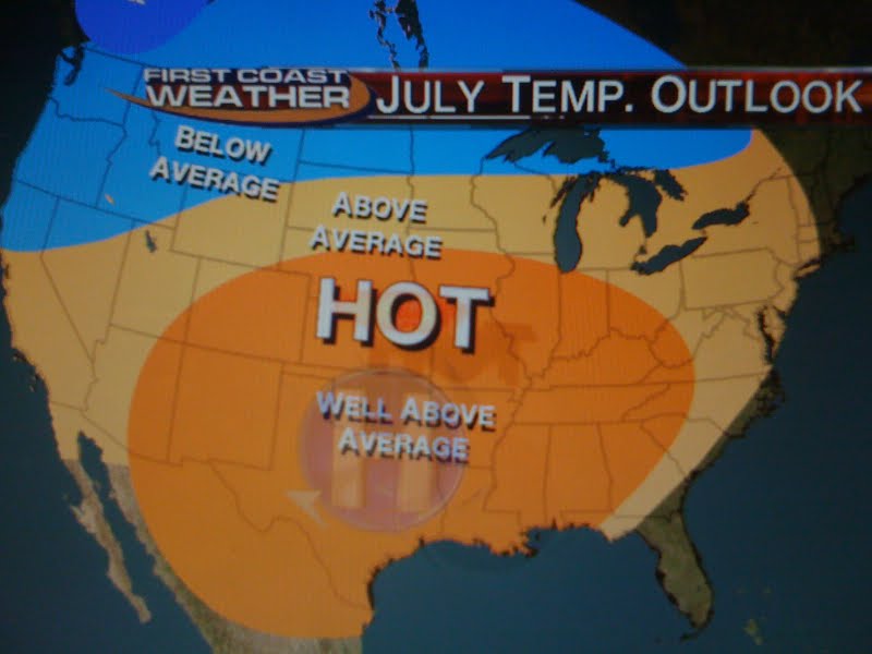
Before the rain arrives we will once again have plenty of heat and humidity with highs near 90 beaches to the middle 90s inland with a heat index near 105-110! But I do have some good news! Congratulations, you have officially made it through the hottest part of the summer at least climatologically. I know my car air-conditioner has not keeping up very well with this heat even when it is on high blast!

But it will be okay because today's average high temperature in Jacksonville falls to 90 degrees and by the end of September we will fall to 83 but the humidity will still be a bear! I think you will really notice the difference by Mid-October when the first strong fronts from the North actually hold together and make it through the area. But we are now heading in the right direction so enjoy the hot weather while you can. Have a great day! Take care and I will see you soon.

Saturday, July 30, 2011

Heat advisories issued! Beat the heat with cheesecake!


Saturday, July 30, 2011

Happy National Cheesecake Day! You are looking at my number one way to beat the heat today! Drink plenty of water and find your cool spots but you enjoy a nice big slice or two of an Olympian delicacy. That is right cheesecake was fed to the very first Olympic athletes in Greece and today you can go for the gold while staying cool! I had the pleasure of tasting the Hershey's Chocolate Bar cheesecake on Good Morning Jacksonville with anchor Len Kiese. It was silky smooth with layers of moist chocolate cake and creamy chocolate frosting with chocolate chips. There was also the white chocolate cheesecake that I am hiding in the back refrigerator. Hopefully nobody at First Coast News is reading this! Shhhhhhh! I want to thank the Cheesecake Factory and remember any slice of their cheesecake is half-price. So show some love and take your date out for dessert and I bet you will forget about the heat in a hurry. You will need to. The latest heat indices at noon are a whopping 107 in Waycross to 102 in downtown Jacksonville.


This afternoon some spots could feel like 115 especially in southeast Georgia. As a result the National Weather Service has put most of our area in a heat advisory. Last year we set a record of 102 on this date and even though I think we will fall short with highs in the middle to upper 90s. It will feel like a record that is for sure. The Jaguars played it smart this morning with a short practice as you see below. It was really only a walk-through but just walking out in all that heat and humidity is tough even by Florida standards!


I really enjoyed watching the first practice on Thursday with my three daughters. They actually sat in the stands with me for over 30 minutes. Now that is love and I am so proud of all of them and so lucky! They are turning into true Jags fans that is for sure. We had plenty of sunscreen and bottles of water but it was hot in the stands on Thursday. The great part is there are cool zone fans that can cool you down if you decide you want to go cheer the teal on this evening. Just keep in mind it will still feel close the 90s to near 100 even at 7 p.m. You always have the cheesecake as Plan B or can go cool down afterwards!

Do not expect much help from nature today in the way of cooling thunderstorms. We have too much sinking air keeping the cross-wind collisions to a minimum. There may be a lone storm or two west of the river but I think our best chance of seeing rain this weekend will be on Sunday. Some of the latest models show storms igniting for about half the area if not more on Sunday thanks to low pressure moving in and high pressure moving out.


Now with plenty of moisture and heat to work with we cannot rule out a strong storm or two. I will keep monitoring it carefully throughout the weekend for you and have the latest on your only Live Doppler Radar.
These rainfall numbers are only averages and can be much higher if you get under a storm. It could certainly rain cats and dogs....speaking of cats...remember you can pick out a cat today and give it a loving home by going to the Jacksonville Humane Society for as little as 15 dollars with all their shots taken care of already.


In the tropics, Don is no more! Unfortunately it fizzled out so badly before bringing needed rain to Texas. But the latest tropical wave will be anything but a fizzler. I am predicting Emily to form by late this weekend at a tropical storm. Emily will not only be the season's first hurricane but likely a major hurricane with wind speeds over 110 miles per hour. If you look at the forecast tropical tracks this morning notice more than half of our best models are indicating that it will likely curve out into the open Atlantic by late next week and weekend but since it has yet to form it really is too early to speculate. One thing is for certain and that is we should have some big surf here in Florida by Friday! Just be careful of the rip currents. I do expect an active hurricane season and we are way ahead of schedule already on named storms. Take a look!


We are already about 3 named storms above average and keep in mind 90% of all tropical cyclone activity occurs after August 1st. This is not a good sign and is another reason to make sure you prepare now. First Coast News will be airing a hurricane special this coming up Thursday at 8 p.m. I think you will enjoy it. It is not your typical run of the mill hurricane special and includes a home....well I cannot give it away. You will just have to watch! Have a great day and make sure to send in some pictures of how you are staying cool...cheesecake eating and all!


Sunday, July 24, 2011

Hot enough to fry eggs on your car before nature's free car wash!


Sunday, July 24, 2011

What an amazing sight yesterday off Long Leaf Pine Parkway in St. Johns County. You can see the pyrocumulus cloud and towering cumulus clouds forming yesterday off Greenbriar Road. Some ashfall was reported in Mandarin as this wildfire sparked by lightning on Friday grew to over 180 acres. It is an unfortunate reminder that we are still in an extreme to severe drought from St. Augustine Beach to Keystone Heights and Alachua northward. Many areas are running one to three inches above normal for the month of July but our high evaporation rates this time of year are taking a toll as evidenced by this picture. Our live doppler radar clearly showed this fire yesterday and based on its live scan and wind speeds we were able to tell folks that they should not have to evacuate. Here was the two minute advantage and what it looked like.


Today nature may help firefighter efforts with scattered afternoon rain in the forecast. A wind shift will push smoke all the way to the beach today. So if you smell smoke, that is why. Luckily, it will not be anything close to the way it was earlier in June. Even though rain is in the forecast today, lightning will once again be an issue due to temperatures in nature's attic remaining below normal, so we cannot rule out a few new wildfires once again. We will keep an eye on it with your only Live Doppler Radar.

It certainly came in handy last night! While 95% of us dried out by 8 p.m. as expected, the other 5% had a rain storm that seemed to never end. Here is a picture from Mike Lyons in Mandarin showing the line of thunderstorms that sat over the Callahan area and highway 301.


What a beautiful shot of the thunderheads or cumulonimbus clouds that formed over highway 301 from Bryceville to near Yulee. Beautiful but beastly with 40 mph wind gusts, frequent lightning and lowland flooding as some areas picked up 1 to 2 inches of rain. What caused the never-ending storm? It was amazing! Their were 4 boundaries that all collided just right or what I called the perfect thunderstorm last night druing the 11 p.m. newscast. We had the Atlantic sea breeze meeting the Gulf Coast sea breeze and two outflow boundaries from the northeast and southwest. They all seemed to merge together just right causing plenty of lift. Florida weather is constantly changing and this time of year even though we do not have any large-scale fronts these microscale fronts are just as important to pick out.


Today we can expect more thunderstorms for about 30% of the area as we stay between two high pressure systems. It looks like a stronger northwest flow will take over and could push some of the storms all the way to the beaches. So today keep an eye to the sky not just over inland locations but at the beaches. Thunderstorms will be moving from the west to the east. There is another upper-level disturbance being picked up on satellite pictures this morning that may even enhance some of our rainfall coverage. So I would not be surprised if at least half of us see rain today! Things should fire up nicely after 2 p.m. The good news is these towering clouds will keep our temperatures from reaching 100! Highs should be mainly in the middle 90s.

The bad news is the dewpoints are still oppressive which will make it feel like 105 degrees this afternoon. Also the beaches will not see their usual sea breeze relief with the sea breeze pinned to the coast.

Let's keep this positive with some facts to cool you down: It was only 4 months ago folks many were complaining about our freezing temperatures and wind chills in the teens and 20s. Our first frost is less than 4 months away and average temperatures will start falling one week from today here in Jacksonville. One last fact is that we will not be anywhere close to Jacksonville's heat index record of 120 set back in 1942 nor our highest temperature on record of 105. So as long as we take the heat seriously and remember the pets I think we can get through this hot spell. By Tuesday of next week I do see temperatures back to near normal in the lower 90s with more rain chances.

Speaking of the heat...is it hot enough to fry an egg on the sidewalk or the hood of your car? Well I kind of gave away the answer already so you can save your car hoods from a mess. Temperatures need to reach 158 degrees for eggs to really fry. The sidewalk and even the blacktop streets rarely get that hot here in Florida except maybe out in Arizona where the dry air can help with the evaporation and frying of the egg better. Since concrete is a poor conductor of heat it usually cools down when you crack an egg open on it. If you want to fry an egg here at home the hood of your car is your best possibility since it is a better conductor of heat and can reach temperatures over 150 degrees. I think I will stick to the traditional frying pan in my kitchen...lol. This is another reminder of why you never take pets on errands this time of year or even think of leaving any kids in your car. It can get just as hot inside your car and make sure you lock your car at all times at home since kids that do not know any better sometimes play in cars with devastating consequences. Hopefully nature will bring many of us a free car wash especially for those frying those eggs outdoors today!

Saturday, July 23, 2011

Not the weekend to be complacent about the heat or lightning


Saturday, July 23, 2011

Climatologically the hottest time of year is the last week of July and it looks like nature is right on cue. My daughters just got back from the Midwest and I am very excited they are home. The sun is certainly shining brighter! Interestingly, they told me when they got off the plane it was cooler than Wisconsin which is the first time I have ever heard them say that! It is easy to see why. The scorching high pressure that has brought heat wave conditions to over 85% of the country has moved East.

We will be under the influence of not only the heat wave high pressure centered mainly over Tennessee today but an extension of the Bermuda High pressure. Both of these weather-makers will combine forces to help make it very uncomfortable here at home even by Florida standards. Heat advisories have already been issued for McIntosh and Wayne County northward where it could feel as hot as 115 in the shade. Here at home we will be in the 105-110 range with actual highs in the middle to upper 90s inland to the lower 90s at the beaches. Head the beach for relief and I do think the beaches will not have to worry about any rain once again today. I know we expect the hot weather here in Florida this time of year but you really still need to be extra careful and make sure you stay hydrated and protect yourself from the sun.


With all the heat and humidity that really hit you in the face as you walk outside we can expect a few pop up thunderstorms but I think it will only cover about 30% of the area. Lori Dorman our First Coast News extraordinaire is on vacation and sent in this beautiful picture of Cedar Key. You can see the West Coast sea breeze building up some nice towering cumulus. This breeze will eventually collide with our Atlantic sea breeze helping to cool down a few of us with some splash and dash thunderstorms west of Interstate 95.

Temperatures in nature's attic are cooler than normal for this time of year so any storms that do form could bring plenty of lightning like we saw yesterday. Lightning safety is always important but today we need to take extra care. Ice crystal collisions will be abundant at 35,000 feet and this means lightning should be more frequent than normal with today's storms. Remember even though Florida is the lightning capital of the country and we are used to it remember if you are within 10 miles of a storm it can be life-threatening. Lightning is the number one killer in Florida. Make sure to get to your safe spot immediately and check out your real-time radar on First Coast News and on our web-site to keep you and your family safe. Time saves lives and we have your only radar without delay which was a huge help to folks yesterday on their busy Friday evening. Here is what you can expect with today's thunderstorms.


Tonight make sure to tune in at 6 and 6:30 p.m. for your storm tracks and the tropics that are still showing plenty of warning signs. We are tracking a vigorous wave that may try to form into DON. What about Don? I will have your answers. We will also take a look at those heat indices and I will have a few tidbits to help keep you stay cool! Remember the pets and remember not to get complacent when it comes to the hot weather or any thunderstorms that do form today! See you soon and have a great day.

Saturday, July 16, 2011

July sunshine washed away in rain

Saturday, July 16, 2011

What happened to your July sunshine? It is on the way but we have to wait for a stationary front to meander south of the area. Since it is living up to its name it will likely not clear the area until Monday. This will keep scattered showers and thunderstorms in the forecast for at least the next couple days. But be careful what you wish for.

Sunshine will return with scorching heat by the middle of next week with highs well into the 90s and it will feel like 105-110. The tropics are still quiet with only a 20% chance of the low pressure off the Florida coast developing. It will likely wrap in dry air from the north and weaken over central Florida early next week.

I will be back to post some pictures and forecast maps tonight! Thanks for your patience!

Sunday, July 10, 2011

Thunderheads snuff more wildfires and warning signs in the tropics


Sunday, July 11, 2011


We have come a long way in about three weeks when we had about 180 fires in a 50 mile radius of Jacksonville. Florida was literally on fire as you can see above. It was so bad folks could not even get out to the pool and some walked their cats and dogs indoors at the nearest pet shopping center and even in their homes. Now compare that to the map below this morning!


We can breathe much easier with only 29 wildfires reported across the area. The air is thick, hazy, and hot today but most of us our smoke-free with the exception of areas near Waycross and the Okefenokee Swamp. Your glasses fog up when you go outside and it feels like a steam bath but it is much easier to take than the stranglehold the smoke had over the area. You can thank those afternoon soakers that have been moving through and we are not done yet! Today we have another friendly front moving our way. It is unusual to have a cold front hold together this far south. Fronts usually stall out in the Carolinas this time of year but over the next couple of days what is left of this front will slowly washout over our area helping to snuff out more wildfires.


This front will be a triggering mechanism to help fire up some showers and thunderstorms. Looking at the atmospheric profile this morning I still do not think it is a good set-up for severe weather. The temperatures in nature's attic are heating up which will not allow the thunderstorms to build too high. There could be a few tops near 35,000 feet but not much higher. By thunderstorm standards in Florida that is quite small and really we would classify these thunderstorms as weaker thundershowers.

The severe storms that swept through a couple weeks ago had tops near 50,000 feet with some cooler air to work with. I do not see that happening today. Remember the taller the thunderstorm the better chance of severe weather.

But do not let your guard down on the roadways. Yesterday we had numerous issues on highway 301 in Bryceville with two inches of rain in an hour. Kingsland, Georgia had a quick inch of rain with many reports of accidents. Today once again the big threat will be heavy downpours and some flood advisories like we saw yesterday. The storms will move from the northwest and drift southeast. Do not be surprised once again if some areas pick up 2 weeks worth of rain in 2 hours. Most of the activity will be this afternoon, although this morning a few storms could pop in nature's soup.


As always lightning will be a threat like we saw yesterday although again with warmer air aloft it will hold down the number of ice crystal collisions in the cloud. But just one bolt of lightning can change your life and this brings us to the weather question of the day. When is it safe to go swimming after a storm passes. Did you guess 30 minutes? Why and what if you have an indoor swimming pool? Is it safe to swim? Nancy wrote me with this question and here was my response.


If you have a large indoor pool it should be treated like an outdoor pool when it comes to lightning safety. Lightning travels from the ground up and loves to travel through plumbing. So I advice folks not to take showers, baths, wash dishes, and this includes indoor swimming.

When you see or hear the first rumble of thunder you will want to clear the pool and then wait 30 minutes after the storm has passed before going back in the water since lightning travels up to 10 miles outside the main cumulonimbus cloud.

If you count to 10 seconds after seeing the flash of lightning to when you hear the thunder roar this means the storm is two miles away. You always divide the time from the bright flash to nature’s rumbling roar by two. This tells you how close the lightning strike was to you. The 30 minute rule ensures the main storm is more than 10  miles away which means you can safely swim indoors and outdoors!

This was a great question and please keep sending them in! My e-mail is mprangley@firstcoastnews.com. Thanks ahead of time. I love this stuff especially since it can really make a difference in keeping people safe!


Yes, we will have some good swimming weather today but remember the earlier the better and remember not to wait to get out of the pool or ocean. When the thunder roars head indoors and if you see it flee it! Most people are struck by lightning when it is not raining. Also remember that convertible cars even with the roof up offer no protection from lightning. Today you want to leave the convertibles home. What happens is the metal shell of your car protects you from lightning in what is called the bird cage efffect. If you do not have that  metal above your head you are putting yourself in danger. Cars are safe during thunderstorms but convertibles are not, that is the bottom line.


Make sure to join me tonight and I will track more storms with you and talk about another unusual summer front coming our way by late week that will once again increase our rain chances. But this one may need to be watched a little closer because sometimes you can get tropical development along these stalled frontal boundaries with the right ingredients. Today's front is in an unfavorable sheared environment as you can see above. But this can change in a hurry now that we are getting later in July.

Today is the actual 15th anniversary of Bertha bringing in big surf and deadly rip currents to Jacksonville Beach where one person drowned. It luckily stayed just off the Florida coast. But Wilmington was not so lucky where it hit with 100 mph winds. This is a good reminder to prepare now! It does still look like a busy season. Not just because we have near record warmth in the Atlantic Ocean but take a look at this graph!

The latest long-range computer models that tried to kill off the La Nina were in fact wrong. It looks like we will have a strengthening La Nina for the rest of the summer and thus less wind shear and a more favorable environment for hurricanes in the Atlantic basin. Make sure prepare and the good news is that your First Coast News Hurricane Tracking charts are now available at area Mc Donald's! It includes your all-important safety checklists and even what to do with your pets. I think you will enjoy it and find it most informative. You have a great day. I better get to church so I can get back and track more Florida storms with you this afternoon! Take care.

Saturday, July 9, 2011

Jamaica express brings more rain and less drought worries!


Saturday, July 9, 2011

Happy weekend! Our weather saying is don't worry, be happy! I know the rain will put a damper on some of those outdoor plans but we really need the rain. The good news is is that it will not be an all-day rain but I do think most of us will see rain this afternoon into at least early this evening. It is not every day we track four weather-makers or in this case rain-makers but here they are front and center.

There is the anti-cyclonic flow coming from the high pressure in the Bahamas, cyclonic flow from our Louisiana low, a frontal system moving south from Georgia and "what could have been Bret" that is now moving into North Florida from the Apalachee Bay. That is right, the tropical wave we have been tracking all week tried to develop but the winds aloft were too strong and tore it apart. Now that it is moving over land it will not be a named system but at least it will help our rainfall. Thank you tropics! That is a lot of available lift and moisture. If you look at the precipitable water (PW values) from the ground to jet stream level it is at an astounding 2.3"! This is something you usually see over the Keys, or even in Jamaica not in Jacksonville. This is why I am calling this the "Jamaican Express". This is where our weather is moving from and it is looking anf feeling more like Jamaica today. Take a look at the PW bulls eye over us on this Saturday.


The PW is actually the measure of how much rain would accumulate on the surface if all the moisture in a vertical column of air is squeezed out from the surface to 36,000 feet. Since we have moisture advection and wind movement a PW of 2.3" over Jacksonville does not mean that is the maximum amount of rain we could receive, but it does tell us there is a ton of water in the atmosphere and it will not take much to set off shower and thunderstorm activity. Heck a PW value of 1.8" is really all we need this time of year for a good chance of rain with a hint of instability. Today we have taken our PW's to the limits of the troposphere. At least we do need the rain. Here is our drought update!


Yes, we have had heavy rains over much of the area the last few weeks but we still have a long way to go. An extreme drought continues from Interstate 10 northward which  means 12" or more of rain is necessary to officially break the drought for good. South of interstate 10 there is a moderate drought with about 8" of rain still needed. Total rainfall for the year in Jacksonville is running about 2 inches below average and 20 inches below since the start of last year. This should make today's rain much easier to take. The latest 16 day rainfall for Jacksonville is coming in above average with 3 to 5 inches of rain! The original forecast I made way back in the middle of June for above average July rainfall still holds.


We will have to watch the tropics carefully and we have another strong tropical wave that could reach the Gulf of Mexico next weekend with perhaps an environment a little more favorable for development. But for now it is all about the rain and areas that have been missed over the last couple of days like Brunswick, Saint Simons Island, Kingland, Fernandina Beach, Lake City and portions of St. Johns County will get in on at least 1 to 2 inches of rain this weekend. If you get under a thunderstorm or two those totals will be closer to 2 to 4 inches by the end of the weekend. If you have plans remember the earlier the better both days. Sunshine will be limited and it looks like this huge slug of moisture over us will linger through at least Monday with drier air moving in Tuesday and Wednesday of next week. It will turn hot as well with less rain. Highs will reach the middle to upper 90s and it will feel like 105-110. But our next front from the north will move south and more tropical moisture will move in by late week. One other good thing about getting this needed rain is we will not be sweltering hot like the rest of the country. We will be one of the few places with temperatures near to slightly below normal through the end of July.


Have a great day and I will see you tonight. We will talk more about this wet and wild pattern taking hold here in Florida and I will have the latest rainfall totals along with your only Live Doppler Radar! I will see you soon.

Monday, July 4, 2011

Happy Fourth of July! Hot Dogs, Apple Pie and a Beautiful Blue Sky!


I better not forget the snow cones! They go well with the sunshine as Cassidy and Cam show us! Thanks Lynn for sending in pictures from the Keystone Heights parade where the weather was perfect and folks were enjoying fine music and honoring those that served and are serving our country. We certainly would not be able to enjoy all this free sunshine without our military! A big thank you. Most people do not realize that our Founding Fathers were fascinated by the weather and really our country's first meteorologists. There are several weather archives you can find from 1776 thanks to them being weather geeks like me! On July 2, 1776 during the heat of the debate when Continental Congress was voting to ratify the Declaration of Independence a cold front likely moved through providing relief from the relentless heat. I think this helped them stay focused and sure enough it was ratified. By July 4th Independence was officially adopted and declared and Jefferson noted that it was comfortable with temperatures in the 70s thanks to a north wind. The rest is history! Two-hundred thirty five years later we have a lot to be proud of!

Enjoy the nice weather for one more day. I will be back to talk about rain on the increase especially by late week. But for now it is all about being thankful with friends and family.

Sunday, July 3, 2011

Dog days begin with more bark than bite! The heat holds off for one more day!


Sunday, July 3, 2011

Today is a big day for meteorologists! Well it is not as big as Ground Hog Day to me and I am not going out to dinner to celebrate, but it is the official beginning of the dog days of summer. You see some of St. Augustine's finest dogs above! They need to be in a movie! Most do not realize that the dog days are not named for man's best friend but the dog star Sirius that rises in the East this time of year close to sunrise. Since it coincides with usually the hottest weather of the year in the Northern Hemisphere, the dog days are equated with hot and sultry weather. The dog days officially last through August 11th.

Biscuit, Crouton, and Bijoux are celebrating in style today and they even have water bowls full of ice to chew on. This is a good reminder to remember to have a cool spot for your pets this time of year since our average temperatures here in Jacksonville are in the lower 90s but if you factor in the humidity it feels like it is 100 on most of our dog days and that is when nature is behaving according to plan which doesn't happen too often anymore.

But for today there is more bark than bite to our dog day weather with one more day of comfortable humidity with highs ranging from the middle to upper 80s at the beaches to near 90 inland. This morning we had a low of 67 which was only 4 degrees shy of our record low. Cecil Field dropped to 63! Wow you do not see that often in July! Thank you dry air and it was nice to see our forecast of good sleeping weather confirmed! Jacksonville International has had two consecutive days of 80 degree weather to start July after recording 90 degree weather on 18 of the last 19 June days! It has been a nice break! Today we may briefly nip 90 at the airport but it will be a close call with still many areas east of I-95 remaining in the 80s!

But do not get used to it! The heat, humidity and storms are never far from home this time of year and we do have the humidity making a comeback. You will notice it a bit on the Fourth of July and really start to feel it by Tuesday as it will feel like 100 once again. With the increasing humidity we could pop a storm. But it looks like man made fireworks will trump nature's fireworks this year including tonight's display in Green Cove Springs!


The latest Futurecast is showing a few areas of green mainly along the Interstate 75 corridor. But even for folks in Lake City it will not ruin your plans to celebrate the red, white, and blue! What is interesting is that we are now tracking a tropical wave that will act to enhance our rain by the middle of the week. It currently is near Hispaniola. After checking the latest shear maps I am not expecting a named system but it is a vigorous tropical wave over very warm Atlantic Ocean temperatures and it should hold together enough to once again help our drought conditions. The highlighted bright areas show you where the atmosphere is conducive for tropical development while the blue areas show unfavorable regions for developing. It looks like our wave stays too far north to really get into that zone where we could talk about it organizing into anything significant.


This should bring us a nice swell for surfers by Wednesday with possible surf of 2 to 4 feet. This is long overdue especially after the dismal conditions of the past couple weeks with the west wind. But the rest of this weekend will be a little better with a surf near 2 feet. Boating looks terrific today. You can crank the Bruce Springsteen and enjoy the light inland chop. If you are taking the boat out for deep sea fishing friendly seas will be at 2 to 3 feet!


There is a low tide late this afternoon and remember swimmers even though it is a beautiful beach day, rip currents will be an issue with more of an onshore flow. Make sure to be alert, stay calm, and break the rip of the grip by swimming parallel to shore!


The blog question deals with just how big our June swoon was! What a turnaround. In only one week much of our area went from extreme drought in the deep red to a moderate drought as of yesterday. Take a look at the huge difference between the two maps below. Keep in mind burn bans are still in effect in most of the area. But we can truly enjoy this nice holiday weekend weather after looking at this!


Only Baker County is now in the deep red or extreme drought conditions and even though this index does not cover southeast Georgia. Conditions have also been downgraded to a moderate drought over much of the area. We are still living on the edge and remember burn bans are still in effect as a result. I am working on your July rainfall and temperature maps. I still agree with the Climate Prediction Center is on target with their forecast of improving drought conditions this summer. Now we can really crank Bruce!!! I will see you tonight at 6, 6:30, and 11 and we will talk more about the tropical wave, surf, and rain returning to your forecast by the middle of next week. See you soon. Until then take care and be safe!

Saturday, July 2, 2011

Splendid Saturday in the Park Before the 4th of July!


Saturday, July 2, 2011

Lauren tells the weather story nicely for us this weekend. It will bring plenty of smiles and splendid sparkling sunshine to go with the sparklers. It will be the first time this summer nobody has any rain in our entire viewing area.  Our rain streak stops at 11. Yes, I have been waiting a long time for this day... I have the Chicago song, Saturday in the Park, stuck in my head for good reason. Here is why it is our weather song of the day.


People talking, really smiling, a man playing guitar, selling ice cream, and singing for us all as high pressure moves in at the surface and aloft. Keystone Heights is really getting into the spirit of our weather tune with their 4th of July in the Park days taking place today, culminating with a fireworks display on Sunday. We not only have the best weather in Florida today but in the entire country. The old front that sparked our storms yesterday will linger into central and south Florida the next couple days. They will be the ones worrying about having more clouds and scattered storms. Much of the country is sizzling and still recovering from flooding. The desert southwest could hit 120 today with much of tornado alley in the heartland being ravaged not by wind but road-buckling 100 degree heat.

Speaking of which I am still calling this weekend bonus weather because we will have comfortable humidity levels by Florida standards and refreshing sea breezes to enjoy! Temperatures east of Interstate 95 will likely not even hit 90 which does not happen often in July along with no real heat index to worry about with lower dewpoints! Yes, a real celebration of weather and freedom. If you are heading to Daytona for the big race tonight the thunderous roar of cars can be expected instead of nature's usual thunderous rain delays. Expect partly cloudy skies with temperatures not far from 80.


Orange Park will be enjoying a nice fireworks display tonight under the stars and stripes at their Freedom Festival.


There is also the street dance going on in Keystone Heights tonight at 7 p.m. The question is when will nature's fireworks return. Here is your updated Futurecast. We should be okay through Sunday with rain chances at 5% or less. But Monday I think a few isolated locations could see a quick shower or storm.


This is way overdone but I would not be surprised to see a fleeting shower or storm mainly from Marion County south and westward as the tropical air from the south starts to slowly  move back northward. It should not ruin any of your plans! You take care and have a wonderful weekend. I will make sure to check back with you here on the blog with what you can expect the rest of July! Will the drought continue to improve? Also I appreciate you tuning in! We have our normal shows this weekend including the 7 a.m. Good Morning Jacksonville Sunday. Have fun and be safe!

Friday, July 1, 2011

Silver lining in the rain clouds in time for the 4th of July weekend


This is what it looked like at Riverside last night after another round of storms passed through the area. Thanks Athena Masson. These are called mammatus clouds that were left over from the cumulonimbus clouds that dropped a quick 2 to 3 inches of rain in the downtown area with 3.5 inches of rain for Roosevelt Boulevard. This bubbly atmosphere is showing signs of finally stabilizing as drier air works into Georgia and the First Coast for the weekend. We are due for a silver lining in the clouds as we have had rain on Live Doppler Radar at least somewhere in the viewing area every single day this summer.


Nature came through for us big time and even gave us the thumbs up yesterday before the storms hit Palatka. Right back at you nature because I just checked out the monthly rainfall and most of the area ended up with impressive amounts. Jacksonville International had just over six inches with the stormiest month since last August! Darien, Georgia was our bread winner with 12" of rain!! Bunnell in Flagler County was singing in the rain. I would be too if I received 10" of rain!  Hilliard and Callahan did very well as they were in the 7 to 8 inch range. St. Marys and Kingsland Georgia were dancing in 3 to 4 inches of rain! Waycross was close to 6 inches while the Okefenokee Swamp checked in with an average of 7 inches while Espanola was close to 8 inches. What a change!! The beaches mainly had between 2 and 3 inches of rain which was closer to normal. Downtown St. Augustine ended up with 4 inches.


This weekend will dry out with high pressure moving but this is not another prolonged dry spell that will make our drought any worse. I still expect improving conditions through July with plenty of showers and thunderstorms. This weekend we have what I call bonus weather.  Not only will it be sunny but we will have fresh breezes off the ocean and low humidity for this time of year. Our next good chance of rain will hold off until at least the middle and latter part of next week. Get out and enjoy! I will keep you updated throughout your holiday weekend!