Thursday, June 30, 2011

Trillions of raindrops unleashed today! Hurricane drought now becoming a bigger concern!


Thursday, June 30, 2011

What a day it was yesterday. I tried to mention as many folks as I could during our weather. We need a local weather channel, no doubt about it. It was amazing showing your only Live Doppler Radar showing heavy thunderstorms over most of the area with an estimated 1,620 trillion drops falling from the individual thunderstorm cells. That is a mind-boggling number, and it is amplified when you consider a few of those thunderstorms yesterday stalled. This means neighborhoods around Ed White High School were swamped with 3 inches of rain in as little as 40 minutes. It was a gush of rain that folks have been waiting for since last year when the drought settled in. Roadways like Cassat Avenue and Normandy Boulevard turned into rivers.


Today once again thunderstorms will have plenty of moisture to work with and lift thanks to an old frontal boundary moving in from Georgia. It will have no problem ringing out a trillion rain drops or more per storm.  In St. Marys, Patty Crosby has a pumpkin patch that is producing an early, enormous pumpkin especially for this time of year! Now we know why! I am ready to celebrate with some pumpkin pie!


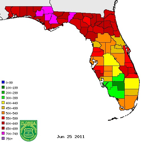
The good news is the cloud cover we are having this morning not only helped me on my run but it will stabilize our atmosphere enough that there is less than a 10% chance of any severe downbursts or wind gusts of 58 mph or greater. Lightning and lowland flooding will once again be our main threats on our Thursday afternoon. Lightning is not causing new wildfires anywhere close to the rate we saw last week thanks to some areas now close to 8 inches of rain for the month which includes the Okefenokee Swamp and Espanola!

We still have quite a few burning although the number is less than half at what it was and once in awhile we have a new one that pops up like we saw in Woodbine, Georgia yesterday captured by Nichole. Thanks for sending that in. So bring on the rainfall nature! We need more especially in Keystone Heights, Mandarin, Julington Creek and the beaches! We still look to be drying out this weekend and heating up so it is crucial we get more rain and of course I will keep you updated.


Last but not least in the tropics our rainy pattern is not being influenced by Arlene which has made landfall in Mexico as a tropical storm this morning. But the rainy pattern impacting us actually helped give birth to the first named storm of the season in the Atlantic.

This brings us to our PRANG FACT of the day. We all know about the rainfall drought that is finally improving, but there is also another drought in Florida many have not heard of. It is a hurricane drought! Since Wilma hit Florida as a category 3 back in 2005 we have had no hurricane strikes! This is one of our longest hurricane-free spells on record for the Sunshine State. Remember 40% of all hurricanes that form in the Atlantic hit Florida. That number is more impressive than the trillion rain drops! Secondly we should have had at least 4 hurricanes hit Florida since Wilma in 2005. WE HAVE HAD NONE! This is just how lucky we have been and as we all know it is not a matter of if but when the next one strikes and it will likely be sooner than later. It still looks like South Florida and the West Coast of Florida have the highest risk this year. You stay safe and cool. Have a great last day of June and be ready for another swoon, especially if you love rain! I will see you soon! Thanks for reading and take care.

Wednesday, June 29, 2011

Drought to Deluge Pattern Continues for 2 More Days


Wednesday  June 29, 2011
Blog update for Wednesday evening:

In this pattern we have been able to set our watches to the storms each day since late last week. They fire up by late afternoon and then die out in the evening. But tonight a front moves south from Georgia which will help generate a few more scattered showers and thunderstorms even during the overnight. Storms will linger well into the evening. Lows will be in the lower 70s. The main threats will continue to be lightning and ponding of water on the roadways. This is a picture of Lane Avenue this afternoon and is a good example of why you will need to slow down and be careful of hyrdoplaning. I just got a rain report of 2 inches at Normandy Boulevard in only 30 minutes! These storms are just not moving much!

Tropical Storm Arlene has 60 mph winds as of 6:30 p.m. and will hit Mexico tomorrow afternoon as a weak hurricane. Hurricane Warnings have been issued along the Mexican coast. It will be known as a flood-maker. Its moisture could eventually bring some much needed rain to New Mexico and the US Southwest.

Blog update for early Wednesday afternoon:


Numerous showers and thunderstorms will once again form along the Interstate 95 corridor and slowly drift south and east. The beaches once again will see some needed rain and they need it. While Jacksonville has officially had its first above average month for rainfall since February, areas like St. Augustine have only had half their monthly averages.

The good news is the beaches will at least be able to play catch-up tonight. The wind speeds all the way to 36,000 feet are less than 5 mph so any thunderstorms that do form will be very slow-moving and have the potential of producing 2 to 3 inch rainfall totals. Driving will be hazardous with hydroplaning a big concern.

Be on the outlook for dangerous lightning and we still cannot rule out a 45 to 60 mph wind gust as a frontal boundary interacts with our heat and humidity adding additional lift to the atmosphere.

We need to squeeze out as much rain as we can because we will start drying out as soon as Friday and especially over the 4th of July holiday as high pressure builds in bringing a drier air mass. It will also turn hot with some areas not far from 100 on the 4th! Yes, it will be as hot as a firecracker!

Tuesday, June 28, 2011

Atmosphere remains juiced up with more rain on the way!


Tuesday, June 28, 2011

We are loving the rain and I can gauge this based on the very kind thank you e-mails, including homemade granola that was waiting for me at work at 3 a.m. on Monday morning! Thanks Lori! It was the first time I have had it and it was outstanding! I was also relieved that it finally rained in St. Augustine and after talking about those poor folks for most of my 11 p.m. weathercast on Sunday night that is one forecast I am glad I got right. I feel like a big boulder has been lifted off my shoulders. At my parents house in Mandarin on the other hand....it has been a different story. I better bring flowers before our dinner tonight! But for most of us and yes I know you need more rain Green Cove Springs.... I guess I can take a little credit for the huge turnaround in our weather pattern but remember I certainly do not control the weather. I ordered this rainy pattern up late last summer! Better late the never.

Thank the dewpoints that are once again in the lower 70s this morning. This is telling us there is a ton of water in the atmosphere ready to be squeezed out again and there is no stopping this process with lower pressures in place and sea breezes on the way! Dewpoints are the true measure of humidity and it feeds thunderstorms this time of year. It may make it uncomfortable outside but this lighter air has a much easier time rising and eventually it cools, condenses, and releases even more heat helping cumulus clouds turn into cumulonimbus clouds or thunderstroms in as little a 20 minutes. Yes, the atmosphere is juiced up! Look for king cumulonimbus to return today. Here is another picture of the King of all clouds sent in from Hilliard.


Since last Friday I was concerned that with this stormy pattern emerging severe weather would come with the territory and we certainly saw that again yesterday in Hilliard. It was the second consecutive day they had numerous trees down and even some roads blocked. This picture was sent in by Jenny in Hilliard and it looks like the sky was falling. This shelf cloud produced 60-70 mph wind gusts. Today we will have to keep our guard up for more strong storms and once again Nassau County could see not only the rain but rough weather. I am out of the office today but am compiling a ton of weather data since true meteorologists never are "off". The weather is always happening. Here are a few stats to help you through the day.

-Thunderstorms will be slow-movers again so more rain amounts in excess of 2 inches could fall in less than 40 minutes like we have seen. Watch for lowland flooding. Storms will drift from the northwest to the southeast.

-The highest values of instability today are in Georgia and storms that do form could produce more isolated wind gusts of 60-70 mph along with dangerous lightning.

-In Florida the highest chances of severe weather will be right along the Georgia border including Nassau County. The Storm Prediction Center agrees and shows the trend. The farther north you go the higher your chances of severe weather today.


The areas in yellow and red will have the highest chances of severe weather due to a front coming from the north causing more convergence in the atmosphere. This front will bring plenty of widespread severe weather for areas from Macon, Georgia through Oxford, Mississippi. Here at home severe weather will be more isolated today with areas from Waycross to Alma and Jesup being with the highest severe weather risk.

This storm front will continue to move south bringing us more good rain chances through at least Thursday and it could enhance our severe weather chances farther south in Florida by tomorrow so we will keep an eye on it!

The tropics are active but anything that forms in the Bay of Campeche will quickly move into Mexico by late week.

Our pattern will likely turn much drier and hot this weekend so we need to squeeze out as much rain as possible. I do not think this will be another extended dry period which is good news for the wildfires. Officially this is our worst fire season since 2001 when about 400,000 acres in Florida burned. Right now we have had just over 200,000 acres scorched. But fire season has already peaked! We can now focus on the TROPICS! Some long-range maps are looking very interesting in the 10 to 15 day period.


Have a great day! Off to my workout and I want to thank Dan from Ponte Vedra for sending this great picture to me. This should make your day! There was no stopping our sunrise this morning even through a few distant storm clouds! A sunrise is a gift from God and puts everything into perspective.

Monday, June 27, 2011

Less smoke, better air quality and more welcome rain on the way!


Monday, June 27, 2011

It is nice to start off this week without smoke making it tough to breathe or see. Visibilities should remain over 5 miles in all locations first thing. Over the weekend more needed rain fell in most locations and where we needed it most with 2 to 4 inches over the Espanola Fire and another inch of rain in the Okefenokee Swamp.


Today we still have all the ingredients in place for more rain. The dog days officially do not begin until July 3rd but the weather map is showing a lazy hazy pattern. It is a what you see is what you get pattern as the main jet stream stays well to the north in Wisconsin and the dry high pressure ridge that caused our drought to become extreme over the Spring remains west of the area. Portions of Texas are experiencing their hottest temperatures ever recorded. Amarillo hit an incredible 111 degrees. Closer to home it will be hazy, hot and humid but a more bearable lower to middle 90s. With lower pressures in place and temperatures falling quicker than normal with height expect more welcome rain today. Thunderstorms will impact 50% of us today. This includes St. Augustine and other spots like Mandarin that missed out on most of the heavier weekend rain. Once again a few of the storms could turn severe with damaging wind gusts the main threat.


The tropics are still active but there is only a slight chance of tropical development this week. A tropical wave may try to develop in the Bay of Campeche but it does look like what develops will be weak and move into Mexico due to the strong high pressure over Texas. Here at home we may not be getting much help with the rain from the tropics but I did put together a 10 day forecast showing that at least scattered rain chance are in the forecast almost every day.


I am concerned we do dry out late this week and over the fourth of July holiday with temperatures of 95 to 100 but this looks like a brief 3 day dry spell rather than 3 months of praying for rain. We will have to watch this closer because if this dry spell lasts only a day or two longer the wildfires could once again become a big problem. But for this week I do think we all notice it will be much easier to breathe and the needed rain will be the big story. Just keep your guard up the strong storms. Have a wonderful and safe day!

Sunday, June 26, 2011

Lightning alley ignites with more rain than new wildfires


Sunday, June 26, 2011
Technically lightning alley runs from Tampa to Titusville where about 100 thunderstorm days per year. Here in Jacksonville we see our fair share of lightning with an average of about 70 thunderstorms per year. Florida is the lightning capital of the the US. We have a ton of heat, moisture and lift to work with thanks to being on a peninsula, our latitude and the collision of two seabreezes that take place. Today we live up to that reputation with more collisions at the surface and at 40,000 feet between ice crystals. Look for more electrically charged clouds to move our way. The blog question of the day is which country averages the most thunderstorm days per year. Take a look at the NASA map above. Impressive! The title has to go to Rwanda in Africa that has an incredible 300 days per year with thunderstorms. Kifuka, Congo has the most lightning strikes per square kilometer per year.  Columbia and Venezuela are next on the list followed by Pakistan and then Florida. So really we are sixth in the world in lightning. The place with the least amount of lightning is the Arctic Ocean and Antarctica but their atmosphere is charged up with the aurora.


Today get ready for more cumulonimbus clouds. A special thanks to Larry who captured this scene at St. Simons Island on Saturday evening before about 1,500 lightning strikes moved through the area. There was also a 60 mph wind gust reported on Jekyll island. The big news was a good portion of Camden County had a one to two inches of drenching of rain as outflow boundaries to the north helped to trigger thunderstorms. Farther south there were reports of one to two inch rains in Putnam Country through northern Flagler County which included areas over the Espanola Fire! So while many areas to the north missed out on rain at least it is falling where we need it most. Here is yesterday's rainfall map.


The areas that were missed yesterday in a strip through portions of southern Bradford, Clay, and the heart of St. Johns County will likely see better chances of heavier rain today. Notice our latest Future Cast model. It shows the heaviest rain today south of Interstate 10 with mainly late day and evening storms which could once again prompt a few warnings for gusty wind and hail. A drier slug of air is moving into Georgia but we cannot rule out an evening storm that could be strong especially up near Waycross.


It eventually all evens out! It really does and the hit and miss nature of our rain is normal. The good news is even though we had a lot of lightning last night with storms they are not igniting as many new wildfires as before. Remember we were seeing about a dozen new wildfires per hour during the worst part of this fire season about 2 weeks ago. Now we are seeing just a handful of new fires that have broken out this weekend according to the Division of Forestry that are small and quickly contained. This is because our soil now has more moisture to work with. The latest KBDI index which measure soil moisture no longer has desert pink over us like I showed you on the blog last week. Check out the much better news!


The scale runs from 0 to 800 based on the top layers of the soil moisture and really anything in pink is desert dry. The red areas are still critical and that is why this forecast is so important. Due to the high evaporation rates, if we only go 3 days of having dry weather the situation could once again ramp out of control with the wildfires once again. The good news is the drought-inducing high pressure will continue to park over Texas this coming up week allowing our sea breeze collisions to take place. There will also be a few disturbance dropping our way along with another frontal boundary by late week. So we have a lot of positives! Every single day there will be storms to track on Live Doppler Radar, especially in the afternoon. Let's keep it coming. It is already made a big difference! It sure is nice to see those blue skies again over Mandarin thanks to all the rain we have had! Here is a nice shot sent to us from Mike Lyons this morning.


You have a wonderful day and make sure to have your First Coast News weather app handy again today!  It has your two minute advantage and I do several video updates on there to keep you ahead of the storm. Be safe and do not get complacent with the lightning. More folks are killed in Florida by lightning than any other weather phenomenon. While it is nice we are getting the needed rain the dangerous lightning and strong storms here in Florida also come with it. They don't call us the lightning capital of the US for nothing.

Saturday, June 25, 2011

Sunshine State turns Cloudy with Storms Firing up South of Jacksonville


Saturday, June 25, 2011

What an unusual sight in the sky this morning! There were stratus clouds. Florida is not living up to its Sunshine State name but I am not complaining because I did not have any reports of smoke to share on Good Morning Jacksonville. Air quality for Jacksonville was actually in the good range! There still may be a few spots downwind of the bigger fires in southeast Georgia and Nassau County with some smoke issues but it will be nothing compared to what we have gone through the past couple weeks! Visibilities should remain above 5 miles and not fall to less than 1/4 miles! We can breathe again! I actually got my first summer run in outside thanks to the nice change in the pattern. I will never take breathing fresh air again for granted. Today for the first time in two weeks nature will help us with another issue, the heat! Many areas will only have highs in the upper 80s all the way to the beaches!


The stratus clouds out our window were formed from a plume of  moisture we can trace all the way back to the Pacific Ocean this morning and the amazing part is that this moisture was part of what once was called Tropical Storm Beatriz. In the Atlantic we still have not had any named storms yet and I think the area to watch over the next week will once again be in the Pacific. There is a tropical low that I am tracking near Belize this weekend but I have this system staying near land and moving into Mexico next week due to a strong area of high pressure to the north in Texas. So Arlene which will be the first named storm this year in the Atlantic will likely not be forming or knocking on anybody's door anytime soon. Unfortunately I do not see us getting any more help from the tropics this coming up week but things can change in a hurry and I do think the tropics will be more a friend to us than foe as the season goes along. This week we can thank a Midwest front for tapping some of what was left with Beatriz and today I think we will see more clouds than sunshine. Scattered showers and storms will pop this afternoon but do not cancel plans. The rain will only impact about 20% to 40% of the area. Here is the latest breakdown for you.


Unfortunately if we are going to get out of the drought the strong storms come as part of the package. We have had some severe weather to go along with our rain but today I see a more stable atmosphere here close to home due in large part to all those unfamiliar clouds. We may still see a few wind gusts near 45 mph and small hail due to colder air aloft. But nothing too bad. Here is a shot of wind damage that hit the west side of town and western portions of Duval County on Thursday.


This looks more like a scene from the Hoosier state of Indiana not Florida but it goes to show you that you do not need tornadoes to have signficant damage. Wet microburst or strong gushes of air from the top of 50,000 foot thunderstorms can gain a lot of momentum by time they reach the ground causing a lot of damage. Here are the latest Futurecast graphics supporting me. Notice I do not see the bright reflectivities that are indicative of strong storms for our Saturday.


Look to the north and northwest today that is where our rain is moving from and it will drift south and southeast. I think most of the rain should be south of our entire area by 8 p.m. Keystone Heights is asking for more rain and I do think that would be an area with at least better chances to see a nice soaking storm this afternoon. The farther south you go the better chances of rain. You can see it is the time of year where rainfall amounts can vary in a big way. This is normal and it usually evens out over the long-haul.


Notice it is the story of the haves and have nots. The 48 hour rainfall shows some bare patches with .10" or less for areas of Columbia, Baker, Bradford and Union Counties. The good news the heaviest rain we have had has been over the Okefenokee Swamp and the Espanola fires with some spots reporting between 3 to 5 inches of rain since Wednesday! In Jacksonville I know a lot of folks in Julington Creek, Mandarin and even Orange Park are wondering where their heavier rain has been. You see the heaviest of rain has stayed from downtown Jacksonville northward into Georgia. The beaches have done well with an average of .50" to 1" of rain.

This is a start and at least the ground is not as tender dry so that when we do get these thunderstorms they will produce more rain than new wildfires. The fire count should continue to fall. I wish we all lived at the airport. Jacksonville International Airport is now reporing 5.08" of rain compared to the monthly normal of 4.23". This would be the first month with above average rainfall since February! AMEN! If you have missed out on the rain do not panic. I see another 2 to 4 inches over us coming the next couple weeks which is still above average. Keep those umbrellas handy. Have a great weekend and make sure to check out our free weather app you can download by searching FCN WX! I will do several video updates for you to keep you updated on the storms, you can also get your exclusive local 10 day forecast I update every morning and evening as needed, and most importantly your 2 minute advantage to keep you ahead of the storms.


Your only Live Doppler Radar sure came through big time this week. You can see why with this amazing storm picture taken yesterday in St. Augustine. Thank you Athena Masson! Remember warnings are not issued with lightning and if you hear the thunder roar outdoors head indoors. Also wait 30 minutes after hearing the last clap of thunder before going back outside. Stay safe and have a great day!

Friday, June 24, 2011

Jacksonville Electrified! More strong storms on the way!


Friday, June 24, 2011

More welcome rain is on the way! The atmosphere is still juiced up and full of plenty of moisture to work with. Showers and thunderstorms will re-develop by mid to late afternoon for most of us. While we are excited about the rain remember your lightning safety rules and like yesterday a few storms will go severe with some isolated wind gusts near 60 mph. Highs will be in the lower 90s and like yesterday the storms will move from in from the south and west.


We have scattered showers and thunderstorms in the forecast through the weekend but I would not cancel plans. Rain coverage will not be as widespread and no all day rains are expected with most of the rain in the middle and later part of the afternoon. It will be hot and humid with highs back in the middle 90s.

Tuesday, June 21, 2011

Longest and smokiest day of the year, but winds of change on the way!


Tuesday, June 21, 2011

It officially is the summer solstice today and our longest day of the year with a sunrise of 6:25 a.m. and sunset of 8:32 p.m. This is due to the sun's most direct rays of the year shining on the northern hemisphere due to the tilt of the earth. The southern hemisphere is celebrating the first day of winter and their shortest day of the year. I think what we will remember most about solstice 2011 is the incredible smoke around the area that was as thick as fog and required dense smoke advisories to be issued as visibilities fell to a quarter-mile.  I shot this picture while out at the beaches and you would think it is our first day of winter. It was a ghost town and felt like you were in a smoke-globe and it looked like a snow-globe at times but instead of snow, ash was falling from the sky! The picture is also dark because the sun was obscured. Our longest day usually brings the brightest sun rays of the year but not today, not even close!

The good news is that it will not be this smoky again, this year, hopefully never again. This is miserable. The pattern change I have been touting is on the way and the upper-flow is changing so that on the first full day of summer tomorrow the smoke will be thickest in Georgia but likely not as bad as today. By Friday I think our entire viewing area will really notice that nature's choke-hold on us will be all but history with increasing south to southwest breezes and more numerous storms to clean up the atmosphere. It could not come soon enough. Here is the Intracoastal Bridge that looks more like London Bridge.


It is another picture that looks more like nightfall is upon us rather than high noon when it was taken! Amazing! There will still be some lowered visibilities tonight even with the sea breeze moving in from the east because the smoke blew all the way out to the Gulf Stream. So improvements are blowing in with the wind but they will be slow improvements. Here is the visible satellite picture that shows the veil of smoke from space.

One thing to note on this beautiful shot is the two seabreezes that will bring isolated storms this evening inland. Look closely and notice the clouds in the Alabama, Georgia and the Florida Panhandle this is heralding the pattern change. There is an unusually strong front right now in the Midwest that is moving south and it will shake this pattern to its core and the choking high pressure will skidaddle as it is no match for this front. I am concerned about more tornadoes and severe weather breaking out in Wisconsin, Michigan, and Indiana. Here is a picture of some of the interesting clouds from our friends in Indiana.


This is a classic shelf cloud that clobbered Lafayette, Indiana. It brought wind and turned the Sagamore Parkway into a river. Yes, this front means business and is unsually strong for this time of year. There have been about 500 storm reports including about 4 dozen tornadoes including one reported near Fond Du Lac, Wisconsin. Here in Florida we will have to be on guard for strong storms as well as cooler temperatures aloft settle in by Friday into next week. I am thinking parts of our area could see at least some scattered rain every single day for the next 7 to 10 days. This is what helped us out of the 1998 wildfire debacle. We had 21 of 31 days of rain in jacksonville in July. This year we could easily pull it off again. Bring it on nature!

Monday, June 20, 2011

Scorching, dry finish to Spring but a new season will bring a new pattern!


Monday, June 20, 2011

Here is the latest visible satellite imagery and once again it is easy to pick up the smoke in southeast Georgia and Nassau County. Today a west wind will keep these areas in the smoke and the rest of us in the scorching hot weather. But we have come a long way in just about a week. After having only 4 days with rain in the previous 41 days, we have had 4 of the last 8 days bring some needed rain. This has helped with the smoke situation. Take a look at how far we have come in just about a week. Here is the visible satellite picture taken last Wednesday. The smoky ash plume covered much of the area and I had to put on my smoke mask downtown.


Some of the ash was as big as wet snowflakes and hot to the touch. My car had a dusting of ash accumulation. It was hard to breathe for everybody not just those with respiratory problems. Here I am at First Coast News trying to breathe.


Today it is much easier to breathe but if you are in southeast Georgia and Nassau County the air quality will be unhealthy at times and in the moderate range for the rest of us as over 140 wildfires continue to burn in and around our viewing area. So we need a real change and I still think it is on the way. Summer officially begins Tuesday at 1:16 p.m. and while it will be hard to find any rain anywhere close to home the latest long-range models are still showing much better chances of rain by late this week. Here are a couple maps showing us ringing in the new season and ringing out the rain!


Pressures have been low and there has been plenty of rain north and south of Florida during the Spring season but an area of high pressure has blocked it from reaching us. Finally this high pressure is weakening and splitting up. A more typical Bermuda high takes hold of our area and with a clock-wise flow around it a nice rich, moist flow from the tropics will ensue!


I think we will all start taking notice of this change by late in the week and our temperatures near 100 will all be a thing of the past as well with more clouds and rain. I will be able to get in front of the Live Doppler Radar again and talk about showers and storms breaking out rather than more wildfires! Here is your 10 day forecast available on our free weather app! This app is also the only one in town with your only live doppler radar and plenty of local weather updates from your local weather channel at First Coast News. I must have updated it 10 times on Saturday. That is the service you deserve!


Ahhhhh, this makes it much easier to take today's heat and smoke! Let's go nature! Now back to my kids. I am officially off today but this update was well worth it! Be safe and stay cool!

Sunday, June 19, 2011

A Sizzling Frizzlin' Father's Day! More smoke than rain today


Sunday, June 19, 2011

Happy Father's Day! I want to take time to thank my three daughters for being my true inspiration and every day is Father's Day for me, because they are gifts from God and I know just how lucky I am. I also wanted to thank my Dad for always being there for me. I would not be doing weather without him. After all I remember him teaching me about clouds while flying our kite when I was just three years old. Talk about a huge day! Today is my Mom's birthday as well and I look forward to celebrating with Mom and Dad over a nice big dinner. Thank you Mom for taking me to the library every week when I was growing up just so I could read another weather book. It is the little things in life that really do add up in a big way and I am very thankful!

Now is nature going to show us some love today? Well the weather word of the day is frizzle. That is the sound you hear when bacon is sizzling on a skillet. We are going to be in nature's frying pan and unfortunately it will get a bit smoky again especially from areas of northern Duval County, Nassau County and south Georgia. There will also be smoke along the beaches although not as thick. Inland areas of Putnam County including the Keystone Heights area will also see an increase in the smoke. Notice on the map above that drier air moves in as depicted by the orange "frizzle" bubble. Any storms that do form today will be isolated and confined to areas from Putnam and Marion County southward. Here is the latest Air Quality forecast for today.


Unfortunately smoke will continue to be a problem this week with over 150 wildfires still burning. It will likely get worse before it gets better with the unhealthy area spreading southward by late Monday and especially Tuesday with more of a west northwest flow around an area of high pressure building in. Sea breezes will be weak and not move in until late day.


It will also be dry. You can also expect heat advisories that are in effect today for portions of Georgia and South Carolina to possibly be issued on the First Coast this week as heat indices reach 105-112 here at home with actual highs near 100 through Wednesday. Here are some notes to get you ready for summer!


The summer solstice officially begins Tuesday at 1:16 p.m. and it will feel like it! This picture gives you a hint that today will be a great day to take Dad out on a cool boat ride. Seas will only be at 2-3 feet with a south wind this afternoon at 10-15 kts. Surf looks flat to a foot with a light inland chop. The boat, pool, and ocean will be the places to beat the heat over the next several days. It will be our hottest start to summer since 1990! The drought and wildfires will also be our big stories as we head into summer and here is the latest assessment from the Climate Prediction Center!


This map shows us painted in green which mean improving conditions. This matches my forecast very well. Nature is showing some love!! Unfortunately for Texas it is not looking very good as the center of high pressure sits over the Lone Star State. Here in Florida we will be dominated by a more moist flow out of the south and southeast with Bermuda High pressure in control. This is something we did not see last summer when the drought really took hold. Speaking of the drought. Just how much rain will it take to finally get rid of it?


It will take a lot! Right now we need a good 10 to 15 inches of rain as you can see above. Poor Miami needs almost two feet of rain. Now I did check some historical records. In 1998 we did flip to a pattern that had rain on 21 of 31 days in July and a tropical system brought nice rains in September. This year I am expecting a similar flip and I feel that it has already begun. So we need to stay patient. Not only is positive thinking on our side but SCIENCE. The one concern I do have is even though we would all love a tropical system to bring us rain I am worried about South Florida. Their hurricane chances go through the roof after having dry Spring weather. The 16% chance of a hurricane South Florida has every year goes up to about 50% in this type of situation. So while nature may turn on the rain spigots I will keep my fingers crossed that we can get some of that needed rain from the tropics without a devastating storm. Make sure to check back here on the blog tomorrow and we will be tracking tropical moisture that will once again increase our rain chances in a big way by late week with highs finally back down where they belong. But for now it is all about Dad and patience. Have a wonderful Father's Day!

Saturday, June 18, 2011

Heaviest rain in St. Augustine since February! More on the way!


Saturday, June 18, 2011

The fire numbers are staggering and we are not out of the smoky woods by any stretch of the imagination but at least we seeing our thunderstorm season really start to kick in. We have had more rain in just 5 days than the previous 6 weeks and an unheard of rain surplus has developed for the month. There are a few locations that have seen much less than rain which usually is the case here in Florida this time of year. The Okefenokee Swamp has had less than .25" or rain while areas to its east and north have had a whopping 2 to 4 inches of rain. Does smoke in fact have the ability to stabilize the atmosphere at times by blocking out enough sunlight causing it to rain much less over the fire? Absolutely. The smoke also holds down high temperatures and increases low temperatures.

The big news was yesterday was out of St. Johns County that is battling 24 wildfires! St. Augustine had its heaviest one day rainfall total yesterday since February 7th with a quenching 1.54" of rain! Folks were dancing in the street celebrating the rain more than Friday night! St. Marys was thrilled it had 1.5" of rain the last 5 days while Brunswick and Saint Simons Island were very content with 2 inches of rain. I found one spot near Nahunta, Georgia with close to 4 inches! Yes!!

In Florida a good 1 to 2 inch average takes up much of our area although areas of central Putnam County have had closer to .25" of rain. The beaches are in the .50" to 1" range with more for Vilano Beach southward including over 3 inches in Palm Coast. Orange Park, Mandarin, and Julington Creek all average out close to 1.25" while Hilliard and Callahan farther north are ecstatic with their 3" of rain. Yulee has had between 1.5 to 2" while Macclenny and Woodbine checked in with a more tame .50" of rain. Our average rainfall over a five day period this time of year ranges from .70" to .90" of an inch of liquid sunshine. So we had a great week with Jacksonville receiving 3 times its normal rain and then some! One other bonus was found in the sky. Take a look!


I think this is the first rainbow I have seen in 2011 or the year of the extreme weather. Do you realize that 4.2 million across have burned across the US. That is the size of the state of Connecticut. Normally fire season chars about 2 million acres. We do have to realize this fire season is far from over even if the long-range maps still have another 3 to 5 inches of rain on the way over the next 2 weeks. Our evaporation rates this time of year are insanely high or about .25" to .50" a day which means a lot of the rain we received this week has been evaporated. The Division of Forestry says it will take a tropical storm dumping over 10" of widespread rain on us to really help! I do not have any tropical storms on the way but at least more rain. Remember, baby steps! It is better than no steps at all. This makes today's forecast important. Let's take a look!


The set-up is a lot like yesterday although I will stick by yesterday's forecast of less rain. I think about 40% of us will see scattered showers and thunderstorms especially east of highway 301 and the storms will move from west to east. We will be helped by the Gulf Coast and East Coast sea breeze meeting over us and that high pressure really will not build into the area in a big way until Sunday. The west-southwest wind today will shift most of the thicker smoke into Georgia. Brunswick and St. Simons Island will likely have reduced visibilities to near 1 mile even this afternoon before we can kick up a few storms. Air quality will be unhealthy in Georgia for sensitive groups with some improvement by late day and Florida will remain in the moderate range which means there is still a moderate health risk for those with respiratory ailments.


Today's storms will once produce a few strong wind gusts like we saw yesterday. We had a few areas like Oceanway you see above hit with 60 mph winds and St. Augsustine officially recorded a 61 mph wind gust. Remember your lightning safety rules and if you cannot see out of your car under one of those heavy downpours make sure to pull to the side of the road until the storm passes. I look forward to updating more rainfall amounts here on the blog on Sunday and we will talk about taking care of Dad for Father's Day! Make sure to get Dad an early tee time with highs in the middle 90s and a heat index near 100. There will be a whole lot more sun than storms with only 10% seeing a cooling storm tomorrow. A movie would even work really well! Take care and if you are looking to stay cool this weekend. Here are a couple more ideas!


You can go see Lizard Man in St. Augustine at the Ripley's Believe it or Not or you can go see CATS playing all weekend at the Times Union Center. You see I got in the spirit as some of the cast members painted whiskers on my face this morning. I told them it was okay as long as it brought rain and hopefully it will rain cats and dogs. Lizard man lived up to the hype as well on Good Morning Jacksonville this morning. No he was not Barry Williams or Michael Winslow but he lived up to the hype and certainly interesting in his own way! Have a great weekend!

Friday, June 17, 2011

Less smoky and stormy, but keep Dad cool for Father's Day


What an incredible picture sent in from Charlie near Hastings. This is a dust-devil he captured for us and this is something you would see in Arizona not in Florida! This shows you how bad our drought actually  is. Now the good news is this did not do any damage and we are not expecting tornadoes to finish out the week. We will see a few strong storms this evening. The main threats will be 40 mph wind gusts, lightning and heavy downpours. Let it rain! Some areas could pick up a quick one to two inches.


We need to squeeze all the rain we can because high pressure move in this weekend which will dry us out. I do not expect as much smoke with more mixing and a southwest breeze. But what this does mean is it will stay scorching hot with highs even at the beaches well into the 90s. Remember to keep Dad cool for Father's Day on Sunday. I am not expecting any cooling storms with highs near 100! Here is a great reminder above to also take care of  man's best friend. Tropical Smoothie is taking care of man's best friend with free water for your pets and smoothies to keep you cool! Stay cool and Happy Father's Day to all the Dads!