
Monday June 7, 2011
Here is your special blog update because I am still convinced showers and thunderstorms will break out across the area today. I know this sounds crazy since we are still mired in one of our worst droughts in years. But the high pressure ridge responsible for this steam bath is loosening its grip over the area by late today. The rain better come soon for many reasons. First off the air so heavy it seems like you are getting a workout just walking around in this stuff. It is thicker out there than pea soup and it looks like it as well. Here is a shot from Interstate 95 showing the hazy atmosphere. It is what I am calling nature's soup. The humidity is through the roof. Before noon in Macclenny it was 94 degrees with a dew point of 78 making it feel like 110! Today will be the hottest day of the year for most of us and it will certainly feel like it! I called for a high of 98 today in Jacksonville to 100 on the south side but if you combine the humidity with the temperature in the shade many areas will feel like closer to 105-115! Make sure to slow it down and yes I am taking my own advice by running inside on the treadmill. Yes, something has got to give. You combine all this heat and humidity with an area of low pressure moving in from the north by late today and I think we have all the ingredients for nature to cook up a nice stormy in place. One concern is that lightning could start new wildfires and that some of the storms that grow in all this heat and humidity briefly go severe. An amazing 19 wildfires around the area have been started by lightning according to the division of forestry. How does this compare to 1998? Let's take a look at our weather question.
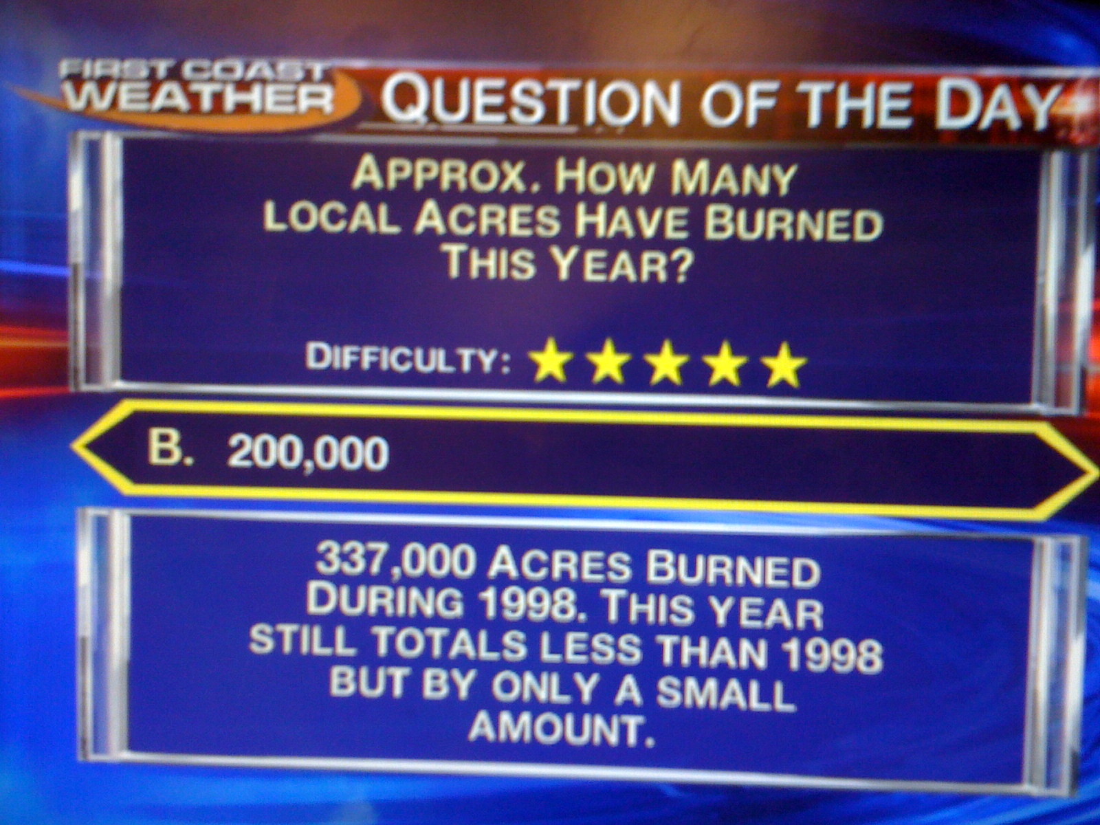
About a quarter million acres have burned in the over 100 wildfires so far this year which is still less than the 337,000 acres we had back in 1998 when Flagler County had mass evacuations. The concern I have is that while we do have some rain in the forecast the next couple days, we will dry back out in many areas over the next 7-10 days. So fire season that peaks in May and June is not even close to peaking this year and we could topple 1998 levels at the pace without question. Many were also asking me what is causing it to be so smoky yesterday. Well what we have been having is an atmospheric phenomenon called an inversion. Take a look.

This is caused by high pressure in the atmosphere that puts a lid on us much like when you put a lid on rice when you are steaming it. The air is trapped by sinking air motions created by high pressure which causes the atmosphere to actually heat up with height rather than cool down. This does not allow any mixing of the drier, cooler air aloft to sink to the ground like it normally does. As a result it has been tough to breathe because this set-up has allowed all the pollutants and particulates to accumulate in a hurry and they have nowhere to go. So if you have any respiratory ailments make sure you stay indoors. We do have better news. Our smoky weather-maker will finally loosen its grip by late today as you can see below.

Low pressure moving in from the north will help disperse the smoke and even help bring us much needed RAIN! Make sure to tune into First Coast News tonight for your only Live Doppler Radar. It is ready to go! I do think some areas could easily see over a half-inch of rain. Now I cannot promise everybody rain since we do not have a bonafide cold front moving through but most of us should receive some free plant waterings and all of us can breathe easier literally by late tonight and tomorrow as the rain helps cleanse the atmosphere and an area of low pressure mixes out the thick smoke. Have a great day and not it is time for my indoor treadmill run which will be moved back outdoors tomorrow. Keep the positive thoughts going and let it rain, let it rain, let it rain. Thanks for reading.
No comments:
Post a Comment