Monday, June 20, 2011
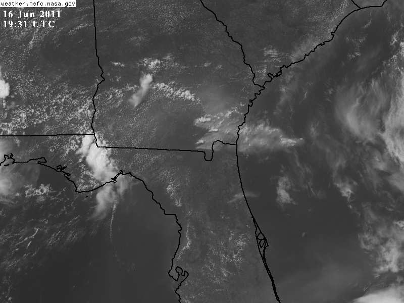
Here is the latest visible satellite imagery and once again it is easy to pick up the smoke in southeast Georgia and Nassau County. Today a west wind will keep these areas in the smoke and the rest of us in the scorching hot weather. But we have come a long way in just about a week. After having only 4 days with rain in the previous 41 days, we have had 4 of the last 8 days bring some needed rain. This has helped with the smoke situation. Take a look at how far we have come in just about a week. Here is the visible satellite picture taken last Wednesday. The smoky ash plume covered much of the area and I had to put on my smoke mask downtown.

Some of the ash was as big as wet snowflakes and hot to the touch. My car had a dusting of ash accumulation. It was hard to breathe for everybody not just those with respiratory problems. Here I am at First Coast News trying to breathe.

Today it is much easier to breathe but if you are in southeast Georgia and Nassau County the air quality will be unhealthy at times and in the moderate range for the rest of us as over 140 wildfires continue to burn in and around our viewing area. So we need a real change and I still think it is on the way. Summer officially begins Tuesday at 1:16 p.m. and while it will be hard to find any rain anywhere close to home the latest long-range models are still showing much better chances of rain by late this week. Here are a couple maps showing us ringing in the new season and ringing out the rain!

Pressures have been low and there has been plenty of rain north and south of Florida during the Spring season but an area of high pressure has blocked it from reaching us. Finally this high pressure is weakening and splitting up. A more typical Bermuda high takes hold of our area and with a clock-wise flow around it a nice rich, moist flow from the tropics will ensue!

I think we will all start taking notice of this change by late in the week and our temperatures near 100 will all be a thing of the past as well with more clouds and rain. I will be able to get in front of the Live Doppler Radar again and talk about showers and storms breaking out rather than more wildfires! Here is your 10 day forecast available on our free weather app! This app is also the only one in town with your only live doppler radar and plenty of local weather updates from your local weather channel at First Coast News. I must have updated it 10 times on Saturday. That is the service you deserve!

Ahhhhh, this makes it much easier to take today's heat and smoke! Let's go nature! Now back to my kids. I am officially off today but this update was well worth it! Be safe and stay cool!
No comments:
Post a Comment