Tuesday, December 27, 2011

No Frightful Weather but Winter Blows Back in with a Vengeance!


December 27, 2011

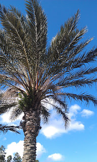
Frightful weather arrives with a flurry or 2! That was the headline in last year's local newspaper. One year later I am outside running in my shorts. I want to thank my daughter Lauren for the great picture she took. My legs are more sore from playing our new Smurfs Dance Party game Santa brought her for the Wii. Maybe it will make me stronger for the National Breast Cancer Marathon which is now only 47 days away and I will finally be the great dancer I could have always have been!  I cannot wait! Before I dance more to Who Let the Smurfs Out I wanted to make sure you knew no severe weather is coming our way! I talked about at least the potential over the holiday weekend.

Have no fear the CAPE is here! This stands for Convective Available Potential Energy. In other words, it is the amount of energy the atmosphere has to work with to form thunderstorms. The higher the number the better the chance of not only boom booms but severe weather. Notice the green shading I usually like to see over us when I forecast thunder is just not happening. What I am more impressed with is the southwest wind over us at 36,000 feet howling at 135 mph! This jet could still whip up a few strong storms over the Carolinas today, but not here. What it will do is bring us a windy late afternoon and evening with gusts of 30 to 40 mph possible. Please get here recycling man....hurry!!! Make sure the small dogs are leashed and the babies secure because this wind will blow with gusto!


Our next concern will be the pets and plants. Notice my Dad's flourishing garden in Mandarin that gave all the Christmas lights some competition. Yes, if you ever get lost going to the Prangleys' house just look for the house with all the flowers. His green thumb was handed down from his Dad and I am hoping like the dancing thing that I am a late bloomer and my garden eventually looks at least half this good! This was our ninth day in a row above normal today and we have not had a freeze so far in December which is very unusual. The last December to have no freezes was way back in 1994. So will we keep the freeze-less streak alive?

Yes! We have high pressure building in which usually does the deed this time of year but it is location, location, location. This high pressure originates from the Pacific Ocean not a from the Northwest Territories. Some models also show a few clouds moving in late Wednesday night and again Thursday night which would also keep us from seeing ideal radiational cooling. This high pressure is not the typical December fair weather freezer, but we should still make sure our pets have a warm spot along with bringing in the sensitive plants.

Look for frosty conditions away from the river and ocean for Thursday and Friday mornings with lows in the middle 30s at the airport and for places like Mandarin and close to the river and ocean, the upper 30s and lower 40s seem more reasonable. Our warm Spring honeymoon is coming to an end as we will have below average temperatures on Wednesday reaching only near 60! To me this still feels great outside after going through winter's in Vermont and Minnesota. I am still sure your out of town guests from the North will not mind either!

  
Now the question on everybody's mind is how is our last weekend of 2011 looking? I am giving it my seal of approval! It looks outstanding with temperatures back in the 70s and I still like my warmer middle 70s to near 80 by New Year's Day. But this is not an easy forecast as we head into 2012. The European Model has gone wild! You see the big blue over the southeast next week, while the other model is showing mainly warm oranges taking up much of the country. The European has highs here only in the 30s with flurries all the way to North Florida and South Georgia by next Tuesday. The other models like us cooling down to more seasonable levels with lows in the 30s and highs in the 60s.


Now which one is right? As much as this hurts to say....the European is out to lunch I think is still on Christmas break. There are no teleconnections to support this. The North Atlantic pressures remain low helping to trap the Arctic air over the polar bears and the Pacific Northwest also is showing no signs of strong high pressure building in. This would not allow a repeat of last year to form in our viewing area like last year, not even close. But I will keep you updated and we at least have memories. Check out last year! You see there was snow place like home with the surreal scene full of flakes and sago palms!

Okay now I am still all fired up about one of the maps still showing snow over us next week, even if it is a snow dream. I will be back soon to verify snow is not coming and we will also have an update on winter's return. Have a great evening! Back to the fam and dancing! Take care and don't blow away!

Sunday, December 25, 2011

Heavy Brief Gully Washers Moving North!


December 25, 2011

Merry Christmas! What a day already. I did not get much sleep but it is a good tired and my kids and family are happy. That is all that really matters. Nature has even made this day exciting for me. Notice the towering clouds at sunrise. This looks like a March scene! I cannot totally rule out a few heavy gully washers today especially from I-95 east. They will not last long but be careful. I want everybody to get to Grandma's house safely. It still looks plenty warm today with highs in the lower to middle 70s. Bobbie in Keystone Heights has already reported a high of 75!


You can see our latest rainfall estimates verifying some of those downpours early this afternoon. What is interesting is the wind is blowing northeast up to 1,500 feet and then it veers to south and eventually southwest by time you head up to 10,000 feet. This is causing the air to pile up and converge. We also have upper-level spin moving northward enhancing our lift. This mean rainfall amounts could hit a quick .25" in only about 10 to 20 minutes. Now that is impressive whenever you are talking rain rates over 4 inches an hour. It is even a  bit humid outside. I cannot rule out a brief rumble of thunder but I would think that with the heavier widespread rain will stay offshore.

How about the cookouts? Well keep those plans! I think the brief downpours impacting about 30% of us will diminish by 4 p.m. over North Florida and early evening in Georgia as our upper support lifts north and northeast. It is great to see all the kids out in the neighborhood trying out their new scooters, bikes, and even go-carts. Have a great rest of your day and I look forward to seeing you tonight at 11 p.m. We will talk about a real soaker on the way and I will tell you why you may be able to wear some of those new holiday sweaters later this week! Now off to Mom and Dad's for dinner!

Saturday, December 24, 2011

A Merry Warm Christmas! More Flowers than Showers


Merry Christmas! We have plenty to be thankful for and I am blessed many times over with three lovely daughters. You see they are all smiles after partaking in the Prangley family tradition of opening up the pajamas the night before Christmas. Lauren even got a barbie doll bonus since she was so good this year and Megan and Abbey loved their new slippers. We can also be thankful for the weather. A weak nor'easter falls apart on our Christmas Day and nature sends us more flowers than showers.


I only expect 10% coverage of isolated rain showers along the coast that should be brief at best. Highs will be back in the lower to middle 70s with upper 70s possible well inland. The three models I trust all came in tonight with .03" or less which means even if this were all snow it would not be enough to stick. Now the big storm to watch is the Gulf low pressure bringing drought relief to Texas. This could spin up our way late Monday Night into Tuesday. I cannot rule out a strong storm or two with the strong southern jet stream dominating our weather. Stay tuned for your two minute advantage and more details here on the blog. But for now it is all about family! All the best and God bless! I will see you tonight at 11 p.m.

Friday, December 23, 2011

What a Difference 22 Years Makes! Freak Snow to Liquid Snow!


Friday, December 23, 2011

Do you remember where you were 22 years ago today? It is the anniversary of the freak snow/ice storm that shut down all our bridges in Jacksonville for 3 days. You could only cross the mighty St. Johns by foot.  It was the White Christmas of 1989 but some folks said it was not a dream come true and had to wait until up to a week after Christmas to open all their presents since many were stranded for days! But most folks loved it and it did not matter if you were 4 years old or 80....many folks went out and played in a snowfall which for many was the first and biggest snow they had ever seen.


This year 1989 could not be further from our minds! The weather is like from another planet! We are stranded in what feels like a tropical paradise. St. Augustine hit 82 degrees along with most of the area south of the Airport! To do this on back to back days this time of year is rare! We have been in a mid-April weather pattern and many areas around the country will have their brownest Christmas since the late 1990s. 2011 will go down as the year of extreme weather and it might as well go out with a bang!


Here at home we are talking liquid snow in the forecast or rain! But it should not keep you from enjoying the Holly Jolly Trolley in St. Augustine or from catching up on shopping! Tonight we will just have a few splash and dash showers. They will only last a few minutes and then move on! Bizarre! This is a Spring pattern. There is a cold front moving through but it is not living up to its name and has very little moisture to work with. Temperatures behind it are still above average for this time of year. Notice Atlanta this evening is still a good 5 to 8 degrees above average. But this sorry excuse for a front will cool us down and bring our temperatures back down to earth and at least make it feel more like Christmas Weekend. Expect highs closer to 70.

The big question is what about the rain. Well we know it is a very weak front but it is turning our wind off the cooler ocean. This is the time of year where nor'easter can develop in a hurry and turn a decent forecast into a disaster. While I do not see that happening this weekend, I do see at least a few coastal showers moving back in by Christmas Day but amounts should once again be light and you can still get outside and the kids can still get outside and try out their new scooters or bikes.

I will make sure to check in with you over Christmas weekend and post updates that is for sure. But suffice it to say I see good flying weather for Comet and Dasher and a much bigger rain event will hold off until Tuesday of next week! Stay tuned and go do something holiday-ish. I am going outside to build a snowman after receiving an early Christmas present. Details on the way! God bless!

Thursday, December 22, 2011

Still on the Nice List at Home, But Nasty Storms North

December 22, 2011

Hello winter! This looks more like Spring and could be used in a Florida tourism commerical. You see Ridge and Dixie enjoying some great fishing weather! Incredible is the weather word of the day. Our temperatures reached record levels in some areas with highs of 82 in Waycross.  In Jacksonville we officially hit a high of 79 which is something we normally would see in the middle of April! So where is winter?  Let's take a look!


Winter? Really nature! This is like a Spring front with severe weather breaking out from Alabama and western Florida through Atlanta and the Carolinas. So while we are nice at home if you have Uncle Johnny and Aunt Peggy coming into town there may be a few travel delays. This same front will give us a chance of a pop up shower or storm by late Friday but most of its upper support will have lifted well north. So I am not expecting severe weather. It will be warm once again with highs near 80.

It is so warm that there are just a few rain showers in the snow belt of the Northeast! I am not quite sure I have ever seen this for this time of year.  I did find winter as we head into 2012! I see a cold shot that could bring us a real freeze and next week maybe a brief taste of December. But for this big Christmas weekend, this Spring front will die out as it moves south with mild air behind it! Expect more 70s and very low chances of rain. Christmas we could be back in the middle 70s and you give some of those outdoor presents a workout.

Wednesday, December 21, 2011

Warm Air Wins and Chilly Rain Stays North


Is it really December? Well you can tell if you have been out shopping today like me. I would still call it a procrastinator's delight. There is nothing worse than soggy presents before they are wrapped or having to walk a long way to your parking spot in bitter cold wind chills. We have nothing like that weatherwise to contend with. But, I did snap a shot of the 22 degree halo over us this afternoon. This was caused by sunlight being refracted twice by hexagonal ice crystals or snow flakes at about 30,000 feet. This is probably as close as we will get to a White Christmas because I still think we could challenge record highs near 80 over the next couple days. A few areas mainly in southeast Georgia had a few rain showers today but most of us stayed dry and this trend will continue not only tonight but through the next several days.


Temperatures right now in Green Bay are near 40 with no snow on the ground. It could be their first brown Christmas since 2006. This is significant for us because the polar air that usually pushes fronts south of us this time of year is nowhere to be found. So we have a stalled front to our north as a result and it is not moving our way anytime soon.


You see this is not an easy forecast. Not far from home it is raining with even some embedded thunder. We will continue to have waves of showers at times mainly over Georgia. Our next chance will be Friday night and early Saturday. Then another area low pressure will form along our stalled boundary and bring more rain chances Christmas Day. Right now the front look like it will be north of Jacksonville on Christmas. This would mean Georgia would have the better chance of rain. Areas near Alma may only be in the lower 60s with a soggy afternoon with areas from Jacksonville south will be well into the 70s once again and mainly dry. So you can throw around the new football outside!


I do think this front will get a better push over us by Monday and Tuesday. That is when the heavier downpours will likely occur. Until then look for the clouds and unsually warm weather to continue. If you are traveling it does not look bad at all with the least amount of snow cover for this time of year since 2004 over the United States and no big snow or ice storms expected. Just be careful of heavier bands of rain the farther north you travel. Now off to do the big shows! See  you soon.

Sunday, December 18, 2011

Colorado Skies & Bright Autumn Skies & Leaves


Sunday, December 18, 2011

Yes, we do have real autumn weather in Florida. I know 13 of 17 days so far this month have been above normal but today nature finally gave us the weather many of us moved to Florida for! This is not a scene from Vermont. I actually snapped this picture in downtown Jacksonville. Believe it or not the deciduous trees that we do have usually peak right around the middle of December and this year the trees are right on cue! It is not by any means a New England scene but for Florida we are looking pretty terrific! It was a  beautiful day! We had what I call Colorado blue skies. Now of course we do not have mountains here but it was so crystal clear you could almost see forever like you would if you were on a summit. It was one of those days I felt I could run forever and I had to force myself to turn around on my run. I lost track at mile 10. Thank you nature! I was certainly running on sunshine.


It was perfect out today with highs in the lower to middle 60s but do not let that fool you. Tonight once the sun sets watch out! I expect patchy frost to be more widespread than last night especially west of highway 301 . Even the airport could get in on the frost along with Hilliard. Even though you see I am forecasting a low of 37, you really want to subtract five degrees to get the ground temperature. Temperatures are measured about six feet high and remember the earth cools from the ground up. This means it will be 32 on the ground which is cold enough for frost to form. I am expecting ideal radiational cooling with clear skies and a light wind as the high pressure bringing in this December chill settles in.


Tonight, I have issued a hot chocolate advisory which means you will need to bundle up in layers if you are checking out the many beautiful luminary displays or if your going out to look at holiday lights. Temperatures by 8 p.m. will only be in the middle to upper 40s. The hot chocolate advisory will continue into Monday morning before we go back to our familiar warm December pattern. This cold air does not have much staying power because most of the country lacks snow cover and the main jet stream continues to detour well to the north of Florida acting as a huge barrier to any cold that will try to hold.

I will be back here on the blog on Monday with your ten day outlook almost into New Years! Will Santa need his shorts, umbrellas, or maybe a lightning rod. It does look like a wild weather week which could even include record highs. Take care and I will be back soon!

Saturday, December 17, 2011

Candy Cane Weather Before Decem"brrrr"s Return

Saturday, December 17, 2011

The California effect moved in yesterday afternoon with a marine layer full of clouds. Our ocean has cooled enough and it does not take much for a warm, tropical wind to condense into clouds. This marine layer moved in with our southeast flow. This is one of the reasons we can turn from sunny to cloudy pretty quickly this time of year. But the good news is the ocean flow is cut off and our Florida sunshine returns in a big way this afternoon!

What a beautiful sunrise captured by Greg at St. Simons Island this morning as a cold front was passing through the area. The Golden Isles will live up to their name today. This cold front will help mix in a drier land breeze from the northwest providing nice bright skies and highs back in the lower to middle 70s with the warmer spots being at the beach! There is some chilly air behind it but it will not arrive until tonight and Sunday. Do not expect any rain as all the upper support is located several hundred miles north of our area.


It may not feel like Christmas here at home but it is looking like it. This is perfect weather to make candy canes. This is what I call candy cane weather since we have all been spoiled rotten so far this December. Eden Kendall shared all the fun this morning with us on Good Morning Jacksonville. If you are looking for something fun to do with the kids today head over to Sweet Peete's and join in on all the holiday fun! Those kids did a great job making candy canes! Speaking of the holidays, a lot of folks asked me where they need to go to see a White Christmas.

Last year I remember telling folks it would be as close to home as the Georgia Mountains. This year a plane ticket will be needed. You can go visit one of my favorite places which is the Northeast Kingdom of Vermont or the Western Great Lakes and if not I am sure a bed and breakfast in the Upper Peninsula of Michigan will be better than a post card! Here is my updated White Christmas map!


This is an amazing turn-around from one year ago. But at least it will be much better for travelers and you can arrive at Grandma's house safely! Now how about here at home? A lot of folks have visitors from up north that want to get out of the cold! Well it looks like their Christmas gift is taken care of courtesy of nature!


This is the forecast I have stuck by since December 1st, although I added in a better chance of rain and if the front hits just right maybe a thunderstorm or two to track on your only Live Doppler Radar. Tonight at 6, 6:30, and 11 we will talk more about where winter has gone and December making a one day return on our Sunday. I do think interior areas will see at least some patchy frost. So dust off the jackets for tonight and Sunday.


If  you are going to the Nights of Lights in St. Augustine temperatures will quickly fall through the 50s this evening. Make sure to look east and make a wish with a loved one. The Geminid meteor shower continues in the east. Watch for dazzling displays of dust coming from the twin stars of Gemini and streaking by Taurus which is close by Gemini to the upper right followed by Jupiter almost overhead this evening. Get out and enjoy the show. This meteor shower officially lasts through the 20th and is known for long, bright yellow trails! I expect at least 10 shooting stars per hour. Have a great day and make sure to slow down and enjoy the weather. I will see you soon!

Thursday, December 15, 2011

Mackeral Skies to Blue Skies and Sheets of Hope!


December 15, 2011

Please grab a sheet from your closet. Tell everybody at work! Tomorrow is SHEETS OF HOPE. We're collecting sheets, blankets and clothes for the homeless at City Rescue Mission. Drop off from 5am to 7:30pm outside Town Center (near Target) and Orange Park Mall (near Sears). The need is greater this year than ever before and with our coldest weather still on the way including a frost back in the forecast this weekend we need your help. Thanks, everybody!


This morning we had fog and a few altocumulus clouds out there and the sky looked "fishy". The old weather proverb says, "mackeral sky mackeral sky not long wet nor dry." This time I do not think it will hold true, but what those mid-level clouds were telling us this morning is that a weekend cold front is on the way and ahead of it even warmer weather!

This afternoon we will go from mackeral skies to blue skies and it will be very warm and pleasant with highs in the middle to upper 70s inland to near 70 at the beaches. On Friday we will still be running 10 to 15 degrees above average as our warmer spots could push 80 by tomorrow afternoon! The big news is that we could go from bathing suits weather to a frosty start by Sunday morning so make sure to join our weather team for these big changes.

We have more beautiful skies to enjoy this evening and the bright star in the east is Venus. Get out there and enjoy! Last night we once again got great viewer feedback on the meteor shower and international space station. Thanks for the nice e-mails and keep in touch. Now I am off to cut more videos you can check out on http://www.firstcoastnews.com/. Take care and have a great day!

Wednesday, December 14, 2011

More Dazzling Skylights Tonight & Brighter Days Are Here to Stay


Wednesday, December 14, 2011

Sunny days are here again! I was up before 6 a.m. looking for shooting stars and saw one in the clear eastern sky! I made a wish of course and I was not the only one. I want to thank Dan for sending our weather team this note.

"This morning at 5:30 my wife and I took the dog out for a walk. We live in the Marietta area on the Westside. During our walk I managed to see two "shooting stars" looking west, but she is assured that it was probably just "light in my eyes". Is it a time for meteor showers now, or is my wife right? They were fast moving, but bright and had an arc to them with a tail."

Even though the meteor shower peaked last night we can once again enjoy shooting stars tonight! Look east before our moonrise just after 9 p.m. and for the early bird runners and risers like me another good time would be between 5 and 6 a.m. Send in more notes and pictures if you can so I can share.
If that is not exciting enough the international space station will be making a five minute appearance in the southern sky for five minutes beginning at 6:17 p.m. If you have never seen it before it will look like the space shuttle fly-over only brighter! It looks like a slow-moving shooting star without all the blinking and flashing. It will be a beautiful continuous beam of light.

What a beautiful day here at home  with gorgeous sunshine as forecasted and not one complaint to the weather center. Despite a soggy day across much of the Midwest and a few thunderstorms and needed rain for Texas the country as a whole is finally experiencing some tame weather! This December to remember for a lack of winter weather was a much needed break. Check out the latest data from the National Climatic Data Center! It will be the known as the year of the billion dollar disasters.
According to NCDC, the twelve billion dollar disasters include:

1. Texas, New Mexico and Arizona Wildfires, Spring-Fall, 2011: Greater than $1.0 billion
2. Hurricane Irene, August 20-29, 2011: Great than $7.3 billion
3. Upper Midwest Flooding, Summer, 2011:
Missouri River: Greater than $2.0 billion
Canadian Prairies: Greater than $1.0 billion
4. Mississippi River Flooding, Spring-Summer, 2011: Between $3.0 and $4.0 billion
5. Southern Plains/Southwest Drought, Heatwave, & Wildfires, Spring-Fall, 2011: Near $10.0 billion
6. Midwest/Southeast Tornadoes and Severe Weather, June 18-22, 2011: Greater than $1.3 billion
7. Midwest/Southeast Tornadoes, May 22-27, 2011: Greater than $9.1 billion
8. Southeast/Ohio Valley/Midwest Tornadoes, April 25-30, 2011: Greater than $10.2 billion
9. Midwest/Southeast Tornadoes, April 14-16, 2011: Greater than $2.1 billion
10. Southeast/Midwest Tornadoes, April 8-11, 2011: Greater than $2.2 billion
11. Midwest/Southeast Tornadoes, April 4-5, 2011: Greater than $2.8 billion
12. Groundhog Day Blizzard, January 29-February 3, 2011: Greater than $1.8 billion


I know we had the never-ending fire season in Florida that choked us for a few weeks and the drought that continues but nature really did let us off easy and we have many blessings to count. Today's latest model run has two major models flipping our temperatures to chilly for Christmas weekend but they may flip-flop a few more times before then. They will have trouble seeing the pattern change which I think will not really hit home until New Years Weekend. But we will see. If they are right it may mean we will have a frosty Christmas morning and then warm up into the 60s during the afternoon. But for now I will stick to my forecast of 70s.

Much of the country will have a brown Christmas as you see above. The map shows where there will be one inch of snow or more on Christmas morning. Here in Florida I think we call this year a green Christmas. Another reason I think the models are too fast with the real polar intrusion is the North Atlantic Oscillation does not flip negative until just after Christmas and there usually is a lag time in the weather pattern for change to take hold. But I think the graph below does show a better chance of real winter cold blasts and even snows farther north by New Years. Check out the change!


That is not all! In keeping with today's brighter days ahead theme keep in mind we have now gained a minute of daylight in the evening! Our new sunset is at 5:27 p.m. Now we will still lose more daylight in the morning than gained in the evening until our shortest day of the year on December 21st. But we are gaining about a minute of evening daylight on average every two days from now until the end of the month. It will not be long before we are back out golfing and gardening in the evenings.


Have a great evening. I am taking my daughters to Mom and Dads for a special dinner and we are going to go out looking at more Christmas lights. We love the musical ones, like the one above we found on Loretto Road. Yes it has a singing pumpkin, lots of Elvis music and even Santa. I do not want to forget the beautiful nativity as well! Make sure to drop off non-perishables for the Mandarin food bank. Take care now it is off for some fun...remember we look south and east this evening and early tomorrow morning. Send in some pictures. Thanks!

Tuesday, December 13, 2011

Bye Bye Clouds and Hello Meteor Shower


Tuesday December  13, 2011

It is the sunshine state but the little secret is out! We do have cloudy days and if there is a so-called cloudy season it is peaking right about now. It begins in early December and continues through early January. We have 14 cloudy days in December which ranks first for our cloudiest month. We also receive the lowest percentage of our possible sunshine in December which is at 54%. Now this would still be pleasant for folks used to the clouds in the Northeast and Midwest but for Florida residents spoiled rotten by sunshine through much of the year it is a big deal!

So today the sun finally came out for really the first time since in almost 100 hours here in St. Johns County and I had to snap a picture of it! It was right as the sun was setting but better late than never and I am ready for a good run now. Another reason I am fired up is that we have a meteor shower tonight and the timing is looking good as most of the area will be mostly clear at least through 11 p.m. before the clouds return in the form of fog once again.

It is the Geminid meteor shower! This meteor shower is known for extra bright shooting stars and even earth-grazers that seem to be close enough for you to reach out and grab. Look east and you will want to go out early. I am thinking the best viewing will be before 8:30 p.m. tonight. We have a bright moonrise at 8:33 p.m. and with it still 88% full it will certainly be tough to see any shooting stars thereafter. So get out while you can. Temperatures will be in the 50s and with those strong nor'easter gusts gone it will feel even better.

The good news is even more sunshine is expected tomorrow and with no strong fronts or nor'easters on the horizon I do think our cloudy season is going on recess through the upcoming weekend! Make those tee times now golfers. Expect temperatures to warm nicely into the 70s.

Our Christmas outlook which I have been updating since the calendar turned to December has not changed. I still like above average temperatures in the 70s. This years White Christmas will be far from home. You will have to go to the Rockies out West, the Dakotas and northern Minnesota, Wisconsin, and Michigan. In the Northeast I think far northern New England will not have to dream of a White Christmas but the Mid-Atlantic and much of southern New England have very low chances of any snow cover. You will have to go into the Great Lakes snow belt from Watertown to Buffalo to have at least a 50% chance. This is a far cry from last year and 1989 when we were snowed in here in Florida for 3 days! I will keep you updated!

There is an arctic air mass that may drop into the lower 48 as we head toward New Years! Enjoy the shooting stars tonight and our much brighter pattern moving in for the rest of the week. Just be careful of late night and early morning fog.

Monday, December 12, 2011

Nor'easter Delivers Badly Needed Rain! Small Hail on the West Side!

Monday, December 12, 2011

We said bring it on nature! Nature has delivered! The picture above shows us how powerful this nor'easter has become. We tracked a few thunderstorms in off the ocean in our volatile atmosphere late last night and early this morning and even though no severe weather was reported we did have pea-size hail at I-295 and Blanding. Thanks for sending this great shot in Jesse! Even better most areas have received the one to two inches of rain. But I do have reports in the two to four inch range where there was thunder and even a report closer to five inches in Flagler County. Now we are talking real drought relief!


Radar rain estimates are lighting the maps  up nicely! Where you see the green hues that is our widespread one to two inches of rain. Notice the widespread two to four inches in the yellow and orange shading especially east of I-95 in St. Johns and Flagler Counties.  This includes over 3.5 inches in St. Augustine! WOW! Also Ware and Clinch Counties in southeast Georgia got in on some of the nice bright yellows! The purple shading near the Gulf Stream is an incredible 12" of rain. Our nor'easter to remember or what I have called the full moon nor'easter of 2011 should start winding down this afternoon. Rain will be out of here before the late day and evening rush hour but still be careful out on the roads. There is still a lot of ponding of water being reported even though our flood advisories will be allowed to expire. There also have been numerous accidents. I will check back with you later this afternoon on specific rain amounts! Be safe and take care so you can enjoy some night bright moonlight tonight!!  It has been awhile. I also have your Christmas forecast update! See you soon.

Sunday, December 11, 2011

A Day of Hope on the Field and Off! Let Hope Rain!


Sunday, December 11, 2011

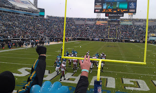
What a wonderful day! The Jags rout the Bucs and you see there was more confetti flying in the stands than rain at least until the end of the third quarter. My section was prepared. We had the two minute advantage weather app and got those ponchos out well before the heavier showers blew through with gusto! There are advantages to having a live doppler radar and like in sports every minute counts. I got back to the station nice and dry and was happy to still have my voice for the newscasts. It is not every day you see any football team score 28 points in one quarter. It was certainly the best the home team has played this season and maybe the best quarter in a few years. It gives all of us fans lots of hope! It took a lot of sting out of those chilly nor'easter breezes of 20-30 mph. Go Jags!


Speaking of hope we have a lot of it in the weather department. We have our heaviest rain on the way in at least two months. This is a huge forecast especially when you have been in a drought since 2010 and still need 6 to 10 inches of rain to catch up!

I have stuck by my forecast for one to two inches of rain for not just the beaches but most areas before all is said and done. Yes, I am paranoid about this forecast because our climate here has been more like a desert than a tropical paradise for so long. The models have been going back and forth between heavy rain and light rain amounts but they are just guides. I think with a strong southern jet stream teaming up with our nor'easter the sky is the limit! We will even have a nice upper-level disturbance form and enhance the lift. We literally have moisture blowing in from all directions and levels converging right over us.

This is a heavy rain signature. So let hope rain! We can celebrate but make sure to be extra careful during the morning commute because it does look very messy. We cannot even rule out a thunderstorm and if you get under one of those storms I am not expecting severe weather but generous rain amounts from 2 to 4 inches in total!

I will have your rain totals and updated Christmas outlook on Monday afternoon! Will it still be warm or a green Christmas? Or will Dan Hicken get his snow!! See you soon. Be careful!

Saturday, December 10, 2011

Chilly Breezes Return Ahead of Major Nor'easter!


Saturday, December 10, 2011

We missed out on an unusual lunar eclipse this morning. There were too many clouds and it took place after our sunrise. But out in Colorado spaceweather.com captured it beautifully for us right before the earth's shadow covered the entire moon. What was unusual about this eclipse was that folks in western North America got to see the eclipsed crimson red moon at the same time that a fiery red sunrise was taking place. This picture about covers our skylights here at home today since we will be stuck in stubborn cloudiness throughout the day thanks to a cold front that continues to push through the area.

The good news is we will not have to cancel any plans. The few sprinkles around this morning will move well offshore by this afternoon. The chilly breezes will be the big story with highs struggling into the lower 60s. At least it is starting to look and feel like the holidays so make sure to feed off that holiday spirit. That is exactly what we were doing this morning on Good Morning Jacksonville with our wonderful guests from the Seasons in the house, Ready Set Cupcakes, Eden Kendall at the Kids party at the Prime Osborn, great gift ideas from PromotionalCodes.com and we had Ringling Brothers talking about their Dragon Circus coming to town in January. I put on the red Rudolph nose as you see and Len Kiese was all smiles as usual. It will not be the prettiest of day but we should not be complaining because most of the country is in a deep freeze with our Indiana friends in Lafayette reporting a low of 12 degrees! There will be some payback though because the warmer temperatures in Florida compared to the rest of the country is going to allow a second weather system to develop this weekend and it we will go from chilly to soggy.


Now this model may be a little robust on rain amounts but even if it is I do think many areas in our coastal counties will see at least an inch of rain which would make this the strongest nor'easter here at home in two months. The lowest rain total I could find on the several different models just into First Coast News is .62" which I think is underdone. You have to go way back to October 10th to find the last time we were socked with a soaking rain over one inch in Jacksonville. This nor'easter has some extra upper-level support to help crank it up so I do not expect it to fizzle like our last few nor'easters and areas well inland will even see some rain. To say we need rain is an understatement. We have had four consecutive months of below normal rainfall and so far in December we are looking like we are trying to go for five in a row. This dubious streak has reinforced our drought conditions. So we really do need the rain. Now the question is when.


Well today it looks like we are in the clear except for a few rain showers well offshore for the deep sea fishing. Tonight I think it should remain dry for the Holiday Regatta of Lights. Expect the sailboats, trawlers, shrimp boats and many other marine boats to light up Matanzas Bay between the Bridge of Lions and Castillo de San Marcos. It will be a nice compliment to the 3 million lights on land! But nature will start lighting up the radar during the day on Sunday as a northeast wind starts to howl. Some wind gusts could hit 35 mph along the beaches! The farther south and east you go the more showers. I think rain will cover at least 50% of our area and I would take the ponchos to the Jags game. The nor'easter turns nasty Sunday night into Monday morning with almost everybody seeing rain except the far western areas! This nor'easter will be one to watch not only for its powerful punch but because it could bring in tides well above normal since it is occurring during the full moon. We will keep a close eye on it. Make sure to have the galoshes ready and I will have your two minute advantage! Have a great weekend and I will see you soon.

Wednesday, December 7, 2011

Back to Back 80s and Now Back to Reality


Wednesday, December 7, 2011

It was all too good to be true. Our weather was right out of a Disney fairy tale especially with all the wild weather going on across the country. I had a nice run today and was bragging to my friends up north about how great it was to run in 80 degree weather! I dodged a few monarch butterflies and beautiful eagles were spotted around the area like this one. But we all know the weather does get cold in North Florida and South Georgia this time of year and sometimes like a flip of a switch! This reminded me of when I lived in Indiana. If you did not like the weather just wait five minutes. Check out our temperature drop from the National Weather Service Observations!

We went from 80 at noon to 61 degrees and a windy chilly mist by 4 p.m. By 7 p.m. it fell to 51 degrees and I had friends and family calling me and asking what my problem is? I guess they did not like the weather change and it goes to show you that being a weatherman is humbling in more than one way...lol. But I loved the ribbing but remember I do not control the weather. By 9 p.m. the temperature fell to 46 with wind chills in the 30s. Now feeling about 50 degrees cooler in only 8 to 9 hours, this is impressive even by Minnesota standards. The only thing that was missing was snow but wait....I start getting more texts about rumors starting around town about snow...now you know if there was a .01% chance of snow I would be shouting about it from the rooftops, so sadly I had to dispel that rumor but it certainly felt like snow.

Now before I go to bed I want to make sure you are ready for the morning. Okay, hats, gloves, and coats will be needed. I think lows will drop in the 30s and it will still be breezy. So wind chills could dip into the 20s. Highs in most areas will struggle just to hit 60! The good news is that this is only a cold snap and tonight I am more concerned about when and how much rain is on the way for the weekend. I will have your answers shortly. You stay warm and now I am off to help my kids with homework while heating up my favorite cup or two of Chocolate Kiss coffee! I will see you at noon and be back here on the blog in a jiffy!

Monday, December 5, 2011

The Best Weather & Fans in the Country! It is Teal Day Monday!


Monday, December 5, 2011

It is hard to believe a team with only 3 wins has generated this much excitement. It goes to show you the Jacksonville Jaguars have a ton of community support. The other big trending topic here at home is certainly the 78 DEGREE WEATHER! Is it really December? We have not had a blackout since 2009 and tonight the stadium will be full! Nature is doing its part with incredible weather. No doubt, Everbank Field in Jacksonville, Florida is the place to be! Take a look at why the Jags and weather are the big ticket. Much of the country is either stormy or too cold! Freeze warning extend all the way into northern Mexico. Even Tuscon, Arizona will be shivering with a low of 26. Yes, all the country will be watching tonight and wishing they were here and all those big markets can only dream that they had the weather and and great fan base we do!


This is certainly more like an October game but for us we know it will have a playoff atmosphere. Speaking of cheering, this past weekend was very special for me. I went to a cheerleading meet at Creekside High School. I was not sure what to expect but was simply amazed at all the flying and flips, including my daughter Abbey's full twist! I wanted to give a special shoutout to all the great schools in St. Johns and Duval County, with a special shout out to my daughter who is on Fruit Cove's team! They finished first in St. Johns County. Great job team and coach Farbo!

How long can we cheer this weather? Well I think we have two more very nice and warm days! By Wednesday we could even challenge a record high of 82 set back in 1978. But remember to be careful late at night and in the early mornings with dense fog that usually accompanies warm, tropical patterns like this in December. Officially it is fog season with our shorter days and it will look and feel like it.


It was a busy weekend and in a good way. Another shout out goes to the Cub Scouts troop 35 from Southside Methodist. These first graders earned their severe weather badge and they loved learning about the two minute advantage and pointing to storms on the chroma key! They did order some snow and cold for Christmas but we did math together and came up with at least a first forecast we can fine-tune as we get closer. It looks like the total opposite of last year when flurries were flying on December 26th.


That is right all these warm days will be a recurring theme through much of our meteorological winter. This could still change but our chances of 70 degree weather are way higher than having cold and chances of snow which I will put at less than one percent at this time. But winter has not been cancelled and we could have a reality check by later this week and maybe even some needed rain. I will check back with you here on the blog tomorrow. Now it is time to cheer on the Jags. Take care and go Jags!

Stratus Sunday & Unusual Cold Air Funnels Ahead of our Big Warm-Up


Sunday, December 4, 2011

Tim sent this in from Nocatee and it in fact does show a cold air funnel that formed at about 12,000 feet. This is something you normally would see in Michigan or Wisconsin. It was caused by our strong cold front that moved through late this week. Temperatures in nature's attic quickly fell to zero degrees while temperatures at the ground were more than 60 degrees warmer. You also had wind blowing in different directions at different heights. This caused instability and spin to take place and voila! Now the good news is this funnel stayed in the sky and rarely do they make it to the ground. When they do damage is usually very light. This funnel is more closely related to a water spout than a tornado. It was quite an interesting weekend for clouds.


We also had those infamous stratus clouds that formed this morning near the ground, better known as fog. This is why we dubbed today Stratus Sunday! Downtown virtually disappeared. I am concerned in this pattern as high pressure takes over the fog will only get worse for Monday and Tuesday mornings. So be extra careful. The good news is any rain shower activity will be in the form of mist this morning from the new I-295 to A1A. By this afternoon we should see a few more rays of sunshine and look for another phenomenon called crespuscular rays. It looks like the sun rays will be shining down from heaven. There will have plenty of clouds, moisture and dust in the air to scatter that sunlight and with the lower sun angle it also helps us see this beautiful sight. Take a look at a few of those rays below!


Our weekend skylights do not end here. Guess what else was spotted in the sky ahead of the big event!
You have guessed it. The blimp was overhead taking pictures of the beautiful Jacksonville skyline for Monday Night's nationally televised game. Check it out and I will be back with the most important Jags forecast in their history. Have a great day!

Saturday, December 3, 2011

Weak Nor'easter will Bring More Spectacular Sunsets Than Rain!


Saturday December 3, 2011

We had unusually strong high pressure by Florida standards. It reached at incredible 30.48" over interior southeast Georgia bring a light frost. This has increased the pressure differences between land and sea. A weak nor'easter has developed as a result but the good news  is this will not ruin our weekend plans. I think it will bring in more clouds than rain and most of all more spectacular sunset like Steve Amos sent us from Fleming Island. Tonight's sunset is at 5:26 p.m. I will be back here on the blog this evening and talk more about the weak nor'easter and active weather across the country that will bring us another wild week of weather. In the meantime, expect temperatures this evening to be in the middle to upper 50s through midnight. Enjoy! Be back soon and join Jessica and I at 6, 7 and 11 p.m. tonight for more news and weather fun! Send in more pics so I can share and any weather numbers! Thank you!

Friday, December 2, 2011

Wonderful Weekend Weather to Make a Positive Difference

Friday, December 2, 2011

Happy Friday and it is an extra special one here at First Coast News. We are proud to be involved with our 3rd Annual Hero Central Food Drive. I know when it comes to the weather we can keep you safe ahead of, during and after the storm but we cannot control the weather. What we can control is doing the best we can to help the needy in our community. I know I throw a lot of weather numbers out at you but was shocked to find out there are about 350,000 folks that battle hunger with almost half that number kids. So today you can do your part by picking up non-perishable items and dropping them off at all the selected locations you see above. We made a huge difference last year and unfortunately this year the need is even greater. The good news is together we can help fight hunger and we have a beautiful sunny day today with temperatures back to where they should be for this time of year. If you are in Georgia here are your selected locations and keep in mind our important food drive is not only today but on Saturday.


We are all thankful for making it through another hurricane season without a major impact. Many folks tell me about how miserable they were after losing power and all our their food for about 2-3 weeks at a time. Well imagine that feeling every single week of your life. This is why I am proud to be a part of this huge food drive. Speaking of hurricane season it was our third most active season on record but we only had 7 hurricanes which was average. Despite not having a major landfalling hurricane in the US for the sixth consecutive year (first time since 1878) it was one of our costliest seasons with about 10 billion dollars in damage.


One reason was the Saharan Dust Layer that caused our tropical waves off Africa to not only form farther north but taking longer to get their act together. Tropical systems need 80 degree water, light upper winds, and deep tropical moisture. This was our saving grace. Even though it is December you can still see a big dust layer choking the Atlantic in the darker orange and red areas. Irene and Tropical Storm Lee with never be forgotten for the flooding they brought and it was inland flooding this season that caused most of the damage showing you that these tropical systems have impact not just at the coastline but well inland. It broke my heart watching 100 year covered bridges being whisked away in Vermont.

Speaking of wind the Santa Ana winds that have hit the West Coast have been incredible the last couple days. The National Weather Service in Sacramento has declared it the most damaging wind storm they have had in about 10 years. You can see why!
...PRELIMINARY STORM INFORMATION...
***** NON THUNDERSTORM WIND GUST REPORTS *****

CEDAR RIDGE (NNE OF SONORA)  THU 94 MPH
DOWNIEVILLE 6 NNW (SIERRA CO)  THU 86 MPH
PASKENTA 6 WNW (TEHAMA CO) THU 72 MPH
DONNER PEAK 2 W (PLACER CO)  THU 68 MPH
ALPINE MEADOWS 13 WSW (PLACER CO)  THU 65 MPH


These winds were caused by a big dip in the jet stream caused by an area of low pressure while a strong high pressure moved in from Canada. This causes a wind to speed up as it rushes through the mountain passes. Luckily we had cold air to work with which kept what would have been a devastating fire storm to take place like it normally does with Santa Ana winds. But at the same time the cold air forced up caused the winds to be stronger than normal with this type of outbreak.

Here closer to home it is all about high pressure at the surface and aloft that will keep the stormy weather well north of our backyards and at the same time allow us to warm back up above average in the 70s. What a difference a year makes! We will take a closer look at this tomorrow with the latest  charts. Have a great weekend and thanks for helping with the food drive!


_