Wednesday, December 15, 2010
Kids Enjoying Homemade Snow & It will not melt in the 70 Degree Weather on the Way!
Wednesday, December 15, 2010 (9 a.m.)
http://lotsofbarkandbiteinyourforecast.blogspot.com/ Blog Archive back to 2007
Decembrrrrrr continues this morning with lows that reached 18 on the Westside and Cecil Field to 19 in Lake City. The airport officially reached 21 which easily broke the old record of 25 set back in 1962. St.Johns had a low of 24 while Fruit Cove by the river was a little warmer near 30. The nation's oldest city felt more like the nation's ice box this morning. St. Augustine checked in with a low of 26! The beaches that normally are sheltered by the warmer ocean were left out in the cold by nature with a low of 27 at Jacksonville Beach and Ponte Vedra Beach. If it is this cold we might as well have snow. That is what I have been saying.
This past weekend I gave us a sight chance of seeing a few snowflakes and it did get some of our neighborhood kids excited. What they did not understand is that a slight chance of snow means it likely will not happen, but all they heard was snow. So I had to do something about this. I am a weatherman that delivers...lol! I actually made two batches of home-made snow and you can see the happy results above. This is the closest ecstatic Cade and Tyler have ever gotten to holding real snow. I was just glad I could be part of this and if I could I would have made enough snow to cover their entire yard. This may be an idea. I can invent an affordable snow machine so kids will never have to dream about playing in the snow again here in Florida. There are quite a few folks in Indiana right now that have written me on Facebook and they would be glad to sell some of their snow and snowmen for free! Especially now that Lafayette has another 3.5 inches of snow on the way.
You can see this snow does look real and it is fairly easy to make. You basically mix sodium polyacrylate with water and the chemical reaction cools the gel and makes it look like snow. If you want dry snow, just mix a little water, or a wetter snow, mix a lot of water. You can add in some salt for just the right texture like I did. The best part is that it is non-toxic. I would still not let my kids eat it. Where do you find sodium polyacrylate? It is the cottony stuff inside diapers. It absorbs up to 400 times its water weight and that is what allows this wintry concoction to end up looking like snow. The best part is it does not melt and does not get too cold like real snow. If you want it to feel cold like real snow, just stick it in the freezer. I am working on this formula to make it even more like snow, but have a long way to go. If anybody can do it, I can! Of even more importance than my little project is something much bigger! THE THIRD ANNUAL SNOW DAY at Durbin Creek Elementary is almost here!
Snow Day is a community event where Durbin Creek focuses on local charities and gets the kids involved in helping others. They celebrate by bringing snow to Durbin Creek and have a family fun day centered around it. This year, it will be Saturday, January 29th from 10AM to 2PM. The charity of focus this year is DREAMS COME TRUE-Kids Helping Kids, a local based nonprofit organization dedicated to fulfilling the dreams of children with life-threatening illnesses. If you would like to volunteer in this big event you can call the school for more information. I am looking forward to it that is for sure!
Now you will need to have home-made snow to play in with 70s in the forecast. The real stuff would melt quickly. I have talked enough about cold weather to last us five Florida winters, wouldn't you say? So let's keep those warm thoughts. Do you realize our first 90 degree day is only about 20 weeks away and we have swimming weather a mere 15 weeks away. Think pool thoughts and you can look at the picture above if you lose focus due to today's highs struggling into the lower 50s. Even though pool temperatures have plummeted and we will not be able to swim this weekend you can look forward to temperatures back in the 70s on Friday and near 70 Saturday! The best part is that we may even get some needed rain for all those wildfires going on around the area. The cold large snow pack to the north has pushed the main storm track closer to home. We will talk warm weather and rain chances here on the blog and morning show Thursday. If you are ready for a forecast full of warm thoughts make sure to tune in. Tonight make sure to look east-northeast once again as the Geminid meteor shower is still producing vivid shooting stars. You should be able to even see some this evening. Let me know how it goes. I have not seen any but the show is not over yet! Have a great day! Time to go workout!!
Tuesday, December 14, 2010
41 hours in the Deep Freeze for Frozen Florida! Even colder tonight with Black Ice Threat!
December 14, 2010 1 p.m.
This picture captures the very essence of what we are going through here in Florida. Those monster icicles on my friend Jeff's house were created by him running a water contraption on his roof and nature took care of the rest. Lows last night reached a record-breaking 20 at Jacksonville's airport and the middle 20s by the river and to the beaches. Upper teens hit the normally colder locations to our west and in Southeast Georgia. The amazing part is we were 20 degrees colder than Caribou, Maine and tonight we will be colder than them once again! It is like we have placed the whole state of Florida up in New England. West Palm Beach had a low of 32! Wind chills this morning were as low as 7 degrees which means it felt like the coldest actual temperature ever recorded in Jacksonville which took place in January of 1985. I can say as somebody who has made Florida my home for several years I have NEVER felt this cold in Florida. Today will officially be our coldest December 14th day on record as highs only reach 44. Previously the coldest December 14th day was 46 in 1944!
You see the flag blowing in the wind with stratocumulus clouds and palm trees in the background on Monday morning. Yes, blame the wind. This wind is packing a huge punch because it is blowing over a huge snow pack taking up about 40% of the country to our north and it is not allowing this cold air to warm up like it usually does when it arrives in the Sunshine State. The stratocumulus clouds above are caused by massive cooling in the atmosphere and sometimes produce snow flurries and while I had no reports in Jacksonville I am still trying to verify reports of a few flurries just north of Tampa on Monday morning due to a cold wind that blew over the Gulf and much like lake-effect snow there may have been enough moisture to produce flurries!
The bigger story here at home is the brutal wind. Many folks are complaining that they cannot feel their faces or fingers and that those bitter breezes are beating up their holiday decorations. Yes, the Prangley garland was blew down as well. You have every right to complain. Do you realize here at 1 p.m. on Tuesday our wind chill has gone above freezing for the first time since 7 p.m. Sunday evening. We are talking 41 hours in the deep freeze or Jacksonville having wind chills of 32 or lower! Well the good news is the wind is finally going to relax this afternoon but it only means we will get colder tonight! We will have perfect conditions for cooling. It will be clear, crisp and calm. Expect a low of 19 in Jacksonville which would be the first time we have been in the teens since January 24, 2003 and the first time December has produced lows in the teens here since 1983! Yes, the hits keep on coming. You will want to keep the tarps out like you see below.
One thing that you may not realize is that with the light wind tonight we will likely have a heavy frost. This can sometimes cause icy conditions or what is called black ice on area overpasses and bridges. It is transparent ice that you cannot see and thus the term black ice. It can be caused by car exhaust freezing on the roadway or frost that forms on the bridge. It can also be caused by patchy areas of fog or what is termed freezing fog when it gets this cold that causes transparent or black ice! This is something you normally see about 1,000 miles north of here. Amazing. Since we are not used to icy roads here is what you need to know. You want to slow down while driving and since Jacksonville has plenty of bridges and overpasses you will also want to not use cruise control. If you feel like you are sliding do not slam on the breaks. This can cause you to lose control. You want to take your foot off the accelerator and allow your car to naturally slow down. If you are going into a tailspin you slowly turn your wheel in the direction your car is spinning. Do everything slowly and do not panic. Please drive slowly and safely. This morning there were a few reports of icy bridges and tonight with the light wind and heavier frost it will only get worse.
I need to go pick up some poinsettias and my kids at the bus stop. Make sure to check back for more on when we will finally warm up and blizzard pictures you will not believe! Yes it could always be worse!.....Okay I am back and have the poinsettias and kids and notice I brought them in the garage as soon as possible. There are some years that are so warm that folks keep them outside or even plant them. This year we will not even have to entertain that thought. Tonight it is about protecting the plants, pets, and pipes. A lot of folks are staying warm by staying in and going to all those great holiday musical performances around town. My oldest daughter certainly took the edge off this cold weather with a heart-warming performance! Here is proud Dad with oldest daughter! I hope my daughter or any of her almost high school age friends do not see this...lol...apparently this could cause trouble or embarrassment. I think it is a great picture, don't you?
Here may be a less controversial picture for everybody. This was sent in by my sister-in-law Shelli from Oshkosh, Wisconsin where they had a blizzard and a foot of snow. What was amazing is that you could not even see out your window it was so bad. Check it out!
This picture is actually turned on its side so tilt your head right. Sorry my computer had trouble and will fix it later. You see the actual snow covering a portion of the window and the rest of it is iced over. Snow drifts of 4 to 5 feet have been reported so as some of that snow hits the warmer glass it briefly melts and then re-freezes making it a glazed winter window. Even by Wisconsin standards this is impressive. So after seeing this it sure looks a whole lot better out our winter window doesn't it! Stay warm and now I am going to go try a little science experiment I will tell you about tomorrow.
Monday, December 13, 2010
Brilliant Meteor Shower Tonight & A Soup Recipe to Stay Warm!
Monday, December 13, 2010
Tis the season for holiday programs and I am getting ready to go to my oldest daughter's chorus performance. Thank goodness Megan got her Grandma's voice. She is a wonderful daughter and an amazing singer. Before we go out I wanted to make sure you knew about what is being called the year's most brilliant meteor shower by astronomers. Throw on some layers and head outside. You could see 1 to 2 shooting stars per minute. Find a dark spot and look east-northeast. I like going to the beach! What makes this meteor shower different is that it is known for slower moving and more dazzling displays of meteors. You also do not have to wait until midnight to see them. They are out early and often. This display is caused by an asteroid that apparently broke up and it is a fairly new phenomenon. It has only been around for about 150 years and it is getting more brilliant every year. It has what is called earth-grazers or shooting stars that like to come closer to the ground before the atmospheric friction causes them to fizzle out. Some of these shooting stars will look like you can reach out and touch them. Get out and enjoy.
We all know it is cold outside and to protect the pipes the next couple nights. I will not harp on it during this blog update. I will talk about solutions and my Mom has one for all of us. I wanted to thank her for lunch today and the Easy Chicken & Tortellini Soup. This is my bowl of soup after 30 seconds. Yes, I need to slow down when I eat, but it is tough when it is soooooo good! Here is a recipe my Mom would like to share with all of us.
Rotisserie chicken is the secret to this rich soup.
3 tablespoons of olive oil, not extra virgin
4 cloves Garlic, crushed
Onions, diced
16 oz. package sliced white mushrooms (optional)
32 oz. package chicken broth
29 oz. can diced tomatoes
16 oz. chopped spinach, frozen
20 oz. package 3-cheese tortellini
all-natural rotisserie chicken
shredded parmesan cheese
1. Heat oil in large pot over medium-high heat. Add onions and garlic, reduce heat to medium and cook slowly until translucent, about 10 minutes. 2. Add mushrooms if you like them and cook until tender, stirring occasionally. 3. Increase heat to high and slowly pour in broth and diced tomatoes with liquid. Cover and bring to a boil, then reduce heat and simmer for 10 minutes. 4. While soup is simmering, dice chicken and set aside, discarding skin and bones. 5. Add frozen spinach to soup, raising heat to keep at simmer if necessary. Cook 5 minutes. Carefully add tortellini, cook 5 more minutes, and then stir in diced chicken. 6. Serve immediately, topping each serving with freshly grated parmesan.
Thanks Mom! Everybody stay warm, off to Fruit Cove Middle School! Please send pictures of shooting stars if you see any! THANKS.
Sunday, December 12, 2010
The Party is Over! Nature Blitzes us with Arctic Blast #3 & A Brief Snow Flurry Still Possible Tonight
Sunday, December 12, 2010 (7:30 a.m.)
http://lotsofbarkandbiteinyourforecast.blogspot.com/ Weather Blog Archive Back to 2007
We at least had the nicest night of the week last night and with all the holiday parties going on folks were very appreciative. You see Scott and Stefanie Glebus were in the holiday spirit as temperatures stayed nice and mild and the rain held off. But it does look like the party is over and Rudolph will need to use his nose if he is taking a practice run for Christmas over much of the country. Nature is doing an all-out arctic blitz today and there are 8 states now in Plains and Midwest with Blizzard Warnings. Minneapolis has check in with 17 inches of snow which will go down as a top 10 snowstorm for them. It is such a big storm the NFL has postponed the Vikings-Giants game since the Giants plane was grounded.The Metrodome roof has apparently collapsed and this is breaking news as of 9 a.m. Luckily at this time their are no confirmations of injuries. Thank goodness there was no game today. Can you imagine if it happened with thousands of people there. Unbelieveable! In Wisconsin every single county has some type of snow advisory and travel is not recommended which is unheard of for those hearty cheese heads. I look forward to seeing some blizzard pictures from my relatives and will post them here on the blog. This raging blizzard will send the strongest front of the season our way. So what are the main concerns with the big Jaguar-Raider game. Let's take a look.
The good news is the Raiders column is our least concern. Yes! Nature may be getting its winter mojo back but the Jags have their MOJO or Maurice Jones-Drew that will carve right through the Raider defense and wind. All week long our weather team thought most of the rain would be Sunday morning and I still think this holds true. Outside of a lingering light shower close to kickoff I do think it should be primarily dry for the game. So take the ponchos for the "tealgating". You may also want to tie down your grills. Even though no thunderstorms are expected wind gusts could be up near 40 to 50 mph with brief heavy downpours. This front means business. The big concerns during the game will be the wind and wind chills. We will still see gusty winds of 20-30 mph with wind chills falling into the 40s. Here is your temperature forecast.
The warmest part of the game will be to start but notice we will fall into the lower to middle 50s due to a strong cold west wind. Since Jags fans have experienced all kinds of wild weather this year I am sure they will be ready to put on a few extra layers and stay warm by doing the wave before and after David Gerrard led touchdown drives. Remember that game when it felt like about 120! Well nature is going to make up for it today and we will have a wind blowing toward the Matthews Bridge. There is always the Bud Zone you can head to if you need a break from the wind. I love their hot dogs!!
Last but not least a lot of kids have been asking for snow and you know I am a snow freak. So here is the very latest as of Sunday morning. We do have one model showing a 10% chance of a brief snow flurry late tonight after midnight. But most models keep our chances at 5% or less. The air behind our arctic front is bone dry with humidity levels dropping to about 20% at 10,000 feet. But check out the map above. There will be a weak disturbance moving through late tonight and it is not out of the realm of possibility some folks see a brief snowflake or two. The best chances although slight would be in Georgia. We are not talking about any trouble on the roadways but it is a sign of just how cold this pattern will be for the next few days. Our big weather story will be wind chill advisories by morning as we wake up to middle 20s to lower 30s and it will feel like 8 to 14 over most of our inland locations! We will have pipe-bursting weather with actual lows in the upper teens by Tuesday and another hard freeze on Wednesday. If there is good news it is we will warm up to near 70 by next Friday. So keep those warm thoughts and hold onto your hats today. Have fun at the game and tonight I will have an update on the huge slew of weather warnings for our area due to cold weather. We will also take a look at why we may not get this cold the rest of the winter! I am going to go find some hot chocolate.
Saturday, December 11, 2010
Bright Lights on the Matanzas and Chocolates to boot before other shoe drops!
Saturday, December 11, 2010 (10:00 a.m.)
It was another fun morning on Good Morning Jacksonville. Our tradition of eating chocolate was taken to a whole new level. We brought in Mark from Peterbrooke Chocolates and he let me partake in a chocolate-dipping demonstration which included drizzling on some white chocolate. That is the only drizzle in the forecast today...okay! The toughest part was not eating the chocolate dipped strawberries until after the interview. So this was one case where it was okay to double-dip and in my case I quadrupled dipped! Yes, in my life there is God, country, family, weather, and CHOCOLATE. It has been proven you live longer by eating chocolate. Of course you want to do it in moderation to some extent or run at least 25 miles a week like I do...lol...now today is a 2 chocolate day....usually I grade our weather based on the chocolate-eating tradition we have started before all our shows. Here is the scale:
No chocolates for you----weather that will make you want to fly away or stay in bed.
1 chocolate day------weather that interrupts you life and big plans you may have.
2 chocolate day------not the best weather and it will be more of a nuisance than anything
3 chocolate day------weather that will not slow you down and you will want to take a walk or run in
4 chocolate day------the reason you moved to Florida, the weather simply could not get much better
I give today a 2 out of 4 because it is a nuisance to not only me but all meteorologists. We have a varmant of a low pressure off the coast and it is taking its sweet little time moving up the coast. This timing issue can mean the difference between 55 and 70! Today I went with gradual clearing from west to east and notice the big temperature differences above at 3:30 p.m. I think highs will top out near 70 close to Interstate 75 where it clears out earlier to the lower 60s along Interstate 95 and near Jacksonville, while southeast Georgia will be stuck in the clouds and upper 50s until late today. So it does look like a good shopping day and one other big note is that the grouper are apparently biting and being caught in big numbers off the Florida coastline. If you are fishing today the wind will be northwest to west at 10 to 15 knots. Remember when the wind is west fishing is best! Seas will be mainly from 3 to 5 feet with a water temperature of 57 degrees. This will only be a narrow window of opportunity because nature is ringing the warning bells like anchor Len Kiese you see below. A small craft advisory and even a gale warning is likely on Sunday and Sunday Night.
We had Pam Bells the bell ringer from Valdosta, Georgia in the studio and she was absolutely full of energy and awesome. She showed Len some cool tricks. Nature is not just ringing warning bells but bringing us the strongest cold front of the season Sunday afternoon. We will really start to feel the cold by Monday morning when temperatures will plummet into the single digits. Make sure to tune in tonight and we will take a closer look at this approaching front which will bring brutal wind chills, gusts, record lows and pipe-dripping weather. We will also have to watch out for a strong thunderstorm. This is a very dynamic system that is already causing blizzard conditions in Minnesota. Areas that are even missed by this storm will be hit hard. Boiler country could see at least 4 inches if not more and by time you head to Remington, Indiana you will be well over 6 inches of snow due to Lake enhancement.
Here at home this brutally cold air mass will collide with our warmer air mass and bring us some heavy downpours and possible wind gusts of 40 to 50 mph. I do think the biggest severe threat remains in the Panhandle of Florida but we cannot rule out severe weather whenever you are talking about a jet stream with over 130 mph winds involved. Tonight make sure to tune in on the timing of these showers and storms. Will it in fact clear out for the Jags game. Right now I do think I would take it all....your loudest cheering voice, biggest coat and even the ponchos. While things should dry out as we head through the afternoon it does look like there may be some lingering leftover showers behind the main line of rain. Rain amounts have generally been in the .25" or less but keep in mind if you do get under a thunderstorm that could be much higher. Our chances of snow in Jacksonville which were 10% earlier in the week have fallen to about 2% and I will still keep an eye on it for you snow-lovers. I will also have an update on rain amounts at 6,7, and 11 since we are in an extreme drought. In the meantime, enjoy your 2 chocolate day...okay 2.5 chocolates since you do not worry about weather every waking moment like me! You will want to do this before the temperatures drop or in this case the other shoe drops! It will fall with a very hard thud! Here is the latest forecast for the St. Augustine Regatta of Lights.
If you get a chance send me some pictures so I can show them on the news at mprangley@firstcoastnews.com. All weather pictures are greatly appreciated or even any question you may have. Take care and yes make it a great day weather wise and otherwise. You also have to check out our free weather app at FCN Wx with your 10 day forecast and street-level mapping. We are only one of five stations in the entire country that does OUR OWN 10 DAY FORECAST! Make sure to also sign up for text alerts at http://www.firstcoastnews.com/. This will come in handy by tomorrow! I will send you text alerts during the game with rain, wind, and temperature updates as needed! Thank you.
Friday, December 10, 2010
No Snow But Falling Ash Around the Area & Sunshine Returns for our Saturday!
Friday, December 10, 2010 (3 p.m.)
Archive of Weather Blog back to 2007 http://lotsofbarkandbiteinyourforecast.blogspot.com/
Friday was a classic day of what an inverted trough can do to a forecast here on the First Coast. Chief Meteorologist Tim Deegan did a great job pointing this out last night on his weather shows. The guy is simply amazing and his 25 plus years of experience here on the First Coast paid its dividends today. I am like a sponge around Tim learning all I can. He is a wealth of knowledge. Those inverted troughs many times cannot be picked up by our weather models very well. Today was a classic example of that and it was what caused what should have and could have been a sunny and nice forecast to dark and gray. The inverted trough had plenty of clouds with it and it held temperatures down in the middle 50s. Our middle 60s we could have reached were out in Tallahassee where they were enjoying all the sunshine today. Yes, this change in our weather is a local phenomenon. Just think of it as a home-brewed low pressure that sometimes forms right here in our backyard. It was caused by temperature differences between the ocean and that cold polar air mass that has overtaken our world this week. Check out this striking map of water temperatures this week of our Florida coastline.
While temperatures were in the upper 20s this morning in Waycross the Gulf Stream about 80 miles offshore still had water temperatures near 80. You add in a little upper-level vorticity or weather disturbance and voila a new low pressure is born. Most of the models did show a low pressure forming today but it was supposed to be much weaker and farther offshore. The good news is this pesky low pressure is going to move northward toward the Carolinas tonight and in its wake we will have the best weather of the week on Saturday. I do not expect any more surprises. Just be wary of a little patchy drizzle and fog from this system mainly east of the river as we had through tonight. The clouds should break up during our Saturday morning.
Now there was also a chill in the air and at times it did look like it would snow outside and with that chilly breeze it felt like it too. There were reports around town of snowflakes over the Buckman Bridge and at the St. Johns Town Center. Did it really snow? Well here is what I found. After speaking to those that that really and sincerely thought they saw snow I double-checked everything just in case. Since I am a SNOW FREAK by nature if there was anybody able to verify snow in the area it would be me. I went over all the radar data that shows precipitation type and it came back negative. Then you have to check temperatures from the ground to about 5,000 feet or higher and it confirmed that snow would not be possible meteorologically. Air temperatures were in the 50s by noon today. Also I checked the 5,000 foot temperatures. To have snow you need temperatures at 5,000 feet close to 27 degrees. Today temperatures were a whopping 18 degrees warmer or 45 degrees even first thing this morning. So based on science I just do not see how it could have snowed. But one theory I did have is you may have seen ash falling from the sky. Here in northeast Florida there are now 20 wildfires going including a new 14 acre fire in Welaka down in Putnam County. Check out this amazing picture shown on First Coast News at Noon.
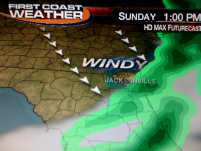
The good news is we do have at least some rain to help dampen up some of that dried out brush causing those wildfires. The latest models are not showing very much rain but we will take every little bit we can in one of our top 5 driest years on record. I think most of us will see a quarter inch or less. If you are in Waycross or Lake City maybe a little bit more. Since timing is everything I do think it is on our side for the big Jaguar game. The back edge of the main line of rain showers should move south of Everbank Field in time for kickoff. Yes, rain will fly in sooner rather than later as the main front rides in on a 130 mph jet stream! Here is the latest future cast that shows the back edge of rain heading into St. Johns County by 1 p.m. so the Jags can take care of business.
So yes you will need the ponchos for "TEALGATING" and the warm winter coats for the main game. Great job Jags fans because for the 7th consecutive home game there will be NO blackout. The support for our Jags has been outstanding this year and we will not let a little rain or wind that moves in during the game keep us from filling the stadium. Besides our running game and all our cheering should make those 20 to 30 mph west-northwest wind gusts a non-factor. Actual temperatures will fall through the 50s during the game. I will keep you updated on this forecast because the main front is still way back in Texas. In the meantime, have a great weekend. Here in Florida we are the lucky ones once again. One to two feet of snow could fall in the Twin Cities and wind chills of 40 below zero are on the way to Duluth. In Lafayette, Indiana you still have at least 2 to 4 inches on the way and there will be so much wind you might as well prepare for it like you would for a foot of snow. Travel will be tough at best. We will track polar outbreak number 3 together this weekend because by Monday morning we could have wind chill advisories here at home. I will keep you updated on our potpourri of weather on the way. Take care and have a great weekend!
Remember to download our free weather app at FCN Wx. You can track our 10 day forecast updated by your weather team at least once per day and it has street-level mapping that will come in handy on Sunday!
Thursday, December 9, 2010
A golf forecast that will even make the ugly swings look nice!
Thursday, December 9, 2010 (12:30 p.m.)
It was a fun show this morning. I made a challenge to myself that I was NOT allowed to use the word COLD and at times it was tough especially when I showed "challenging" and "character building" weather next week. But that is next week. Today we celebrated real southern hospitality weather returning to our area. We are already up into the middle 50s at noon and I reported a temperature in the sun at 67 degrees while doing laps around the building before my show. Yes, the first thing you need to do before any weather show is look out the window and better yet get out in the weather. You realize we are only 81 days to the start of meteorological spring and the good news is unlike last year our Florida/Georgia spring will begin in really about 60 days. That is when the azaleas will be blooming and the pollen flying. There will be 70 degree weather not just by this weekend but some 70 degree days this year in January and February. I would not even rule out an 80 degree day in January and February in this pattern. La Nina is known for big temperature swings. You can keep the shorts and sunscreen out.
I loved giving a golf forecast and made fun of my horrible swing. There is nothing like calling yourself out on the air....lol...this business humbled me a long time ago so no big deal. You see the graph above showing fair to good conditions to not just hit par but birdie a few holes. Now I do average about one or two birdies per 18 holes. It is just the other 16 holes that do me in. But seriously if you are heading out this afternoon and wondering if you can play some golf by all means do so! You can even get an early tee time the next couple of days. Lows tonight in much of the area east of Highway 301 could actually stay above freezing. Lows will be from 35 in Jacksonville to the middle and upper 40s at the beaches. By Saturday morning lows may hold closer to 40! The roses can finally thaw out!
That onshore flow off the Atlantic Ocean is doing wonders. Yes, we have finally gotten rid of the polar express or the wind coming straight down from the North Pole. Check out the nice rebound in high temperatures. We normally have highs of 67 this time of year so to actually get above normal would be quite an accomplishment after some of us had lows in the teens earlier this week. A second factor helping us along is the polar jet stream has also lifted. You combine that with a Midwest Monster of a storm this weekend and we have a nice couple of outdoor days. The best weather of the week still looks to be Saturday with highs up near 70.
Now for those reading along in the Midwest here is the latest snowfall totals you can expect. I understand a lot of forecasters are trying to downplay this storm through North-Central Indiana. Well this storm is so big it will have a huge impact on not only Wisconsin and Michigan but most of Indiana. I am still sending you to the grocery store to stock up! The storm track may have shifted farther north but it still looks like at least 5 inches will snow in northern parts of the Lafayette viewing area with some slick roads all the way down to Indianapolis. My Wisconsin relatives will see the brunt of the storm with over a foot of snow not out of the question. Yes, it should be a major winter storm. Here is the latest map and I really should have put Tippecanoe County in a 2 to 4 inch band so just keep that in mind and please be safe as things go downhill quickly by late Saturday.
Here at home we will be watching this storm because it will not only help to warm us up in time for all those holiday parties but bring us our next chance of rain and we really need it! We will take a closer look at that here on the blog tomorrow and we will talk about some "challenging" weather next week. But for now it is time to go take the dog on a nice long walk in the Florida sunshine! Really I should also hit the driving range!Have a great day.
Subscribe to:
Posts (Atom)